TopoQuest Logo
Do you find TopoQuest useful?
Help keep TopoQuest running and adding new maps/features by donating!
Bitcoin:  19c7KJd3qBynnjoSw5npx9KScwjBe4ifkT
Litecoin:  LXs6TkuXGGXo1vDsWCkWVdjQX94eUKd6ui
Home View Maps Find Maps Find Places Resources & Links


Accident, Maryland Topographic Map

USGS Map Title: Accident, MD
USGS Map MRC: 39079F3
DRG (GeoTIFF) Download: o39079f3.tif


Neighboring USGS Topographic Map Quads:


  Ohiopyle, PA  
39079G4
 

  Confluence, PA  
39079G3
 

  Markleton, PA  
39079G2
 

  Friendsville, MD  
39079F4
 

  Accident, MD  
39079F3
 

  Grantsville, MD  
39079F2
 

  Sang Run, MD  
39079E4
 

  McHenry, MD  
39079E3
 

  Bittinger, MD  
39079E2


Map MRC Location:

N40°
W80°
N40°
W79°
H8 H7 H6 H5 H4 H3 H2 H1
G8 G7 G6 G5 G4 G3 G2 G1
F8 F7 F6 F5 F4 F3 F2 F1
E8 E7 E6 E5 E4 E3 E2 E1
D8 D7 D6 D5 D4 D3 D2 D1
C8 C7 C6 C5 C4 C3 C2 C1
B8 B7 B6 B5 B4 B3 B2 B1
A8 A7 A6 A5 A4 A3 A2 A1
N39°
W80°
N39°
W79°

Accident, MD USGS 1:24K Topographic Map Preview:
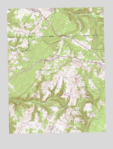
Accident, MD USGS Topographic Map
Click on map above to begin viewing in our Map Viewer.

This topographic map contains these locations and features:
Feature Name Type Latitude Longitude GNIS ID View Map
AccidentPopulated PlaceN39.6287°W79.3198°582858View Map
Accident Elementary SchoolSchoolN39.6262°W79.3104°1729630View Map
Accident Evangelical Lutheran ChurchChurchN39.6309°W79.3181°1711026View Map
Accident Post OfficePost OfficeN39.6282°W79.3190°2780888View Map
Accident Volunteer Fire Department Station 50BuildingN39.6276°W79.3194°1953586View Map
AddisonPopulated PlaceN39.7473°W79.3392°1168078View Map
Addison Post OfficePost OfficeN39.7472°W79.3325°2779772View Map
Addison Post Office (historical)Post OfficeN39.7473°W79.3392°1214450View Map
Addison Volunteer Fire Department - Station 613BuildingN39.7487°W79.3381°2644708View Map
Bald KnobSummitN39.6618°W79.2736°589685View Map
Bear Creek Fish Rearing StationLocaleN39.6462°W79.2848°1711031View Map
Borough of AddisonCivilN39.7452°W79.3343°1215580View Map
Chocolate Drop HillSummitN39.6701°W79.2795°589972View Map
Chub RunStreamN39.7154°W79.3450°583777View Map
Chub RunStreamN39.7156°W79.3442°1171834View Map
CoveLocaleN39.6804°W79.3000°583917View Map
Cove RunStreamN39.6592°W79.3123°583924View Map
Cove RunStreamN39.7090°W79.3486°583925View Map
District 5, AccidentCivilN39.6488°W79.3170°1929624View Map
Engle MillPopulated PlaceN39.6470°W79.2864°588653View Map
Fikes RunStreamN39.6559°W79.3370°584375View Map
Hoy RunStreamN39.7420°W79.2520°1177525View Map
Kaese MillPopulated PlaceN39.6504°W79.2961°590578View Map
Little Bear CreekStreamN39.6501°W79.2886°585435View Map
Mineral SpringPopulated PlaceN39.7081°W79.3503°590810View Map
Niles Mill (historical)LocaleN39.7167°W79.3442°1711090View Map
Northern Garrett High SchoolSchoolN39.6645°W79.2976°1711093View Map
Northern Middle SchoolSchoolN39.6634°W79.3022°1711094View Map
Oak HillSummitN39.6306°W79.3598°590915View Map
Pine SpringsSpringN39.7034°W79.2811°1711095View Map
Puzzley RunStreamN39.7420°W79.2636°1184511View Map
Rich HillSummitN39.7084°W79.3111°586818View Map
Rich SchoolSchoolN39.7029°W79.3078°586821View Map
Saint John's English Lutheran Church CemeteryCemeteryN39.6804°W79.3000°1711099View Map
Saint Johns English Lutheran ChurchChurchN39.6801°W79.3003°1711100View Map
Saint Johns Lutheran ChurchChurchN39.6798°W79.2998°1711101View Map
Sausman MineMineN39.7137°W79.3467°587224View Map
State Line United Methodist ChurchChurchN39.7212°W79.2989°1711111View Map
StrawnPopulated PlaceN39.7212°W79.2967°591362View Map
Town of AccidentCivilN39.6257°W79.3200°2390695View Map
Town of Accident PoliceBuildingN39.6290°W79.3208°2733320View Map
Turney CemeteryCemeteryN39.7351°W79.3342°1189965View Map
UnamisPopulated PlaceN39.7429°W79.2853°1190080View Map
Wagner HillSummitN39.6523°W79.3131°591477View Map
Winding RidgeLocaleN39.6881°W79.3256°588281View Map
Winding RidgeRidgeN39.7081°W79.3117°588282View Map
Zion Evangelical Lutheran ChurchChurchN39.6309°W79.3181°1711118View Map

Note: Coordinates in the location and feature list above are referenced to NAD83 datum.


Copyright (C) 2008-2024 Ryan Niemi / Sunset Dynamics ... All Rights Reserved