TopoQuest Logo
Do you find TopoQuest useful?
Help keep TopoQuest running and adding new maps/features by donating!
Bitcoin:  19c7KJd3qBynnjoSw5npx9KScwjBe4ifkT
Litecoin:  LXs6TkuXGGXo1vDsWCkWVdjQX94eUKd6ui
Home View Maps Find Maps Find Places Resources & Links


Chokecherry Mountain, Nevada Topographic Map

USGS Map Title: Chokecherry Mountain, NV
USGS Map MRC: 37114E6
DRG (GeoTIFF) Download: o37114e6.tif


Neighboring USGS Topographic Map Quads:


  Pahroc Spring NE, NV  
37114F7
 

  Caliente NW, NV  
37114F6
 

  Chief Mountain, NV  
37114F5
 

  Pahroc Spring SE, NV  
37114E7
 

  Chokecherry Mountain, NV  
37114E6
 

  Caliente, NV  
37114E5
 

  Delamar, NV  
37114D7
 

  Slidy Mountain, NV  
37114D6
 

  Elgin NE, NV  
37114D5


Map MRC Location:

N38°
W115°
N38°
W114°
H8 H7 H6 H5 H4 H3 H2 H1
G8 G7 G6 G5 G4 G3 G2 G1
F8 F7 F6 F5 F4 F3 F2 F1
E8 E7 E6 E5 E4 E3 E2 E1
D8 D7 D6 D5 D4 D3 D2 D1
C8 C7 C6 C5 C4 C3 C2 C1
B8 B7 B6 B5 B4 B3 B2 B1
A8 A7 A6 A5 A4 A3 A2 A1
N37°
W115°
N37°
W114°

Chokecherry Mountain, NV USGS 1:24K Topographic Map Preview:
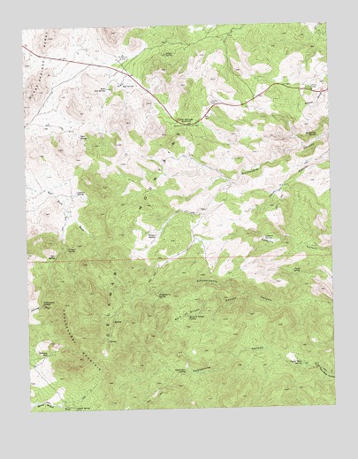
Chokecherry Mountain, NV USGS Topographic Map
Click on map above to begin viewing in our Map Viewer.

This topographic map contains these locations and features:
Feature Name Type Latitude Longitude GNIS ID View Map
Applewhite CanyonValleyN37.5186°W114.6522°838490View Map
Applewhite SpringSpringN37.5116°W114.6871°838491View Map
Balm of Gilead CanyonValleyN37.5355°W114.6592°838590View Map
Balm of Gilead SpringSpringN37.5302°W114.6851°838591View Map
Bird SpringSpringN37.5614°W114.7133°851230View Map
Buckboard SpringSpringN37.5887°W114.6313°839124View Map
Canyon Number Two SpringSpringN37.5500°W114.7208°851228View Map
Canyon SpringSpringN37.5523°W114.7341°845793View Map
Chalk SpringSpringN37.5436°W114.6392°839411View Map
Chokecherry MountainSummitN37.5344°W114.7342°845408View Map
Chokecherry SpringSpringN37.5371°W114.6976°839510View Map
Colburn SpringSpringN37.5547°W114.6532°839605View Map
Cottonwood SpringSpringN37.5345°W114.7447°839760View Map
Coyote SpringSpringN37.5008°W114.7328°839831View Map
Cylone SpringSpringN37.5710°W114.7300°839905View Map
Moon SpringSpringN37.5594°W114.7450°851229View Map
Mule SpringSpringN37.6002°W114.6644°851226View Map
Nelson SpringSpringN37.6155°W114.6923°842405View Map
Oak SpringSpringN37.6055°W114.7102°842584View Map
Oak Springs SummitGapN37.5925°W114.6856°847440View Map
Pine SpringSpringN37.5503°W114.7391°842836View Map
Robinson SeepSpringN37.5182°W114.7431°843257View Map
South Willow SpringSpringN37.5455°W114.7031°851227View Map
Taylor MineMineN37.5127°W114.6331°847506View Map
Taylor Mine SpringSpringN37.5136°W114.6392°844185View Map
Tyler SpringSpringN37.5891°W114.7282°844513View Map
West Oak SpringSpringN37.6046°W114.7165°844729View Map
Willow SpringSpringN37.5565°W114.6982°844929View Map

Note: Coordinates in the location and feature list above are referenced to NAD83 datum.


Copyright (C) 2008-2024 Ryan Niemi / Sunset Dynamics ... All Rights Reserved