TopoQuest Logo
Do you find TopoQuest useful?
Help keep TopoQuest running and adding new maps/features by donating!
Bitcoin:  19c7KJd3qBynnjoSw5npx9KScwjBe4ifkT
Litecoin:  LXs6TkuXGGXo1vDsWCkWVdjQX94eUKd6ui
Home View Maps Find Maps Find Places Resources & Links


Christmas Meadows, Utah Topographic Map

USGS Map Title: Christmas Meadows, UT
USGS Map MRC: 40110G7
DRG (GeoTIFF) Download: o40110g7.tif


Neighboring USGS Topographic Map Quads:


  Seven Tree Flat, UT  
40110H8
 

  Deadman Mountain, UT  
40110H7
 

  Elizabeth Mountain, UT  
40110H6
 

  Whitney Reservoir, UT  
40110G8
 

  Christmas Meadows, UT  
40110G7
 

  Red Knob, UT  
40110G6
 

  Mirror Lake, UT  
40110F8
 

  Hayden Peak, UT  
40110F7
 

  Explorer Peak, UT  
40110F6


Map MRC Location:

N41°
W111°
N41°
W110°
H8 H7 H6 H5 H4 H3 H2 H1
G8 G7 G6 G5 G4 G3 G2 G1
F8 F7 F6 F5 F4 F3 F2 F1
E8 E7 E6 E5 E4 E3 E2 E1
D8 D7 D6 D5 D4 D3 D2 D1
C8 C7 C6 C5 C4 C3 C2 C1
B8 B7 B6 B5 B4 B3 B2 B1
A8 A7 A6 A5 A4 A3 A2 A1
N40°
W111°
N40°
W110°

Christmas Meadows, UT USGS 1:24K Topographic Map Preview:
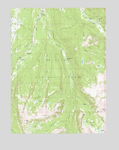
Christmas Meadows, UT USGS Topographic Map
Click on map above to begin viewing in our Map Viewer.

This topographic map contains these locations and features:
Feature Name Type Latitude Longitude GNIS ID View Map
A-1 PeakSummitN40.7680°W110.8329°1438108View Map
Amethyst BasinBasinN40.7591°W110.7688°1438201View Map
Amethyst LakeReservoirN40.7512°W110.7586°1438202View Map
Baker LakeLakeN40.8169°W110.7581°1438335View Map
Bear River Smiths Fork TrailTrailN40.8563°W110.7960°1438489View Map
Beaver View CampgroundLocaleN40.8236°W110.8630°1438547View Map
Boundary CreekStreamN40.8658°W110.7763°1439036View Map
Christmas Meadow Summer Home AreaPopulated PlaceN40.8269°W110.8077°1454705View Map
Christmas MeadowsFlatN40.8141°W110.7991°1439731View Map
Christmas Meadows CampgroundLocaleN40.8244°W110.8021°1439732View Map
Coyote HollowValleyN40.8624°W110.8710°1440117View Map
East Fork Bear River CampLocaleN40.8647°W110.7718°1440784View Map
Hayden ForkStreamN40.8672°W110.8357°1441644View Map
Hayden Fork CampgroundLocaleN40.8297°W110.8535°1441645View Map
Hell HoleBendN40.7805°W110.8427°1441675View Map
Hell Hole LakeLakeN40.7822°W110.8412°1441682View Map
Kletting PeakSummitN40.7630°W110.8563°1442342View Map
Lamotte PeakSummitN40.7738°W110.7521°1442433View Map
Main ForkStreamN40.8452°W110.8246°1443102View Map
Old BurnSlopeN40.8541°W110.7691°1454849View Map
Ostler ForkStreamN40.7894°W110.7952°1444117View Map
Ostler LakeLakeN40.7622°W110.7786°1444118View Map
Price DamDamN40.8608°W110.7604°1444641View Map
Salamander LakeLakeN40.7779°W110.7813°1445260View Map
Scow LakeLakeN40.8212°W110.7817°1445392View Map
Stillwater CampgroundLocaleN40.8686°W110.8352°1446147View Map
Stillwater ForkStreamN40.8672°W110.8357°1446148View Map
Toomset LakeLakeN40.7681°W110.7775°1446652View Map
West BasinBasinN40.7533°W110.8310°1447110View Map
Windsor DamDamN40.8599°W110.7649°1447467View Map
Wolverine Recreation TrailheadLocaleN40.8469°W110.8157°1450158View Map

Note: Coordinates in the location and feature list above are referenced to NAD83 datum.


Copyright (C) 2008-2025 Ryan Niemi / Sunset Dynamics ... All Rights Reserved