TopoQuest Logo
Do you find TopoQuest useful?
Help keep TopoQuest running and adding new maps/features by donating!
Bitcoin:  19c7KJd3qBynnjoSw5npx9KScwjBe4ifkT
Litecoin:  LXs6TkuXGGXo1vDsWCkWVdjQX94eUKd6ui
Home View Maps Find Maps Find Places Resources & Links


Cima Dome, California Topographic Map

USGS Map Title: Cima Dome, CA
USGS Map MRC: 35115C5
DRG (GeoTIFF) Download: o35115c5.tif


Neighboring USGS Topographic Map Quads:


  Valley Wells, CA  
35115D6
 

  Mescal Range, CA  
35115D5
 

  Mineral Hill, CA  
35115D4
 

  Cow Cove, CA  
35115C6
 

  Cima Dome, CA  
35115C5
 

  Joshua, CA  
35115C4
 

  Marl Mountains, CA  
35115B6
 

  Cima, CA  
35115B5
 

  Mid Hills, CA  
35115B4


Map MRC Location:

N36°
W116°
N36°
W115°
H8 H7 H6 H5 H4 H3 H2 H1
G8 G7 G6 G5 G4 G3 G2 G1
F8 F7 F6 F5 F4 F3 F2 F1
E8 E7 E6 E5 E4 E3 E2 E1
D8 D7 D6 D5 D4 D3 D2 D1
C8 C7 C6 C5 C4 C3 C2 C1
B8 B7 B6 B5 B4 B3 B2 B1
A8 A7 A6 A5 A4 A3 A2 A1
N35°
W116°
N35°
W115°

Cima Dome, CA USGS 1:24K Topographic Map Preview:
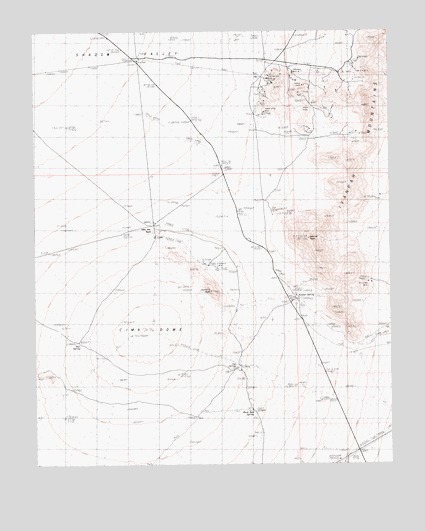
Cima Dome, CA USGS Topographic Map
Click on map above to begin viewing in our Map Viewer.

This topographic map contains these locations and features:
Feature Name Type Latitude Longitude GNIS ID View Map
Billy Boy MineMineN35.3025°W115.5086°1667009View Map
Cima DomeSummitN35.2893°W115.5849°1667011View Map
Copper King MineMineN35.3517°W115.5453°240907View Map
Cut SpringSpringN35.2788°W115.5552°241177View Map
Deer SpringSpringN35.2852°W115.6098°241378View Map
Evening Star MineMineN35.3600°W115.5417°242104View Map
Geer Dolomite QuarryMineN35.3572°W115.5325°1670650View Map
Geer ProspectMineN35.3614°W115.5353°1670713View Map
Ginn ProspectMineN35.3555°W115.5142°1670714View Map
Hartman MineMineN35.3580°W115.5408°1670651View Map
Johnny ProspectsMineN35.3586°W115.5300°1670652View Map
Johnny ShaftMineN35.3592°W115.5308°1667021View Map
Johnny TunnelMineN35.3528°W115.5283°1667022View Map
Kessler PeakSummitN35.3151°W115.5294°244282View Map
Kessler RanchLocaleN35.2980°W115.5347°1670715View Map
Kessler SpringSpringN35.2987°W115.5339°244283View Map
New Era MineMineN35.3605°W115.5131°1670716View Map
New Era Number Three MineMineN35.3633°W115.5119°1667029View Map
Ord TankReservoirN35.3667°W115.5892°1667030View Map
Rex ProspectMineN35.3547°W115.5444°1670653View Map
Ross ProspectMineN35.3642°W115.5103°1670719View Map
Standard Mine Number TwoMineN35.3628°W115.5347°249862View Map
Teutonia MineMineN35.3064°W115.5625°250359View Map
Teutonia PeakSummitN35.3001°W115.5638°250360View Map
Valley View RanchLocaleN35.3192°W115.5847°1667039View Map
White Rock SpringSpringN35.2649°W115.5489°251486View Map

Note: Coordinates in the location and feature list above are referenced to NAD83 datum.


Copyright (C) 2008-2025 Ryan Niemi / Sunset Dynamics ... All Rights Reserved