TopoQuest Logo
Do you find TopoQuest useful?
Help keep TopoQuest running and adding new maps/features by donating!
Bitcoin:  19c7KJd3qBynnjoSw5npx9KScwjBe4ifkT
Litecoin:  LXs6TkuXGGXo1vDsWCkWVdjQX94eUKd6ui
Home View Maps Find Maps Find Places Resources & Links


Clam Lake, Wisconsin Topographic Map

USGS Map Title: Clam Lake, WI
USGS Map MRC: 46090B8
DRG (GeoTIFF) Download: o46090b8.tif


Neighboring USGS Topographic Map Quads:


  Grand View, WI  
46091C1
 

  Marengo Lake, WI  
46090C8
 

  Mineral Lake, WI  
46090C7
 

  Namekagon Lake, WI  
46091B1
 

  Clam Lake, WI  
46090B8
 

  Clam Lake NE, WI  
46090B7
 

  Moose Lake, WI  
46091A1
 

  Clam Lake SW, WI  
46090A8
 

  Clam Lake SE, WI  
46090A7


Map MRC Location:

N47°
W91°
N47°
W90°
H8 H7 H6 H5 H4 H3 H2 H1
G8 G7 G6 G5 G4 G3 G2 G1
F8 F7 F6 F5 F4 F3 F2 F1
E8 E7 E6 E5 E4 E3 E2 E1
D8 D7 D6 D5 D4 D3 D2 D1
C8 C7 C6 C5 C4 C3 C2 C1
B8 B7 B6 B5 B4 B3 B2 B1
A8 A7 A6 A5 A4 A3 A2 A1
N46°
W91°
N46°
W90°

Clam Lake, WI USGS 1:24K Topographic Map Preview:
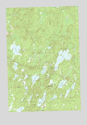
Clam Lake, WI USGS Topographic Map
Click on map above to begin viewing in our Map Viewer.

This topographic map contains these locations and features:
Feature Name Type Latitude Longitude GNIS ID View Map
Beaver LakeLakeN46.1579°W90.9229°1578737View Map
Bentley LakeLakeN46.1408°W90.9738°1578757View Map
Buffalo LakeLakeN46.1642°W90.9533°1578878View Map
Chippewa LakeLakeN46.1996°W90.9838°1578996View Map
Christy LakeLakeN46.1278°W90.9798°1579001View Map
Church of Saint GeorgeChurchN46.1375°W90.9349°1579005View Map
Clam LakePopulated PlaceN46.1638°W90.9024°1579011View Map
Clam Lake Census Designated PlaceCensusN46.1582°W90.9056°2586467View Map
Clam Lake Field StationLocaleN46.1977°W90.9777°1580962View Map
Clam Lake Guard Station (historical)LocaleN46.1597°W90.8860°1837827View Map
Clam Lake Lookout TowerTowerN46.1330°W90.9580°1581192View Map
Cranberry LakeLakeN46.1630°W90.8824°1579052View Map
Day DamDamN46.1766°W90.9118°1793114View Map
Day LakeReservoirN46.1766°W90.9118°1793115View Map
Day LakeLakeN46.1874°W90.9064°1579088View Map
Day Lake CampgroundLocaleN46.1819°W90.9043°1580964View Map
Delano LakeLakeN46.1441°W90.9504°1579111View Map
Dells LakeLakeN46.1797°W90.9862°1579113View Map
Duck LakeLakeN46.2009°W90.9267°1579156View Map
Hadley LakeLakeN46.1511°W90.9684°1579369View Map
Lake FiveLakeN46.1671°W90.9859°1579250View Map
Little Clam LakeLakeN46.1540°W90.8874°1579672View Map
Little Clam Lake Seaplane BaseAirportN46.1586°W90.8843°1581918View Map
Lower Clam LakeLakeN46.1386°W90.9421°1579774View Map
Lower Clam Lake 16ReservoirN46.1386°W90.9421°1792834View Map
Lower Clam Lake DamDamN46.1400°W90.9368°1792833View Map
McLaren LakeLakeN46.1409°W90.9212°1579849View Map
Mud LakeLakeN46.1990°W90.8839°1579961View Map
Muskie Springs LakeLakeN46.1674°W90.9675°1579979View Map
Noble LakeLakeN46.1390°W90.9763°1580016View Map
North and South Turtle Lakes 25ReservoirN46.2283°W90.9017°1792850View Map
Pole LakeLakeN46.1437°W90.9084°1580180View Map
Range Line LakeLakeN46.1683°W90.9303°1580228View Map
Red Ike LakeLakeN46.1414°W90.9611°1580237View Map
Spider Lake State Natural AreaParkN46.2294°W90.8947°2516346View Map
Spot LakeLakeN46.1460°W90.9996°1580482View Map
Turtle Lake 2WP845 DamDamN46.2283°W90.9019°1792849View Map
Upper Clam LakeLakeN46.1529°W90.9065°1580694View Map
White Bass LakeLakeN46.1738°W90.9374°1580772View Map
Wildwood CemeteryCemeteryN46.1663°W90.9055°1580789View Map

Note: Coordinates in the location and feature list above are referenced to NAD83 datum.


Copyright (C) 2008-2025 Ryan Niemi / Sunset Dynamics ... All Rights Reserved