TopoQuest Logo
Do you find TopoQuest useful?
Help keep TopoQuest running and adding new maps/features by donating!
Bitcoin:  19c7KJd3qBynnjoSw5npx9KScwjBe4ifkT
Litecoin:  LXs6TkuXGGXo1vDsWCkWVdjQX94eUKd6ui
Home View Maps Find Maps Find Places Resources & Links


Clarkfield, Minnesota Topographic Map

USGS Map Title: Clarkfield, MN
USGS Map MRC: 44095G7
DRG (GeoTIFF) Download: o44095g7.tif


Neighboring USGS Topographic Map Quads:


  Tenmile Lake, MN  
44095H8
 

  Clarkfield NE, MN  
44095H7
 

  Montevideo, MN  
44095H6
 

  Boyd, MN  
44095G8
 

  Clarkfield, MN  
44095G7
 

  Hazel Run, MN  
44095G6
 

  Minneota NW, MN  
44095F8
 

  Normania, MN  
44095F7
 

  Wood Lake NW, MN  
44095F6


Map MRC Location:

N45°
W96°
N45°
W95°
H8 H7 H6 H5 H4 H3 H2 H1
G8 G7 G6 G5 G4 G3 G2 G1
F8 F7 F6 F5 F4 F3 F2 F1
E8 E7 E6 E5 E4 E3 E2 E1
D8 D7 D6 D5 D4 D3 D2 D1
C8 C7 C6 C5 C4 C3 C2 C1
B8 B7 B6 B5 B4 B3 B2 B1
A8 A7 A6 A5 A4 A3 A2 A1
N44°
W96°
N44°
W95°

Clarkfield, MN USGS 1:24K Topographic Map Preview:
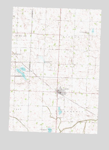
Clarkfield, MN USGS Topographic Map
Click on map above to begin viewing in our Map Viewer.

This topographic map contains these locations and features:
Feature Name Type Latitude Longitude GNIS ID View Map
Alliance ChurchChurchN44.7894°W95.7986°2065635View Map
Augusta Lutheran ChurchChurchN44.7917°W95.8036°2065634View Map
Christopherson State Wildlife Management AreParkN44.8522°W95.7620°641205View Map
City of ClarkfieldCivilN44.7907°W95.8077°2393538View Map
ClarkfieldPopulated PlaceN44.7905°W95.8086°641251View Map
ClarkfieldLocaleN44.7889°W95.8039°2065642View Map
Clarkfield - Boyd Police DepartmentBuildingN44.7906°W95.8051°2065640View Map
Clarkfield Area AmbulanceBuildingN44.7889°W95.7976°2721240View Map
Clarkfield Assembly of God ChurchChurchN44.7936°W95.8078°2065633View Map
Clarkfield Care CenterHospitalN44.7889°W95.7972°2065637View Map
Clarkfield CemeteryCemeteryN44.7980°W95.7897°641252View Map
Clarkfield City HallBuildingN44.7911°W95.8028°2065641View Map
Clarkfield Community LibraryBuildingN44.7911°W95.8019°2065638View Map
Clarkfield Fire Department and Ambulance ServiceBuildingN44.7909°W95.8034°2666204View Map
Clarkfield Lutheran ChurchChurchN44.7961°W95.8042°2065632View Map
Clarkfield Medical ClinicHospitalN44.7911°W95.8019°2065636View Map
Clarkfield Post OfficePost OfficeN44.7903°W95.8056°2065643View Map
Flinks SloughGutN44.8091°W95.8606°643742View Map
Flinks State Wildlife Management AreaParkN44.8094°W95.8470°643743View Map
Judicial Ditch Number TwentyoneCanalN44.8383°W95.7845°645854View Map
Lake LouieLakeN44.7516°W95.8173°647220View Map
North ParkParkN44.7964°W95.8067°2066282View Map
North ParkParkN44.7964°W95.8067°2065645View Map
Rysdal FarmsLocaleN44.7525°W95.8064°2674622View Map
Stokke State Wildlife Management AreaParkN44.7547°W95.8200°652656View Map
Stony Run State Wildlife Management AreaParkN44.8225°W95.8334°652697View Map
Township of FriendshipCivilN44.7606°W95.7871°664234View Map
Township of LisbonCivilN44.8485°W95.7871°664794View Map
Vahalla ParkParkN44.7933°W95.8047°2066281View Map
Vahalla ParkParkN44.7933°W95.8047°2065644View Map
Yellow East Medicine SchoolSchoolN44.7925°W95.8069°2066276View Map
Yellow East Medicine SchoolSchoolN44.7925°W95.8069°2065639View Map

Note: Coordinates in the location and feature list above are referenced to NAD83 datum.


Copyright (C) 2008-2025 Ryan Niemi / Sunset Dynamics ... All Rights Reserved