TopoQuest Logo
Do you find TopoQuest useful?
Help keep TopoQuest running and adding new maps/features by donating!
Bitcoin:  19c7KJd3qBynnjoSw5npx9KScwjBe4ifkT
Litecoin:  LXs6TkuXGGXo1vDsWCkWVdjQX94eUKd6ui
Home View Maps Find Maps Find Places Resources & Links


Clay Center NE, Kansas Topographic Map

USGS Map Title: Clay Center NE, KS
USGS Map MRC: 39097D1
DRG (GeoTIFF) Download: o39097d1.tif


Neighboring USGS Topographic Map Quads:


  Linn SW, KS  
39097E2
 

  Linn SE, KS  
39097E1
 

  Kimeo, KS  
39096E8
 

  Clay Center NW, KS  
39097D2
 

  Clay Center NE, KS  
39097D1
 

  Lasita, KS  
39096D8
 

  Clay Center SW, KS  
39097C2
 

  Clay Center SE, KS  
39097C1
 

  Bala, KS  
39096C8


Map MRC Location:

N40°
W98°
N40°
W97°
H8 H7 H6 H5 H4 H3 H2 H1
G8 G7 G6 G5 G4 G3 G2 G1
F8 F7 F6 F5 F4 F3 F2 F1
E8 E7 E6 E5 E4 E3 E2 E1
D8 D7 D6 D5 D4 D3 D2 D1
C8 C7 C6 C5 C4 C3 C2 C1
B8 B7 B6 B5 B4 B3 B2 B1
A8 A7 A6 A5 A4 A3 A2 A1
N39°
W98°
N39°
W97°

Clay Center NE, KS USGS 1:24K Topographic Map Preview:
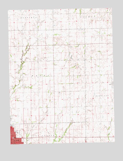
Clay Center NE, KS USGS Topographic Map
Click on map above to begin viewing in our Map Viewer.

This topographic map contains these locations and features:
Feature Name Type Latitude Longitude GNIS ID View Map
Brethren in Christ CemeteryCemeteryN39.4807°W97.0346°476038View Map
Callaway AirparkAirportN39.4291°W97.1241°476030View Map
City of GreenCivilN39.4300°W97.0001°2394974View Map
Clay CenterPopulated PlaceN39.3769°W97.1247°476034View Map
Clay Center Carnegie LibraryBuildingN39.3765°W97.1243°2694630View Map
Clay Center Christian ChurchChurchN39.3814°W97.1170°2689751View Map
Clay Center Community High SchoolSchoolN39.3862°W97.1174°480286View Map
Clay Center Community Middle SchoolSchoolN39.3887°W97.1173°2497347View Map
Clay Center Wesleyan ChurchChurchN39.3774°W97.1155°2689747View Map
Clay County Medical CenterHospitalN39.3923°W97.1238°2499077View Map
Clay County MuseumBuildingN39.3913°W97.1230°2694302View Map
Evangelical Covenant Church of Clay CenterChurchN39.3836°W97.1090°2689752View Map
First Presbyterian ChurchChurchN39.3791°W97.1243°2690570View Map
GreenPopulated PlaceN39.4278°W97.0020°476044View Map
Hawks Landing Mobile Home ParkPopulated PlaceN39.3821°W97.1026°2694095View Map
Hayes CemeteryCemeteryN39.4516°W97.0805°476040View Map
Hayes United Methodist ChurchChurchN39.4482°W97.0713°476041View Map
Hebron Reformed Presbyterian ChurchChurchN39.3834°W97.1114°476167View Map
McKinley Middle SchoolSchoolN39.3811°W97.1217°476036View Map
Mizpath CemeteryCemeteryN39.3952°W97.1245°2739652View Map
Saint Paul Lutheran ChurchChurchN39.3774°W97.1189°2689753View Map
Saint Paul's Episcopal ChurchChurchN39.3795°W97.1244°2690925View Map
Saint Peter and Paul Catholic ChurchChurchN39.3769°W97.1211°2689750View Map
Township of HayesCivilN39.4377°W97.0898°476025View Map

Note: Coordinates in the location and feature list above are referenced to NAD83 datum.


Copyright (C) 2008-2025 Ryan Niemi / Sunset Dynamics ... All Rights Reserved