TopoQuest Logo
Do you find TopoQuest useful?
Help keep TopoQuest running and adding new maps/features by donating!
Bitcoin:  19c7KJd3qBynnjoSw5npx9KScwjBe4ifkT
Litecoin:  LXs6TkuXGGXo1vDsWCkWVdjQX94eUKd6ui
Home View Maps Find Maps Find Places Resources & Links


Clay Spur, Wyoming Topographic Map

USGS Map Title: Clay Spur, WY
USGS Map MRC: 44104A4
DRG (GeoTIFF) Download: o44104a4.tif


Neighboring USGS Topographic Map Quads:


  Arrowhead Reservoir, WY  
44104B5
 

  Sheldon Creek, WY  
44104B4
 

  Inyan Kara Mountain, WY  
44104B3
 

  Upton East, WY  
44104A5
 

  Clay Spur, WY  
44104A4
 

  Skull Creek, WY  
44104A3
 

  Sheep Canyon Creek East, WY  
43104H5
 

  Osage, WY  
43104H4
 

  Pedro, WY  
43104H3


Map MRC Location:

N45°
W105°
N45°
W104°
H8 H7 H6 H5 H4 H3 H2 H1
G8 G7 G6 G5 G4 G3 G2 G1
F8 F7 F6 F5 F4 F3 F2 F1
E8 E7 E6 E5 E4 E3 E2 E1
D8 D7 D6 D5 D4 D3 D2 D1
C8 C7 C6 C5 C4 C3 C2 C1
B8 B7 B6 B5 B4 B3 B2 B1
A8 A7 A6 A5 A4 A3 A2 A1
N44°
W105°
N44°
W104°

Clay Spur, WY USGS 1:24K Topographic Map Preview:
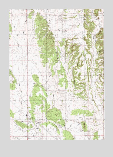
Clay Spur, WY USGS Topographic Map
Click on map above to begin viewing in our Map Viewer.

This topographic map contains these locations and features:
Feature Name Type Latitude Longitude GNIS ID View Map
Berry CanyonValleyN44.0580°W104.3880°1585398View Map
Bertha CanyonValleyN44.0830°W104.3841°1585402View Map
Clay SpurPopulated PlaceN44.0225°W104.4763°1586755View Map
Douglas PlaceLocaleN44.1175°W104.4408°1604957View Map
Douglas-Sweet SchoolSchoolN44.1136°W104.4297°1587754View Map
East Iron CreekStreamN44.0211°W104.4869°1599510View Map
Farley Number One MineMineN44.0828°W104.4083°1726393View Map
Farley Number Three MineMineN44.0672°W104.4083°1726395View Map
Farley Number Two MineMineN44.0672°W104.4083°1726394View Map
Johnson DrawValleyN44.0930°W104.4861°1590164View Map
Jordan DrawValleyN44.0158°W104.4183°1590235View Map
Kellog ReservoirReservoirN44.0520°W104.4566°1604959View Map
Little Turner CreekStreamN44.0139°W104.4683°1590888View Map
Osage Clay Spur Quarries MineMineN44.0100°W104.4855°1704315View Map
Osage MineMineN44.0169°W104.4580°1704314View Map
Piney RidgeRidgeN44.0972°W104.4400°1592826View Map
Shale HillSummitN44.0136°W104.4019°1594149View Map
Sunquist DrawValleyN44.0494°W104.4161°1595211View Map
Sweet RanchLocaleN44.1153°W104.4122°1604958View Map
Tavegia Pit MineMineN44.1022°W104.3991°1704317View Map
Walcott DrawValleyN44.0433°W104.4800°1595989View Map
West Fork Skull CreekStreamN44.1094°W104.3802°1604074View Map

Note: Coordinates in the location and feature list above are referenced to NAD83 datum.


Copyright (C) 2008-2024 Ryan Niemi / Sunset Dynamics ... All Rights Reserved