TopoQuest Logo
Do you find TopoQuest useful?
Help keep TopoQuest running and adding new maps/features by donating!
Bitcoin:  19c7KJd3qBynnjoSw5npx9KScwjBe4ifkT
Litecoin:  LXs6TkuXGGXo1vDsWCkWVdjQX94eUKd6ui
Home View Maps Find Maps Find Places Resources & Links


Clayton, New Mexico Topographic Map

USGS Map Title: Clayton, NM
USGS Map MRC: 36103D2
DRG (GeoTIFF) Download: o36103d2.tif


Neighboring USGS Topographic Map Quads:


  Bible Top Butte, NM  
36103E3
 

  Rabbit Ear Mountain, NM  
36103E2
 

  Rardin Hill, NM  
36103E1
 

  Royce, NM  
36103D3
 

  Clayton, NM  
36103D2
 

  Texline North, TX  
36103D1
 

  Sand Hill, NM  
36103C3
 

  Clayton SW, NM  
36103C2
 

  Texline South, TX  
36103C1


Map MRC Location:

N37°
W104°
N37°
W103°
H8 H7 H6 H5 H4 H3 H2 H1
G8 G7 G6 G5 G4 G3 G2 G1
F8 F7 F6 F5 F4 F3 F2 F1
E8 E7 E6 E5 E4 E3 E2 E1
D8 D7 D6 D5 D4 D3 D2 D1
C8 C7 C6 C5 C4 C3 C2 C1
B8 B7 B6 B5 B4 B3 B2 B1
A8 A7 A6 A5 A4 A3 A2 A1
N36°
W104°
N36°
W103°

Clayton, NM USGS 1:24K Topographic Map Preview:
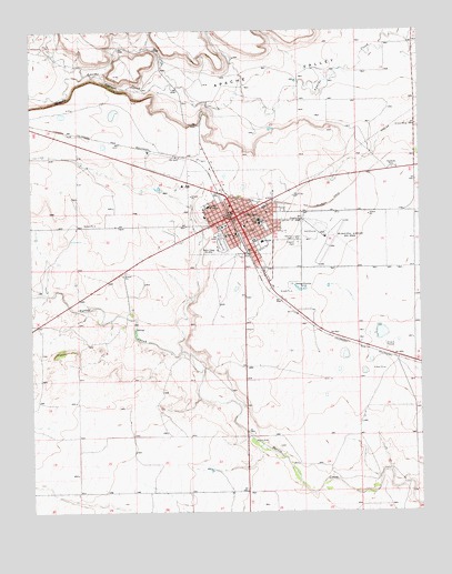
Clayton, NM USGS Topographic Map
Click on map above to begin viewing in our Map Viewer.

This topographic map contains these locations and features:
Feature Name Type Latitude Longitude GNIS ID View Map
Albert W Thompson Memorial LibraryBuildingN36.4517°W103.1841°931374View Map
Alvis SchoolSchoolN36.4453°W103.1760°903125View Map
Amistad Elementary SchoolSchoolN36.4517°W103.1841°934146View Map
Apache CanyonValleyN36.4842°W103.2133°903221View Map
Apache SpringSpringN36.4742°W103.1719°902604View Map
Assembly of God ChurchChurchN36.4517°W103.1841°902586View Map
Church of ChristChurchN36.4517°W103.1841°902539View Map
Church of GodChurchN36.4517°W103.1841°902588View Map
ClaytonPopulated PlaceN36.4517°W103.1841°905193View Map
Clayton CemeteryCemeteryN36.4450°W103.1646°905195View Map
Clayton Fire Rescue Station 1BuildingN36.4524°W103.1856°2657577View Map
Clayton Fire Rescue Station 2BuildingN36.4474°W103.1876°2657960View Map
Clayton High SchoolSchoolN36.4517°W103.1841°934148View Map
Clayton Historical MarkerParkN36.4517°W103.1841°932237View Map
Clayton Junior High SchoolSchoolN36.4428°W103.1755°913460View Map
Clayton Municipal AirparkAirportN36.4448°W103.1497°936922View Map
Clayton Police DepartmentBuildingN36.4526°W103.1858°2722566View Map
Clayton Post OfficePost OfficeN36.4508°W103.1849°938145View Map
County CemeteryCemeteryN36.4459°W103.1646°2013507View Map
Double A FeedersLocaleN36.4786°W103.1310°2013506View Map
Eklund Hotel Historic SiteBuildingN36.4517°W103.1841°933784View Map
Eklund Storage Works DamDamN36.4750°W103.1738°924100View Map
First Baptist ChurchChurchN36.4517°W103.1841°902540View Map
First United Methodist ChurchChurchN36.4517°W103.1841°902589View Map
Gospel CenterChurchN36.4517°W103.1841°902537View Map
Herzstein Memorial Museum Historic SiteBuildingN36.4517°W103.1841°933749View Map
Independent Order of Odd Fellows CemeteryCemeteryN36.4461°W103.1646°909356View Map
Jehovahs Witnesses ChurchChurchN36.4517°W103.1841°902538View Map
Kiowa and Rita Blanca Ranger District OfficeLocaleN36.4534°W103.1830°913426View Map
Kiser SchoolSchoolN36.4489°W103.1888°907567View Map
KLMX-AM (Clayton)TowerN36.4442°W103.1905°938588View Map
KOA CampgroundLocaleN36.4447°W103.1733°913455View Map
Leighton GroveWoodsN36.3931°W103.1791°902688View Map
NASA Wind ChargerLocaleN36.4467°W103.1910°913459View Map
Rabbit Ear Fire Department Main StationBuildingN36.4375°W103.1754°2658167View Map
Saint Francis Xavier Catholic ChurchChurchN36.4517°W103.1841°902587View Map
Santa Fe Trail Rest AreaLocaleN36.4639°W103.1341°913458View Map
Seventh Day Adventist ChurchChurchN36.4517°W103.1841°902590View Map
Seventh Day Adventist ChurchChurchN36.4539°W103.1944°901725View Map
Town of ClaytonCivilN36.4434°W103.1578°2413209View Map
Union County Courthouse Historic SiteBuildingN36.4517°W103.1841°934325View Map
Union County General HospitalHospitalN36.4542°W103.1933°901333View Map
Union County General Hospital Medical LibraryBuildingN36.4517°W103.1841°929454View Map
Union County Sheriff's OfficeBuildingN36.4494°W103.1877°2722497View Map

Note: Coordinates in the location and feature list above are referenced to NAD83 datum.


Copyright (C) 2008-2025 Ryan Niemi / Sunset Dynamics ... All Rights Reserved