TopoQuest Logo
Do you find TopoQuest useful?
Help keep TopoQuest running and adding new maps/features by donating!
Bitcoin:  19c7KJd3qBynnjoSw5npx9KScwjBe4ifkT
Litecoin:  LXs6TkuXGGXo1vDsWCkWVdjQX94eUKd6ui
Home View Maps Find Maps Find Places Resources & Links


Clayton, Michigan Topographic Map

USGS Map Title: Clayton, MI
USGS Map MRC: 41084G2
DRG (GeoTIFF) Download: o41084g2.tif


Neighboring USGS Topographic Map Quads:


  Addison, MI  
41084H3
 

  Rome Center, MI  
41084H2
 

  Adrian, MI  
41084H1
 

  Hudson, MI  
41084G3
 

  Clayton, MI  
41084G2
 

  Jasper, MI  
41084G1
 

  Fayette, OH  
41084F3
 

  Morenci, MI  
41084F2
 

  Lyons, OH  
41084F1


Map MRC Location:

N42°
W85°
N42°
W84°
H8 H7 H6 H5 H4 H3 H2 H1
G8 G7 G6 G5 G4 G3 G2 G1
F8 F7 F6 F5 F4 F3 F2 F1
E8 E7 E6 E5 E4 E3 E2 E1
D8 D7 D6 D5 D4 D3 D2 D1
C8 C7 C6 C5 C4 C3 C2 C1
B8 B7 B6 B5 B4 B3 B2 B1
A8 A7 A6 A5 A4 A3 A2 A1
N41°
W85°
N41°
W84°

Clayton, MI USGS 1:24K Topographic Map Preview:
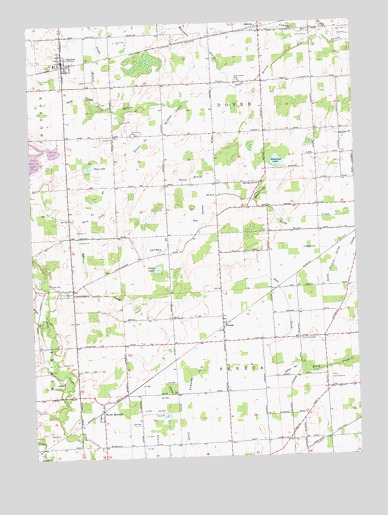
Clayton, MI USGS Topographic Map
Click on map above to begin viewing in our Map Viewer.

This topographic map contains these locations and features:
Feature Name Type Latitude Longitude GNIS ID View Map
Bear CreekStreamN41.7770°W84.1461°620838View Map
Benner DrainStreamN41.8237°W84.1636°621103View Map
Big Swamp DrainStreamN41.8253°W84.1772°621363View Map
Bird DrainStreamN41.8531°W84.2241°621433View Map
Bordine DrainCanalN41.8489°W84.1938°621743View Map
Bovee DrainStreamN41.8250°W84.1833°621783View Map
CadmusPopulated PlaceN41.8739°W84.1605°622433View Map
Cadmus DrainStreamN41.8703°W84.1363°622434View Map
Cadmus Post OfficePost OfficeN41.8739°W84.1606°2435693View Map
Cadmus Presbyterian ChurchChurchN41.8728°W84.1572°2465615View Map
Cadmus Station (historical)LocaleN41.8739°W84.1608°2435562View Map
CanandaiguaPopulated PlaceN41.7987°W84.2344°622682View Map
Canandaigua CemeteryCemeteryN41.8028°W84.2347°2465715View Map
Canandaigua Community ChurchChurchN41.7975°W84.2361°2463797View Map
Canandaigua Post Office (historical)Post OfficeN41.7986°W84.2344°2435691View Map
ClaytonPopulated PlaceN41.8634°W84.2363°623395View Map
Clayton Bible ChurchChurchN41.8619°W84.2364°2465621View Map
Clayton Fire DepartmentBuildingN41.8643°W84.2376°2620091View Map
Clayton LibraryBuildingN41.8642°W84.2364°2465620View Map
Clayton Post OfficePost OfficeN41.8653°W84.2364°2465619View Map
Clayton Station (historical)LocaleN41.8633°W84.2361°2465622View Map
Covell DrainStreamN41.7892°W84.2466°623910View Map
De-Mor Hills Golf CourseLocaleN41.7639°W84.2472°2463801View Map
Deline DrainCanalN41.8409°W84.2063°624529View Map
Deline DrainStreamN41.7762°W84.1491°624530View Map
Demings LakeLakeN41.8350°W84.1548°624541View Map
Demings Lake ChurchChurchN41.8289°W84.1619°624542View Map
Dover Center CemeteryCemeteryN41.8584°W84.1699°624834View Map
Dover Township HallBuildingN41.8581°W84.1742°2465616View Map
Fractional District Number Three School Historical MarkerParkN41.7528°W84.2242°2465773View Map
Furman DrainStreamN41.8139°W84.1977°626577View Map
Gage CemeteryCemeteryN41.8725°W84.1261°626586View Map
Haley LakeLakeN41.8389°W84.2411°2465709View Map
Harrison DrainStreamN41.8567°W84.1747°627857View Map
Hazen CreekStreamN41.8695°W84.1336°628022View Map
Lake Hudson State Recreation AreaParkN41.8361°W84.2417°2465630View Map
Marvin Post Office (historical)Post OfficeN41.7833°W84.1569°2435675View Map
New Haven Church of ChristChurchN41.8583°W84.1589°2465617View Map
North MorenciPopulated PlaceN41.7637°W84.2236°633615View Map
North Morenci Post Office (historical)Post OfficeN41.7636°W84.2236°2435669View Map
North Morenci StationLocaleN41.7631°W84.2233°2435557View Map
Oneida Post Office (historical)Post OfficeN41.8206°W84.2167°2435608View Map
Porter CemeteryCemeteryN41.7834°W84.1461°635293View Map
Rice LakeLakeN41.8339°W84.2269°635841View Map
Rice Lake DrainStreamN41.8162°W84.2316°635848View Map
Sampson DrainStreamN41.7681°W84.1947°637153View Map
SenecaPopulated PlaceN41.7875°W84.1766°637574View Map
Seneca Community ChurchChurchN41.7897°W84.1767°2436160View Map
Seneca DrainStreamN41.7681°W84.1949°637575View Map
Seneca Post OfficePost OfficeN41.7875°W84.1767°2435598View Map
Seneca StationLocaleN41.7889°W84.1750°2435550View Map
South Dover CemeteryCemeteryN41.8431°W84.2108°638337View Map
Township of DoverCivilN41.8571°W84.1787°1626189View Map
Township of SenecaCivilN41.7651°W84.1730°1627058View Map
United Methodist ChurchChurchN41.8675°W84.2372°2465618View Map
Vales LakeLakeN41.8043°W84.2013°1615445View Map
Village of ClaytonCivilN41.8649°W84.2348°2397641View Map

Note: Coordinates in the location and feature list above are referenced to NAD83 datum.


Copyright (C) 2008-2025 Ryan Niemi / Sunset Dynamics ... All Rights Reserved