TopoQuest Logo
Do you find TopoQuest useful?
Help keep TopoQuest running and adding new maps/features by donating!
Bitcoin:  19c7KJd3qBynnjoSw5npx9KScwjBe4ifkT
Litecoin:  LXs6TkuXGGXo1vDsWCkWVdjQX94eUKd6ui
Home View Maps Find Maps Find Places Resources & Links


Clear West Peak, Washington Topographic Map

USGS Map Title: Clear West Peak, WA
USGS Map MRC: 47121A6
DRG (GeoTIFF) Download: o47121a6.tif


Neighboring USGS Topographic Map Quads:


  Cyclone Creek, WA  
47121B7
 

  Greenwater, WA  
47121B6
 

  Nagrom, WA  
47121B5
 

  Bearhead Mountain, WA  
47121A7
 

  Clear West Peak, WA  
47121A6
 

  Sun Top, WA  
47121A5
 

  Mowich Lake, WA  
46121H7
 

  Sunrise, WA  
46121H6
 

  White River Park, WA  
46121H5


Map MRC Location:

N48°
W122°
N48°
W121°
H8 H7 H6 H5 H4 H3 H2 H1
G8 G7 G6 G5 G4 G3 G2 G1
F8 F7 F6 F5 F4 F3 F2 F1
E8 E7 E6 E5 E4 E3 E2 E1
D8 D7 D6 D5 D4 D3 D2 D1
C8 C7 C6 C5 C4 C3 C2 C1
B8 B7 B6 B5 B4 B3 B2 B1
A8 A7 A6 A5 A4 A3 A2 A1
N47°
W122°
N47°
W121°

Clear West Peak, WA USGS 1:24K Topographic Map Preview:
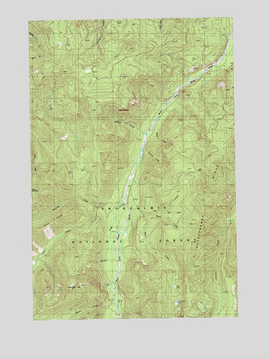
Clear West Peak, WA USGS Topographic Map
Click on map above to begin viewing in our Map Viewer.

This topographic map contains these locations and features:
Feature Name Type Latitude Longitude GNIS ID View Map
Clear West PeakSummitN47.0126°W121.7282°1517841View Map
Clear West Peak LookoutLocaleN47.0126°W121.7282°1529655View Map
Eleanor CreekStreamN47.0407°W121.6259°1519245View Map
Flip-O-Way TrailTrailN47.0643°W121.7293°1519652View Map
Haller PassGapN47.0612°W121.6495°1520473View Map
Hank CreekStreamN47.0429°W121.6776°1520506View Map
Hazzard CreekStreamN47.0773°W121.6807°1520643View Map
Jim CreekStreamN47.0454°W121.6918°1521368View Map
Joe CreekStreamN47.0448°W121.6734°1521386View Map
Lonesome LakeLakeN47.0065°W121.6636°1522383View Map
Mule CreekStreamN47.0440°W121.6832°1523501View Map
Mule LakeLakeN47.0129°W121.6645°1523503View Map
Nosedive CreekStreamN47.0701°W121.6826°1523926View Map
Pigeon CreekStreamN47.0073°W121.7020°1528854View Map
Pinochle CreekStreamN47.0507°W121.6948°1524468View Map
The PalisadesSummitN47.0887°W121.6918°1527056View Map
Thirsty CreekStreamN47.0796°W121.6759°1527089View Map
Three PeaksSummitN47.0401°W121.7382°1527158View Map
Viola CreekStreamN47.0462°W121.7109°1527719View Map
Wrong CreekStreamN47.0487°W121.6940°1528326View Map

Note: Coordinates in the location and feature list above are referenced to NAD83 datum.


Copyright (C) 2008-2024 Ryan Niemi / Sunset Dynamics ... All Rights Reserved