TopoQuest Logo
Do you find TopoQuest useful?
Help keep TopoQuest running and adding new maps/features by donating!
Bitcoin:  19c7KJd3qBynnjoSw5npx9KScwjBe4ifkT
Litecoin:  LXs6TkuXGGXo1vDsWCkWVdjQX94eUKd6ui
Home View Maps Find Maps Find Places Resources & Links


Clifty Falls, Indiana Topographic Map

USGS Map Title: Clifty Falls, IN
USGS Map MRC: 38085G4
DRG (GeoTIFF) Download: o38085g4.tif


Neighboring USGS Topographic Map Quads:


  Vernon, IN  
38085H5
 

  San Jacinto, IN  
38085H4
 

  Rexville, IN  
38085H3
 

  Volga, IN  
38085G5
 

  Clifty Falls, IN  
38085G4
 

  Canaan, IN  
38085G3
 

  Kent, IN  
38085F5
 

  Madison West, IN  
38085F4
 

  Madison East, IN  
38085F3


Map MRC Location:

N39°
W86°
N39°
W85°
H8 H7 H6 H5 H4 H3 H2 H1
G8 G7 G6 G5 G4 G3 G2 G1
F8 F7 F6 F5 F4 F3 F2 F1
E8 E7 E6 E5 E4 E3 E2 E1
D8 D7 D6 D5 D4 D3 D2 D1
C8 C7 C6 C5 C4 C3 C2 C1
B8 B7 B6 B5 B4 B3 B2 B1
A8 A7 A6 A5 A4 A3 A2 A1
N38°
W86°
N38°
W85°

Clifty Falls, IN USGS 1:24K Topographic Map Preview:
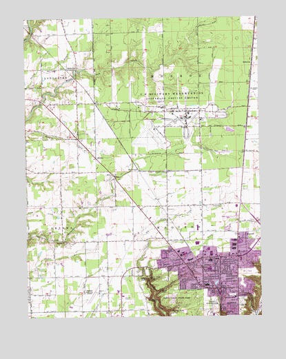
Clifty Falls, IN USGS Topographic Map
Click on map above to begin viewing in our Map Viewer.

This topographic map contains these locations and features:
Feature Name Type Latitude Longitude GNIS ID View Map
Baxter CemeteryCemeteryN38.7564°W85.3866°430590View Map
Bayless CemeteryCemeteryN38.7567°W85.3866°430593View Map
BelleviewPopulated PlaceN38.8559°W85.3780°430779View Map
Big Creek CemeteryCemeteryN38.7551°W85.3867°431031View Map
Bland CemeteryCemeteryN38.8720°W85.4974°431176View Map
Brights StationLocaleN38.8259°W85.4513°452190View Map
Bryner Miner CemeteryCemeteryN38.7714°W85.4056°431705View Map
Burke's Airport (historical)AirportN38.7714°W85.4848°2677060View Map
Calloway Station (historical)Populated PlaceN38.8403°W85.4622°452191View Map
Calvary ChurchChurchN38.7770°W85.3861°431980View Map
City of MadisonCivilN38.7581°W85.3970°2395805View Map
Clifty FallsFallsN38.7664°W85.4363°432661View Map
Clifty Falls State ParkParkN38.7595°W85.4186°432662View Map
Deans BranchStreamN38.7601°W85.4313°433393View Map
Emery O Muncie Elementary SchoolSchoolN38.7637°W85.4036°439880View Map
Fairmount CemeteryCemeteryN38.7576°W85.3860°434306View Map
Faith Alliance ChurchChurchN38.7711°W85.3886°2740645View Map
Faith Lutheran ChurchChurchN38.7839°W85.3864°2740652View Map
First Church of the NazareneChurchN38.7644°W85.3961°2740649View Map
Giltner AirportAirportN38.8131°W85.4460°2677061View Map
Grace Baptist ChurchChurchN38.7664°W85.4069°2740646View Map
Grace Fellowship ChurchChurchN38.7731°W85.4181°2740648View Map
Hanging RockCliffN38.7517°W85.3936°435678View Map
Higbie CemeteryCemeteryN38.7698°W85.4405°436129View Map
Hoffman FallsFallsN38.7526°W85.4225°436279View Map
Indiana Veterans Memorial CemeteryCemeteryN38.7534°W85.4050°2775148View Map
Jefferson CountyCivilN38.7858°W85.4386°450363View Map
Jefferson Proving GroundsMilitaryN38.8619°W85.4157°2512248View Map
Liberty ChurchChurchN38.8659°W85.3761°437828View Map
Little Clifty CreekStreamN38.7645°W85.4352°438014View Map
Little Clifty FallsFallsN38.7667°W85.4341°438015View Map
Madison Municipal AirportAirportN38.7602°W85.4617°449255View Map
Madison Township Volunteer Fire DepartmentBuildingN38.7889°W85.3873°2625639View Map
Madison Volunteer Fire Department - North Madison Fire Company 5BuildingN38.7610°W85.3984°2625520View Map
Madison Volunteer Fire Department Clifty Six Fire and Rescue Company 6BuildingN38.7744°W85.4004°2625534View Map
MiddleforkPopulated PlaceN38.8539°W85.4722°439115View Map
MidwayPopulated PlaceN38.8164°W85.4627°439122View Map
Monroe CemeteryCemeteryN38.7569°W85.3858°439340View Map
Mud Luck Post Office (historical)Post OfficeN38.8412°W85.3797°453027View Map
North MadisonPopulated PlaceN38.7678°W85.3966°440275View Map
North Madison Baptist ChurchChurchN38.7628°W85.4006°2740650View Map
Resurrection Lutheran ChurchChurchN38.7711°W85.4178°2740647View Map
RingwaldPopulated PlaceN38.7837°W85.3827°442052View Map
Saint Joseph CemeteryCemeteryN38.7516°W85.3780°442630View Map
Saint Patricks CemeteryCemeteryN38.7589°W85.3900°442750View Map
Shawe Memorial High SchoolSchoolN38.7581°W85.3883°443321View Map
SmyrnaPopulated PlaceN38.7820°W85.4808°443716View Map
Stony PointLocaleN38.8203°W85.3822°449858View Map
Stony Point Post Office (historical)Post OfficeN38.8203°W85.3822°453028View Map
Township of MadisonCivilN38.7789°W85.3829°453593View Map
Township of MonroeCivilN38.8693°W85.4070°453640View Map
Tunnel FallsFallsN38.7612°W85.4283°444951View Map
Wallace FallsFallsN38.7576°W85.4336°445392View Map
WirtPopulated PlaceN38.8095°W85.4536°446203View Map
Wirt StationPopulated PlaceN38.8114°W85.4397°446204View Map

Note: Coordinates in the location and feature list above are referenced to NAD83 datum.


Copyright (C) 2008-2025 Ryan Niemi / Sunset Dynamics ... All Rights Reserved