TopoQuest Logo
Do you find TopoQuest useful?
Help keep TopoQuest running and adding new maps/features by donating!
Bitcoin:  19c7KJd3qBynnjoSw5npx9KScwjBe4ifkT
Litecoin:  LXs6TkuXGGXo1vDsWCkWVdjQX94eUKd6ui
Home View Maps Find Maps Find Places Resources & Links


Clint, Texas Topographic Map

USGS Map Title: Clint, TX
USGS Map MRC: 31106E2
DRG (GeoTIFF) Download: o31106e2.tif


Neighboring USGS Topographic Map Quads:


  Ysleta, TX  
31106F3
 

  Clint NW, TX  
31106F2
 

  Clint NE, TX  
31106F1
 

  San Elizario, TX  
31106E3
 

  Clint, TX  
31106E2
 

  Clint SE, TX  
31106E1


  Isla, TX  
31106D2
 

  Tornillo, TX  
31106D1


Map MRC Location:

N32°
W107°
N32°
W106°
H8 H7 H6 H5 H4 H3 H2 H1
G8 G7 G6 G5 G4 G3 G2 G1
F8 F7 F6 F5 F4 F3 F2 F1
E8 E7 E6 E5 E4 E3 E2 E1
D8 D7 D6 D5 D4 D3 D2 D1
C8 C7 C6 C5 C4 C3 C2 C1
B8 B7 B6 B5 B4 B3 B2 B1
A8 A7 A6 A5 A4 A3 A2 A1
N31°
W107°
N31°
W106°

Clint, TX USGS 1:24K Topographic Map Preview:
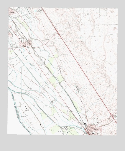
Clint, TX USGS Topographic Map
Click on map above to begin viewing in our Map Viewer.

This topographic map contains these locations and features:
Feature Name Type Latitude Longitude GNIS ID View Map
Ascencion Park Estates ColoniaPopulated PlaceN31.6212°W106.1436°2010166View Map
Athena West ColoniaPopulated PlaceN31.6162°W106.2216°2010167View Map
Burbridge Acres ColoniaPopulated PlaceN31.6032°W106.2425°2010179View Map
Camp SchoolSchoolN31.5115°W106.1522°1353672View Map
ClintPopulated PlaceN31.5923°W106.2241°1354674View Map
Clint High SchoolSchoolN31.6037°W106.2475°2005128View Map
Clint Independent School District Football Stadium and Baseball FieldParkN31.5957°W106.2372°2027554View Map
Clint Junior High SchoolSchoolN31.6001°W106.2441°2005129View Map
Clint LateralCanalN31.5946°W106.2316°1354675View Map
Clint Police DepartmentBuildingN31.5870°W106.2310°2750546View Map
Clint Post OfficePost OfficeN31.5885°W106.2332°2732056View Map
Clint Volunteer Fire Department Station 1BuildingN31.5910°W106.2244°2552044View Map
Clint Volunteer Fire Department Station 2BuildingN31.6098°W106.1560°2551941View Map
Clint Volunteer Fire Department Station 3BuildingN31.5953°W106.2020°2551098View Map
Coffin LateralCanalN31.5679°W106.2233°1354729View Map
Colonia del Rio Number 3Populated PlaceN31.5721°W106.2475°2010096View Map
Connington ColoniaPopulated PlaceN31.5721°W106.2175°2010097View Map
Cotton Valley Estates ColoniaPopulated PlaceN31.6221°W106.2386°2010098View Map
CuadrillaPopulated PlaceN31.5332°W106.2005°1388211View Map
Cuadrilla LateralCanalN31.5215°W106.1972°1355454View Map
El Paso County Constable's Office Precinct 6BuildingN31.5863°W106.2307°2750703View Map
El Paso County Sheriff's Office Clint SubstationBuildingN31.5865°W106.2306°2750377View Map
El Paso County Sheriff's Office Fabins SubstationBuildingN31.5025°W106.1581°2750424View Map
FabensPopulated PlaceN31.5023°W106.1586°1357151View Map
Fabens AirportAirportN31.5143°W106.1480°1386621View Map
Fabens Census Designated PlaceCensusN31.5135°W106.1521°2408099View Map
Fabens DamDamN31.5185°W106.1253°1373689View Map
Fabens Fire and Rescue Station 1BuildingN31.5045°W106.1600°2551987View Map
Fabens Intercepting DrainCanalN31.5146°W106.1814°1357155View Map
Fabens ParkParkN31.5018°W106.1511°2028382View Map
Fabens Post OfficePost OfficeN31.5076°W106.1623°2731213View Map
Green LateralCanalN31.5837°W106.2266°1358377View Map
Hacienda Real ColoniaPopulated PlaceN31.5871°W106.2044°2010123View Map
Haciendas del Valle Number 1 ColoniaPopulated PlaceN31.6201°W106.2486°2010124View Map
Island FeederCanalN31.5526°W106.2350°1360047View Map
Island Main LateralCanalN31.5176°W106.2172°1360048View Map
Island Spur DrainCanalN31.5054°W106.2228°1360049View Map
KPAS-FM (Fabens)TowerN31.5951°W106.2000°1387968View Map
Lee Moore Intercepting DrainCanalN31.5243°W106.2114°1361039View Map
Life Ambulance Service Station 3BuildingN31.5045°W106.1600°2655849View Map
Lordsville ColoniaPopulated PlaceN31.6012°W106.2475°2010062View Map
Morning GloryPopulated PlaceN31.5701°W106.2158°1852739View Map
Morning Glory Census Designated PlaceCensusN31.5648°W106.2089°2408869View Map
Morning Glory Manor ColoniaPopulated PlaceN31.5712°W106.2136°2010022View Map
Orr WellWellN31.5965°W106.1661°1364589View Map
Quail Mesa ColoniaPopulated PlaceN31.6201°W106.2255°2010037View Map
Rancho Miraval Estates ColoniaPopulated PlaceN31.6162°W106.2425°2010039View Map
Rio Pasado Estates ColoniaPopulated PlaceN31.5871°W106.2466°2010040View Map
River DrainCanalN31.5073°W106.1683°1366516View Map
River DrainCanalN31.5429°W106.2278°1375758View Map
River Spur DrainCanalN31.5646°W106.2469°1366522View Map
Riverside Canal ExtendedCanalN31.5168°W106.2022°1366532View Map
Rodriquena LateralCanalN31.5990°W106.2469°1366820View Map
Salatral LateralCanalN31.5754°W106.2044°1367342View Map
San Felipe ArroyoValleyN31.5086°W106.1491°1367495View Map
San Lorenzo CemeteryCemeteryN31.5948°W106.2064°1367524View Map
Sanchez ColoniaPopulated PlaceN31.5082°W106.1675°2009997View Map
Santa Martina ColoniaPopulated PlaceN31.6190°W106.2466°2009998View Map
Sunshine Acres ColoniaPopulated PlaceN31.5701°W106.2166°2010010View Map
Town of ClintCivilN31.5901°W106.2289°2413216View Map
United States Border Patrol StationBuildingN31.5814°W106.2291°2750701View Map
Vista Larga ColoniaPopulated PlaceN31.6090°W106.1855°2009947View Map
Vista Larga Number 2 ColoniaPopulated PlaceN31.6040°W106.1844°2009948View Map
Wildhorse Valley ColoniaPopulated PlaceN31.5921°W106.2105°2009957View Map
William David Surratt Elementary SchoolSchoolN31.6037°W106.2472°2004960View Map

Note: Coordinates in the location and feature list above are referenced to NAD83 datum.


Copyright (C) 2008-2024 Ryan Niemi / Sunset Dynamics ... All Rights Reserved