TopoQuest Logo
Do you find TopoQuest useful?
Help keep TopoQuest running and adding new maps/features by donating!
Bitcoin:  19c7KJd3qBynnjoSw5npx9KScwjBe4ifkT
Litecoin:  LXs6TkuXGGXo1vDsWCkWVdjQX94eUKd6ui
Home View Maps Find Maps Find Places Resources & Links


Clinton, Minnesota Topographic Map

USGS Map Title: Clinton, MN
USGS Map MRC: 45096D4
DRG (GeoTIFF) Download: o45096d4.tif


Neighboring USGS Topographic Map Quads:


  Barry, MN  
45096E5
 

  Graceville, MN  
45096E4
 

  Johnson, MN  
45096E3
 

  Big Stone Lake East, MN  
45096D5
 

  Clinton, MN  
45096D4
 

  Dismal Swamp, MN  
45096D3
 

  Big Stone Lake SE, SD  
45096C5
 

  Ortonville, MN  
45096C4
 

  Odessa, MN  
45096C3


Map MRC Location:

N46°
W97°
N46°
W96°
H8 H7 H6 H5 H4 H3 H2 H1
G8 G7 G6 G5 G4 G3 G2 G1
F8 F7 F6 F5 F4 F3 F2 F1
E8 E7 E6 E5 E4 E3 E2 E1
D8 D7 D6 D5 D4 D3 D2 D1
C8 C7 C6 C5 C4 C3 C2 C1
B8 B7 B6 B5 B4 B3 B2 B1
A8 A7 A6 A5 A4 A3 A2 A1
N45°
W97°
N45°
W96°

Clinton, MN USGS 1:24K Topographic Map Preview:
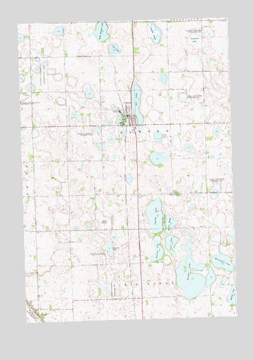
Clinton, MN USGS Topographic Map
Click on map above to begin viewing in our Map Viewer.

This topographic map contains these locations and features:
Feature Name Type Latitude Longitude GNIS ID View Map
Bassett SloughLakeN45.4146°W96.4131°639714View Map
Big Stone Baptist CemeteryCemeteryN45.3972°W96.3889°2067151View Map
Big Stone CountyCivilN45.4261°W96.4109°659451View Map
Campbell SloughLakeN45.4942°W96.4187°640856View Map
City of ClintonCivilN45.4632°W96.4415°2393569View Map
ClintonPopulated PlaceN45.4602°W96.4337°641338View Map
Clinton (historical)LocaleN45.4597°W96.4361°2067178View Map
Clinton CemeteryCemeteryN45.4664°W96.4525°2110013View Map
Clinton Community ClinicHospitalN45.4603°W96.4333°2067185View Map
Clinton Elementary SchoolSchoolN45.4619°W96.4403°2067186View Map
Clinton Post OfficePost OfficeN45.4605°W96.4347°2067180View Map
Clinton Volunteer Fire DepartmentBuildingN45.4599°W96.4356°2666239View Map
Cup LakeLakeN45.4881°W96.4425°642551View Map
Eli LakeLakeN45.4658°W96.4305°643243View Map
Elim Lutheran ChurchChurchN45.4589°W96.4319°2067183View Map
Long Island CemeteryCemeteryN45.4269°W96.4137°647030View Map
Lysing LakeLakeN45.4181°W96.4220°647343View Map
Moulton LakeLakeN45.4047°W96.4487°648141View Map
Munnwyler LakeLakeN45.3978°W96.3824°648385View Map
Olson LakeLakeN45.4064°W96.4128°648952View Map
Saint Pauli CemeteryCemeteryN45.4265°W96.4307°2067154View Map
Saint Pauli Norwegian Evangelical Lutheran ChurchChurchN45.4266°W96.4309°650964View Map
Sandy SloughSwampN45.4152°W96.4520°651200View Map
School Number 21 (historical)SchoolN45.4128°W96.4725°2110008View Map
South Rothwell LakeLakeN45.4952°W96.4518°639177View Map
Sweetwater LakeSwampN45.4908°W96.3951°652943View Map
Swenson LakeLakeN45.4016°W96.4206°652948View Map
Thielke LakeLakeN45.3915°W96.4018°653130View Map
Township of AlmondCivilN45.4336°W96.4313°663417View Map
Trinity Lutheran ChurchChurchN45.4567°W96.4342°2067181View Map
Trinity Lutheran SchoolSchoolN45.4567°W96.4342°2067179View Map
United Methodist ChurchChurchN45.4594°W96.4392°2067182View Map

Note: Coordinates in the location and feature list above are referenced to NAD83 datum.


Copyright (C) 2008-2025 Ryan Niemi / Sunset Dynamics ... All Rights Reserved