TopoQuest Logo
Do you find TopoQuest useful?
Help keep TopoQuest running and adding new maps/features by donating!
Bitcoin:  19c7KJd3qBynnjoSw5npx9KScwjBe4ifkT
Litecoin:  LXs6TkuXGGXo1vDsWCkWVdjQX94eUKd6ui
Home View Maps Find Maps Find Places Resources & Links


Anceney, Montana Topographic Map

USGS Map Title: Anceney, MT
USGS Map MRC: 45111F3
DRG (GeoTIFF) Download: o45111f3.tif


Neighboring USGS Topographic Map Quads:


  Manhattan SW, MT  
45111G4
 

  Manhattan, MT  
45111G3
 

  Belgrade, MT  
45111G2
 

  Madison Plateau, MT  
45111F4
 

  Anceney, MT  
45111F3
 

  Bozeman Hot Springs, MT  
45111F2
 

  Cherry Creek Canyon, MT  
45111E4
 

  Ruby Mountain, MT  
45111E3
 

  Gallatin Gateway, MT  
45111E2


Map MRC Location:

N46°
W112°
N46°
W111°
H8 H7 H6 H5 H4 H3 H2 H1
G8 G7 G6 G5 G4 G3 G2 G1
F8 F7 F6 F5 F4 F3 F2 F1
E8 E7 E6 E5 E4 E3 E2 E1
D8 D7 D6 D5 D4 D3 D2 D1
C8 C7 C6 C5 C4 C3 C2 C1
B8 B7 B6 B5 B4 B3 B2 B1
A8 A7 A6 A5 A4 A3 A2 A1
N45°
W112°
N45°
W111°

Anceney, MT USGS 1:24K Topographic Map Preview:
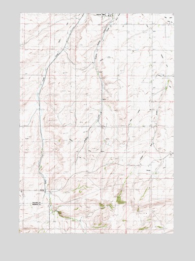
Anceney, MT USGS Topographic Map
Click on map above to begin viewing in our Map Viewer.

This topographic map contains these locations and features:
Feature Name Type Latitude Longitude GNIS ID View Map
01S03E13CA__01 WellWellN45.7494°W111.3016°811644View Map
01S03E13CA__02 WellWellN45.7494°W111.3016°811645View Map
01S03E13CB__01 WellWellN45.7494°W111.3069°811646View Map
01S03E13CB__02 WellWellN45.7494°W111.3069°811647View Map
01S03E13CB__03 WellWellN45.7494°W111.3069°811648View Map
01S03E14CC__01 WellWellN45.7452°W111.3277°811622View Map
01S03E22DC__01 WellWellN45.7308°W111.3380°811495View Map
01S03E23ADBC01 WellWellN45.7388°W111.3141°811563View Map
01S03E23ADBC01 WellWellN45.7422°W111.3127°811588View Map
01S03E24BA__01 WellWellN45.7416°W111.3019°811582View Map
01S03E24CB__01 WellWellN45.7344°W111.3072°811529View Map
01S03E24DBAB01 WellWellN45.7360°W111.2955°811539View Map
01S03E26DA__01 WellWellN45.7199°W111.3122°811398View Map
01S03E27AB__01 WellWellN45.7272°W111.3380°811469View Map
01S03E27BA__01 WellWellN45.7272°W111.3430°811470View Map
01S03E28DA__01 WellWellN45.7199°W111.3536°811399View Map
01S03E36BCCD01 WellWellN45.7094°W111.3069°811329View Map
01S04E17DA__01 WellWellN45.7494°W111.2502°811642View Map
01S04E17DC__01 WellWellN45.7452°W111.2555°811621View Map
01S04E17DD__01 WellWellN45.7452°W111.2505°811620View Map
01S04E18DA__01 WellWellN45.7494°W111.2711°811643View Map
01S04E19BC__01 WellWellN45.7380°W111.2866°811557View Map
01S04E19DA__01 WellWellN45.7344°W111.2711°811528View Map
01S04E20AA__01 WellWellN45.7416°W111.2505°811580View Map
01S04E20BA__01 WellWellN45.7416°W111.2608°811581View Map
01S04E20CD__01 WellWellN45.7308°W111.2608°811494View Map
01S04E29ABA_01 WellWellN45.7280°W111.2544°811474View Map
01S04E29ABB_01 WellWellN45.7280°W111.2569°811475View Map
01S04E29BDCD01 WellWellN45.7224°W111.2638°811417View Map
01S04E29BDCD02 WellWellN45.7224°W111.2638°811418View Map
01S04E29DC__01 WellWellN45.7163°W111.2555°811367View Map
01S04E30AA__01 WellWellN45.7272°W111.2711°811468View Map
01S04E30DA__01 WellWellN45.7199°W111.2711°811397View Map
01S04E31AA__01 WellWellN45.7127°W111.2711°811349View Map
01S04E31DD__01 WellWellN45.7019°W111.2711°811260View Map
01S04E32AA__01 WellWellN45.7127°W111.2502°811348View Map
02S03E01CC__01 WellWellN45.6874°W111.3069°811136View Map
02S03E02CB__01 WellWellN45.6910°W111.3277°811171View Map
02S03E02DA__01 WellWellN45.6910°W111.3122°811170View Map
02S03E04AC__01 WellWellN45.6947°W111.3586°811199View Map
02S03E04BAAD01 WellWellN45.6983°W111.3616°811227View Map
02S03E08AA__01 WellWellN45.6838°W111.3738°811108View Map
02S03E10AA__01 WellWellN45.6838°W111.3327°811107View Map
02S03E10BC__01 WellWellN45.6802°W111.3483°811081View Map
02S03E11AA__01 WellWellN45.6838°W111.3122°811106View Map
02S03E12BB__01 WellWellN45.6838°W111.3069°811105View Map
02S03E12DD__01 WellWellN45.6730°W111.2916°811023View Map
02S03E13CC__01 SpringSpringN45.6585°W111.3069°810882View Map
02S03E14BB__01 WellWellN45.6694°W111.3277°810987View Map
02S03E20AD__01 WellWellN45.6510°W111.3738°810813View Map
02S03E21AD__01 WellWellN45.6510°W111.3533°810812View Map
02S03E21DA__01 WellWellN45.6474°W111.3533°810792View Map
02S04E05BCBB01 WellWellN45.6958°W111.2686°811207View Map
02S04E17AA__01 WellWellN45.6694°W111.2502°810986View Map
02S04E18AC__01 WellWellN45.6658°W111.2761°810953View Map
02S04E18CA__01 WellWellN45.6622°W111.2813°810925View Map
02S04E29CDDC01 WellWellN45.6274°W111.2602°810662View Map
Amsterdam Census Designated PlaceCensusN45.7463°W111.3301°2629942View Map
Amsterdam-Churchill Census Designated Place (historical)CensusN45.7435°W111.3196°2407741View Map
AnceneyPopulated PlaceN45.6485°W111.3547°801991View Map
Anceney (historical)LocaleN45.6485°W111.3547°1743910View Map
Anceney School (historical)SchoolN45.6485°W111.3547°1738057View Map
ArnoldPopulated PlaceN45.7144°W111.3550°768343View Map
Arnold (historical)LocaleN45.7144°W111.3550°1743909View Map
Barnhart School (historical)SchoolN45.7360°W111.3063°1743481View Map
Bos School (historical)SchoolN45.7333°W111.3091°1743482View Map
Churchill Census Designated PlaceCensusN45.7500°W111.3103°2629943View Map
Godfrey CanyonValleyN45.7455°W111.3002°771820View Map
Green LateralCanalN45.6897°W111.2852°771964View Map
Highline CanalCanalN45.6697°W111.3086°806779View Map
Highline School (historical)SchoolN45.7069°W111.2683°772403View Map
Hills CemeteryCemeteryN45.6855°W111.3105°1743527View Map
KGVW-FM (Belgrade)TowerN45.6366°W111.2730°806643View Map
Lewis DitchCanalN45.7477°W111.2594°773320View Map
Little Holland CemeteryCemeteryN45.6860°W111.3105°773452View Map
Little Holland School (historical)SchoolN45.6863°W111.3088°773453View Map
Lowline CanalCanalN45.7285°W111.3522°773747View Map
Pine Butte School (historical)SchoolN45.6666°W111.2591°1738061View Map
Romola Post Office (historical)Post OfficeN45.7027°W111.3175°1743806View Map
Valley DitchCanalN45.7397°W111.2683°777975View Map
VincentPopulated PlaceN45.6958°W111.3600°778028View Map
Vincent School (historical)SchoolN45.6944°W111.3619°1738048View Map
Walrath (historical)LocaleN45.7466°W111.3272°1743671View Map
WestlakePopulated PlaceN45.7294°W111.3408°802238View Map
Yellow Dog CreekStreamN45.7474°W111.2580°778730View Map

Note: Coordinates in the location and feature list above are referenced to NAD83 datum.


Copyright (C) 2008-2024 Ryan Niemi / Sunset Dynamics ... All Rights Reserved