TopoQuest Logo
Do you find TopoQuest useful?
Help keep TopoQuest running and adding new maps/features by donating!
Bitcoin:  19c7KJd3qBynnjoSw5npx9KScwjBe4ifkT
Litecoin:  LXs6TkuXGGXo1vDsWCkWVdjQX94eUKd6ui
Home View Maps Find Maps Find Places Resources & Links


Coldwater, Kansas Topographic Map

USGS Map Title: Coldwater, KS
USGS Map MRC: 37099C3
DRG (GeoTIFF) Download: o37099c3.tif


Neighboring USGS Topographic Map Quads:


  East Kiowa Creek North, KS  
37099D4
 

  Coldwater NE, KS  
37099D3
 

  Iron Mountain, KS  
37099D2
 

  East Kiowa Creek South, KS  
37099C4
 

  Coldwater, KS  
37099C3
 

  Wilmore, KS  
37099C2
 

  Protection, KS  
37099B4
 

  Protection NE, KS  
37099B3
 

  Nescatunga Creek North, KS  
37099B2


Map MRC Location:

N38°
W100°
N38°
W99°
H8 H7 H6 H5 H4 H3 H2 H1
G8 G7 G6 G5 G4 G3 G2 G1
F8 F7 F6 F5 F4 F3 F2 F1
E8 E7 E6 E5 E4 E3 E2 E1
D8 D7 D6 D5 D4 D3 D2 D1
C8 C7 C6 C5 C4 C3 C2 C1
B8 B7 B6 B5 B4 B3 B2 B1
A8 A7 A6 A5 A4 A3 A2 A1
N37°
W100°
N37°
W99°

Coldwater, KS USGS 1:24K Topographic Map Preview:
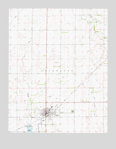
Coldwater, KS USGS Topographic Map
Click on map above to begin viewing in our Map Viewer.

This topographic map contains these locations and features:
Feature Name Type Latitude Longitude GNIS ID View Map
Assembly of God ChurchChurchN37.2677°W99.3285°2689298View Map
City of ColdwaterCivilN37.2516°W99.3508°2393591View Map
ColdwaterPopulated PlaceN37.2689°W99.3268°470738View Map
Coldwater - Wilmore Regional Library Main BranchBuildingN37.2697°W99.3259°2694631View Map
Coldwater City HallBuildingN37.2697°W99.3256°2693118View Map
Coldwater Police DepartmentBuildingN37.2697°W99.3255°2504187View Map
Coldwater Post OfficePost OfficeN37.2703°W99.3263°2693673View Map
Coldwater United Methodist ChurchChurchN37.2714°W99.3248°2689381View Map
Coldwater Wastewater PlantLocaleN37.2526°W99.3616°2693415View Map
Comanche County Ambulance ServiceBuildingN37.2736°W99.3275°2696515View Map
Comanche County CourthouseBuildingN37.2684°W99.3261°2625107View Map
Comanche County FairgroundsLocaleN37.2749°W99.3182°2695094View Map
Comanche County Fire Department - Coldwater StationBuildingN37.2693°W99.3269°2111222View Map
Comanche County Game WardenBuildingN37.2697°W99.3256°2504190View Map
Comanche County Health DepartmentBuildingN37.2678°W99.3331°2694996View Map
Comanche County Historical MuseumBuildingN37.2698°W99.3287°2694305View Map
Comanche County HospitalHospitalN37.2681°W99.3327°2499130View Map
Comanche County JailBuildingN37.2684°W99.3260°2754345View Map
Comanche County Sheriff's OfficeBuildingN37.2741°W99.3284°2503958View Map
Crown Hill CemeteryCemeteryN37.2716°W99.2944°470740View Map
Dugout CreekStreamN37.3047°W99.3051°470722View Map
Farmers Co - Operative Grain Elevator Number 3LocaleN37.2650°W99.3315°2695317View Map
First Christian ChurchChurchN37.2714°W99.3276°2689776View Map
First Presbyterian ChurchChurchN37.2703°W99.3236°2690571View Map
Holy Spirit Catholic ChurchChurchN37.2713°W99.3256°2689777View Map
South Central High SchoolSchoolN37.2759°W99.3207°2497535View Map
Stark Airport (historical)AirportN37.2742°W99.3176°470739View Map

Note: Coordinates in the location and feature list above are referenced to NAD83 datum.


Copyright (C) 2008-2024 Ryan Niemi / Sunset Dynamics ... All Rights Reserved