TopoQuest Logo
Do you find TopoQuest useful?
Help keep TopoQuest running and adding new maps/features by donating!
Bitcoin:  19c7KJd3qBynnjoSw5npx9KScwjBe4ifkT
Litecoin:  LXs6TkuXGGXo1vDsWCkWVdjQX94eUKd6ui
Home View Maps Find Maps Find Places Resources & Links


College Peaks, Arizona Topographic Map

USGS Map Title: College Peaks, AZ
USGS Map MRC: 31109D4
DRG (GeoTIFF) Download: o31109d4.tif


Neighboring USGS Topographic Map Quads:


  Leslie Canyon, AZ  
31109E5
 

  Pedregosa Mountains West, AZ  
31109E4
 

  Pedregosa Mountains East, AZ  
31109E3
 

  Douglas NE, AZ  
31109D5
 

  College Peaks, AZ  
31109D4
 

  Cinder Hill, AZ  
31109D3
 

  Douglas, AZ  
31109C5
 

  East of Douglas, AZ  
31109C4
 

  San Bernardino Ranch, AZ  
31109C3


Map MRC Location:

N32°
W110°
N32°
W109°
H8 H7 H6 H5 H4 H3 H2 H1
G8 G7 G6 G5 G4 G3 G2 G1
F8 F7 F6 F5 F4 F3 F2 F1
E8 E7 E6 E5 E4 E3 E2 E1
D8 D7 D6 D5 D4 D3 D2 D1
C8 C7 C6 C5 C4 C3 C2 C1
B8 B7 B6 B5 B4 B3 B2 B1
A8 A7 A6 A5 A4 A3 A2 A1
N31°
W110°
N31°
W109°

College Peaks, AZ USGS 1:24K Topographic Map Preview:
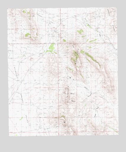
College Peaks, AZ USGS Topographic Map
Click on map above to begin viewing in our Map Viewer.

This topographic map contains these locations and features:
Feature Name Type Latitude Longitude GNIS ID View Map
Bass TankReservoirN31.4315°W109.4308°1057View Map
CazadorPopulated PlaceN31.4915°W109.4223°24349View Map
Circle H Ranch AirportAirportN31.4971°W109.3927°2623647View Map
College PeaksSummitN31.4551°W109.4220°3121View Map
Douglas DivisionCivilN31.4240°W109.4808°1934936View Map
Gardner WindmillLocaleN31.4059°W109.4734°4949View Map
Georges CanyonValleyN31.4048°W109.3873°4988View Map
Hog CanyonValleyN31.4037°W109.3792°5853View Map
Johnson WindmillLocaleN31.3848°W109.3906°6485View Map
Johnson WindmillLocaleN31.4932°W109.3978°6486View Map
Lease WindmillLocaleN31.4262°W109.4820°6939View Map
Lower Hog Canyon WindmillLocaleN31.4123°W109.3937°7444View Map
Lower Tincup SpringSpringN31.4167°W109.4303°7514View Map
New WindmillLocaleN31.4034°W109.4509°8632View Map
North College PeakSummitN31.4640°W109.4251°22153View Map
Perilla MountainsRidgeN31.4098°W109.4259°9331View Map
Poverty FlatFlatN31.4926°W109.4573°9711View Map
Saddle GapGapN31.3879°W109.4351°10641View Map
South Collge PeakSummitN31.4551°W109.4217°22234View Map
Turner WindmillLocaleN31.4832°W109.3970°12891View Map
Upper Tincup SpringSpringN31.4095°W109.4292°13129View Map
Watson WindmillLocaleN31.4773°W109.4395°13407View Map
Watt WindmillLocaleN31.4248°W109.4581°13408View Map

Note: Coordinates in the location and feature list above are referenced to NAD83 datum.


Copyright (C) 2008-2025 Ryan Niemi / Sunset Dynamics ... All Rights Reserved