TopoQuest Logo
Do you find TopoQuest useful?
Help keep TopoQuest running and adding new maps/features by donating!
Bitcoin:  19c7KJd3qBynnjoSw5npx9KScwjBe4ifkT
Litecoin:  LXs6TkuXGGXo1vDsWCkWVdjQX94eUKd6ui
Home View Maps Find Maps Find Places Resources & Links


College Place, Washington Topographic Map

USGS Map Title: College Place, WA
USGS Map MRC: 46118A4
DRG (GeoTIFF) Download: o46118a4.tif


Neighboring USGS Topographic Map Quads:


  Rulo, WA  
46118B5
 

  Hadley, WA  
46118B4
 

  Valley Grove, WA  
46118B3
 

  Lowden, WA  
46118A5
 

  College Place, WA  
46118A4
 

  Walla Walla, WA  
46118A3
 

  Waterman, OR  
45118H5
 

  Milton-Freewater, OR  
45118H4
 

  Bowlus Hill, OR  
45118H3


Map MRC Location:

N47°
W119°
N47°
W118°
H8 H7 H6 H5 H4 H3 H2 H1
G8 G7 G6 G5 G4 G3 G2 G1
F8 F7 F6 F5 F4 F3 F2 F1
E8 E7 E6 E5 E4 E3 E2 E1
D8 D7 D6 D5 D4 D3 D2 D1
C8 C7 C6 C5 C4 C3 C2 C1
B8 B7 B6 B5 B4 B3 B2 B1
A8 A7 A6 A5 A4 A3 A2 A1
N46°
W119°
N46°
W118°

College Place, WA USGS 1:24K Topographic Map Preview:
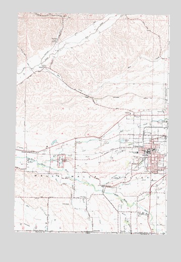
College Place, WA USGS Topographic Map
Click on map above to begin viewing in our Map Viewer.

This topographic map contains these locations and features:
Feature Name Type Latitude Longitude GNIS ID View Map
Big Spring BranchStreamN46.0110°W118.3997°1117676View Map
Big Spring BranchStreamN46.0076°W118.4077°1513345View Map
Big Y Shopping CenterLocaleN46.0562°W118.3752°1511856View Map
Birch CreekStreamN46.0018°W118.3783°1503382View Map
Birch CreekStreamN46.0018°W118.3783°1117719View Map
Blalock LakeReservoirN46.0532°W118.4125°1513898View Map
Blalock Lake DamDamN46.0532°W118.4144°1532988View Map
Blue Mountain Boys RanchLocaleN46.0410°W118.4894°1503456View Map
Braden Post Office (historical)Post OfficeN46.0004°W118.4047°1164234View Map
CalhounvillePopulated PlaceN46.0010°W118.4352°1512058View Map
City of College PlaceCivilN46.0430°W118.3870°2410192View Map
Clara E Rogers Elementary SchoolSchoolN46.0449°W118.3916°1531093View Map
Cold CreekStreamN46.0465°W118.4611°1504056View Map
College PlacePopulated PlaceN46.0493°W118.3883°1512107View Map
College Place Fire DepartmentBuildingN46.0427°W118.3869°2619363View Map
College Place Police DepartmentBuildingN46.0428°W118.3869°2721999View Map
College Place Post OfficePost OfficeN46.0448°W118.3889°2769165View Map
Davis Elementary SchoolSchoolN46.0485°W118.3866°1533440View Map
Dixie CrossingPopulated PlaceN46.0921°W118.4719°1514675View Map
Doan CreekStreamN46.0410°W118.4722°1504490View Map
Dry CreekLocaleN46.1087°W118.4666°1504549View Map
East Little Walla Walla RiverStreamN46.0193°W118.4122°1513360View Map
East Prong Little Walla Walla RiverStreamN46.0196°W118.4119°1120345View Map
GarrettPopulated PlaceN46.0521°W118.4027°1512234View Map
Garrett Census Designated PlaceCensusN46.0635°W118.3863°2408284View Map
Garrison CreekStreamN46.0260°W118.4344°1505091View Map
Grandview CreekStreamN46.0110°W118.3997°1121290View Map
Great GraveCemeteryN46.0421°W118.4625°2782558View Map
John Sager Middle SchoolSchoolN46.0309°W118.3875°1531104View Map
Kiwanis ParkParkN46.0485°W118.3830°1514237View Map
KUJ-AM (Walla Walla)TowerN46.0674°W118.4033°1534315View Map
Lyons City ParkParkN46.0415°W118.3772°1514253View Map
Martin FieldParkN46.0485°W118.3964°1510653View Map
Martin FieldAirportN46.0469°W118.4146°1533717View Map
Mill CreekStreamN46.0387°W118.4786°1506691View Map
Mill CreekStreamN46.0387°W118.4786°1146230View Map
MojonnierPopulated PlaceN46.0268°W118.4250°1511161View Map
Mount Hope CemeteryCemeteryN46.0437°W118.3983°1506818View Map
Mud CreekStreamN46.0951°W118.4825°1506862View Map
PedigoPopulated PlaceN46.0782°W118.4402°1511221View Map
StatelinePopulated PlaceN46.0010°W118.4144°1511333View Map
Stiller DamDamN46.0515°W118.4711°1532036View Map
Stone CreekStreamN46.0237°W118.4266°1508756View Map
SudburyPopulated PlaceN46.0940°W118.4775°1511344View Map
Tausick Swimming PoolLocaleN46.0454°W118.3950°1514497View Map
TwilightLocaleN46.0018°W118.4133°1514615View Map
Valley Chapel CemeteryCemeteryN46.0205°W118.4413°1509201View Map
Village SquareLocaleN46.0387°W118.3894°1512988View Map
Waiilatpo (historical)Populated PlaceN46.0410°W118.4622°1514902View Map
Walla Walla County Fire District 4 Station 42BuildingN46.0564°W118.3906°2643978View Map
Walla Walla County Fire District 4 Station 44BuildingN46.0234°W118.3942°2643980View Map
Walla Walla UniversitySchoolN46.0470°W118.3898°1509270View Map
Walla Walla Valley AcademySchoolN46.0468°W118.3999°1509272View Map
Walsh CreekStreamN46.0276°W118.4514°1509275View Map
West Little Walla Walla RiverStreamN46.0385°W118.4822°1513413View Map
West Prong Little Walla Walla RiverStreamN46.0385°W118.4816°1639344View Map
WhitmanPopulated PlaceN46.0457°W118.4897°1511479View Map
Whitman MemorialParkN46.0415°W118.4603°1509482View Map
Whitman Mission National Historic SiteParkN46.0418°W118.4644°1531185View Map
Yellowhawk CreekStreamN46.0168°W118.4008°1509660View Map

Note: Coordinates in the location and feature list above are referenced to NAD83 datum.


Copyright (C) 2008-2024 Ryan Niemi / Sunset Dynamics ... All Rights Reserved