TopoQuest Logo
Do you find TopoQuest useful?
Help keep TopoQuest running and adding new maps/features by donating!
Bitcoin:  19c7KJd3qBynnjoSw5npx9KScwjBe4ifkT
Litecoin:  LXs6TkuXGGXo1vDsWCkWVdjQX94eUKd6ui
Home View Maps Find Maps Find Places Resources & Links


Columbia Mountain, California Topographic Map

USGS Map Title: Columbia Mountain, CA
USGS Map MRC: 35115A4
DRG (GeoTIFF) Download: o35115a4.tif


Neighboring USGS Topographic Map Quads:


  Cima, CA  
35115B5
 

  Mid Hills, CA  
35115B4
 

  Pinto Valley, CA  
35115B3
 

  Hayden, CA  
35115A5
 

  Columbia Mountain, CA  
35115A4
 

  Woods Mountains, CA  
35115A3
 

  Fountain Peak, CA  
34115H5
 

  Colton Well, CA  
34115H4
 

  Desert Spring, CA  
34115H3


Map MRC Location:

N36°
W116°
N36°
W115°
H8 H7 H6 H5 H4 H3 H2 H1
G8 G7 G6 G5 G4 G3 G2 G1
F8 F7 F6 F5 F4 F3 F2 F1
E8 E7 E6 E5 E4 E3 E2 E1
D8 D7 D6 D5 D4 D3 D2 D1
C8 C7 C6 C5 C4 C3 C2 C1
B8 B7 B6 B5 B4 B3 B2 B1
A8 A7 A6 A5 A4 A3 A2 A1
N35°
W116°
N35°
W115°

Columbia Mountain, CA USGS 1:24K Topographic Map Preview:
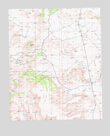
Columbia Mountain, CA USGS Topographic Map
Click on map above to begin viewing in our Map Viewer.

This topographic map contains these locations and features:
Feature Name Type Latitude Longitude GNIS ID View Map
Barber WellWellN35.0050°W115.4803°238980View Map
Black CanyonValleyN35.1109°W115.4058°239392View Map
Borrego CanyonValleyN35.0108°W115.3936°1667049View Map
Bullock SpringSpringN35.0950°W115.4842°239829View Map
Chicken Water SpringSpringN35.1087°W115.4670°240534View Map
Columbia MineMineN35.0667°W115.4767°240815View Map
Columbia MountainSummitN35.0834°W115.4726°240817View Map
Coyote SpringSpringN35.1208°W115.4730°1667053View Map
Globe MineMineN35.0444°W115.4867°242752View Map
Gold ValleyValleyN35.0410°W115.3880°242807View Map
Gold Valley MineMineN35.0692°W115.4158°242809View Map
Gold Valley SpringSpringN35.0766°W115.4127°242810View Map
Granite WellWellN35.0761°W115.4328°242923View Map
Hole-in-the WallGapN35.0433°W115.3997°243532View Map
Hole-in-the-Wall CampgroundLocaleN35.0433°W115.3958°1667063View Map
Little Thorne MountainsSummitN35.0849°W115.4353°252315View Map
Mexican Water SpringSpringN35.0943°W115.4768°245839View Map
Saddle Horse CanyonValleyN35.0276°W115.4174°1667080View Map
Silver Lead SpringSpringN35.1078°W115.4519°249480View Map
Summit SpringSpringN35.0343°W115.4956°250078View Map
Wild Horse CanyonValleyN35.0308°W115.4056°251533View Map
Wild Horse MesaSummitN35.0446°W115.4572°1667094View Map
Wildcat SpringSpringN35.1229°W115.4687°251555View Map
Willow WellWellN35.0686°W115.4514°1667095View Map

Note: Coordinates in the location and feature list above are referenced to NAD83 datum.


Copyright (C) 2008-2025 Ryan Niemi / Sunset Dynamics ... All Rights Reserved