TopoQuest Logo
Do you find TopoQuest useful?
Help keep TopoQuest running and adding new maps/features by donating!
Bitcoin:  19c7KJd3qBynnjoSw5npx9KScwjBe4ifkT
Litecoin:  LXs6TkuXGGXo1vDsWCkWVdjQX94eUKd6ui
Home View Maps Find Maps Find Places Resources & Links


Columbus West, Montana Topographic Map

USGS Map Title: Columbus West, MT
USGS Map MRC: 45109F3
DRG (GeoTIFF) Download: o45109f3.tif


Neighboring USGS Topographic Map Quads:


  Antelope Point, MT  
45109G4
 

  Lindemulder Hill, MT  
45109G3
 

  Wheat Basin SW, MT  
45109G2
 

  Springtime, MT  
45109F4
 

  Columbus West, MT  
45109F3
 

  Columbus East, MT  
45109F2
 

  Absarokee, MT  
45109E4
 

  Whitebird School, MT  
45109E3
 

  Shane Ridge, MT  
45109E2


Map MRC Location:

N46°
W110°
N46°
W109°
H8 H7 H6 H5 H4 H3 H2 H1
G8 G7 G6 G5 G4 G3 G2 G1
F8 F7 F6 F5 F4 F3 F2 F1
E8 E7 E6 E5 E4 E3 E2 E1
D8 D7 D6 D5 D4 D3 D2 D1
C8 C7 C6 C5 C4 C3 C2 C1
B8 B7 B6 B5 B4 B3 B2 B1
A8 A7 A6 A5 A4 A3 A2 A1
N45°
W110°
N45°
W109°

Columbus West, MT USGS 1:24K Topographic Map Preview:
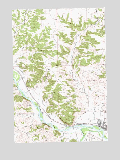
Columbus West, MT USGS Topographic Map
Click on map above to begin viewing in our Map Viewer.

This topographic map contains these locations and features:
Feature Name Type Latitude Longitude GNIS ID View Map
01S20E32BCBB01 WellWellN45.7066°W109.2949°811303View Map
02S19E23DBDA01 WellWellN45.6352°W109.3421°810716View Map
02S20E16CCCA01 WellWellN45.6549°W109.2727°810846View Map
02S20E28CAAC01 WellWellN45.6297°W109.2654°810679View Map
02S20E28CABB01 WellWellN45.6305°W109.2677°810682View Map
02S20E28CACD01 WellWellN45.6288°W109.2666°810664View Map
02S20E28DBCD01 WellWellN45.6280°W109.2624°810663View Map
02S20E28DCBA01 WellWellN45.6274°W109.2616°810661View Map
02S20E28DDBC01 WellWellN45.6263°W109.2577°810656View Map
02S20E29AADC01 WellWellN45.6349°W109.2763°810714View Map
Assembly of God ChurchChurchN45.6383°W109.2518°1726968View Map
Baney CouleeValleyN45.6691°W109.3404°768492View Map
Bensons BluffCliffN45.6438°W109.3088°768709View Map
Cardwell School (historical)SchoolN45.6774°W109.3574°769598View Map
Carlton CouleeValleyN45.6483°W109.3443°769605View Map
ColumbusLocaleN45.6374°W109.2563°1726934View Map
ColumbusPopulated PlaceN45.6366°W109.2521°770043View Map
Columbus Baptist ChurchChurchN45.6366°W109.2521°1726971View Map
Columbus ClinicHospitalN45.6430°W109.2591°1726906View Map
Columbus Elementary SchoolSchoolN45.6396°W109.2569°1726954View Map
Columbus Evangelical ChurchChurchN45.6397°W109.2596°1726965View Map
Columbus High SchoolSchoolN45.6429°W109.2554°1726955View Map
Columbus Historical MarkerParkN45.6444°W109.2518°1726925View Map
Columbus Police DepartmentBuildingN45.6387°W109.2544°1726945View Map
Columbus Post OfficePost OfficeN45.6387°W109.2521°1726879View Map
Columbus Rest AreaLocaleN45.6444°W109.2518°1726923View Map
Columbus Water Users Association DitchCanalN45.6499°W109.2835°770044View Map
Community Congregational United Church of ChristChurchN45.6391°W109.2541°1726966View Map
Countryman CreekStreamN45.6494°W109.3418°770205View Map
Dry CreekStreamN45.6533°W109.2654°770783View Map
East Keyser CreekStreamN45.7297°W109.2652°771092View Map
Granite Peak ParkParkN45.6458°W109.2513°1726959View Map
H and H Trailer CourtPopulated PlaceN45.6438°W109.2610°1726962View Map
Handy DamDamN45.6883°W109.3257°796572View Map
Harvest State Cooperatives ElevatorLocaleN45.6374°W109.2557°1726947View Map
Haystack CouleeValleyN45.6752°W109.3685°772283View Map
Huntley CreekStreamN45.6336°W109.3079°772647View Map
Jehovah's WitnessesChurchN45.6366°W109.2521°1726989View Map
Keyser CreekStreamN45.6397°W109.2685°773016View Map
Kovanda Number 1 DamDamN45.7383°W109.3107°796571View Map
Merrill Columbus DitchCanalN45.6722°W109.3491°774112View Map
Mountain View CemeteryCemeteryN45.6422°W109.2731°774430View Map
Museum of the BeartoothsBuildingN45.6416°W109.2516°1726911View Map
Park Avenue ParkParkN45.6372°W109.2527°1726961View Map
Park City Historical MarkerParkN45.6444°W109.2518°1726924View Map
Pershing HillSummitN45.7458°W109.2607°806962View Map
Quinn CouleeValleyN45.6374°W109.3235°775518View Map
S&L Edwards AirportAirportN45.6394°W109.3122°2770382View Map
Saint James Lutheran ChurchChurchN45.6388°W109.2574°1726964View Map
Saint Marys Catholic ChurchChurchN45.6402°W109.2541°1726970View Map
Smith CouleeValleyN45.6611°W109.3329°776658View Map
Stillwater Bible ChurchChurchN45.6377°W109.2557°1726969View Map
Stillwater Community Hospital Extended Care UnitHospitalN45.6430°W109.2591°1726908View Map
Stillwater Convalescent CenterHospitalN45.6374°W109.2560°1726909View Map
Stillwater County CourthouseBuildingN45.6411°W109.2535°1726944View Map
Stillwater County FairgroundsLocaleN45.6416°W109.2518°1726941View Map
Stillwater County LibraryBuildingN45.6402°W109.2524°1726910View Map
Stillwater County Sheriff's OfficeBuildingN45.6410°W109.2537°1726943View Map
Stillwater RiverStreamN45.6380°W109.2821°791524View Map
Stump GulchValleyN45.6999°W109.3716°777276View Map
Valley Vista Trailer ParkPopulated PlaceN45.6444°W109.2624°1726892View Map
Wataga (historical)LocaleN45.6622°W109.3424°1726972View Map
White DitchCanalN45.6252°W109.2818°778375View Map
Wildcat CouleeValleyN45.7299°W109.2638°778490View Map

Note: Coordinates in the location and feature list above are referenced to NAD83 datum.


Copyright (C) 2008-2025 Ryan Niemi / Sunset Dynamics ... All Rights Reserved