TopoQuest Logo
Do you find TopoQuest useful?
Help keep TopoQuest running and adding new maps/features by donating!
Bitcoin:  19c7KJd3qBynnjoSw5npx9KScwjBe4ifkT
Litecoin:  LXs6TkuXGGXo1vDsWCkWVdjQX94eUKd6ui
Home View Maps Find Maps Find Places Resources & Links


Como Creek, Wisconsin Topographic Map

USGS Map Title: Como Creek, WI
USGS Map MRC: 45091A5
DRG (GeoTIFF) Download: o45091a5.tif


Neighboring USGS Topographic Map Quads:


  Sand Creek, WI  
45091B6
 

  New Auburn, WI  
45091B5
 

  Marsh-Miller Lake, WI  
45091B4
 

  Colfax North, WI  
45091A6
 

  Como Creek, WI  
45091A5
 

  Bloomer, WI  
45091A4
 

  Colfax South, WI  
44091H6
 

  Albertville, WI  
44091H5
 

  Chippewa Falls, WI  
44091H4


Map MRC Location:

N46°
W92°
N46°
W91°
H8 H7 H6 H5 H4 H3 H2 H1
G8 G7 G6 G5 G4 G3 G2 G1
F8 F7 F6 F5 F4 F3 F2 F1
E8 E7 E6 E5 E4 E3 E2 E1
D8 D7 D6 D5 D4 D3 D2 D1
C8 C7 C6 C5 C4 C3 C2 C1
B8 B7 B6 B5 B4 B3 B2 B1
A8 A7 A6 A5 A4 A3 A2 A1
N45°
W92°
N45°
W91°

Como Creek, WI USGS 1:24K Topographic Map Preview:
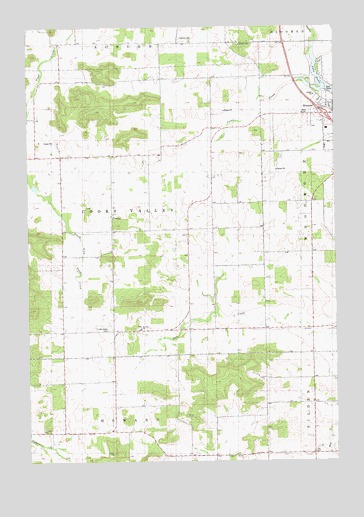
Como Creek, WI USGS Topographic Map
Click on map above to begin viewing in our Map Viewer.

This topographic map contains these locations and features:
Feature Name Type Latitude Longitude GNIS ID View Map
Auburn CemeteryCemeteryN45.1216°W91.5621°1561005View Map
Auburn Center School (historical)SchoolN45.1208°W91.5757°1578466View Map
Auburn Dale School (historical)SchoolN45.0961°W91.5496°1578467View Map
Auburn School (historical)SchoolN45.0875°W91.6113°1578468View Map
Bloomer Medical CenterHospitalN45.1016°W91.5017°1842791View Map
Chippewa Fire District Station 6BuildingN45.0090°W91.5893°2696994View Map
Como CreekStreamN45.1091°W91.5160°1563300View Map
Cooks Valley CemeteryCemeteryN45.0377°W91.5929°1563350View Map
Cooks Valley Church (historical)ChurchN45.0377°W91.5924°1578476View Map
Cooks Valley Dairy FarmLocaleN45.0889°W91.6078°2711421View Map
Cooks Valley TownhallBuildingN45.0702°W91.5904°1842819View Map
D D FarmsLocaleN45.0817°W91.6103°2711365View Map
Good Shepherd Lutheran ChurchChurchN45.1022°W91.5032°1842850View Map
Hay Creek NurseryBuildingN45.0436°W91.5506°2711428View Map
Kelm FarmLocaleN45.0406°W91.5281°2711374View Map
Lake ComoReservoirN45.1076°W91.5048°1563302View Map
Loew School (historical)SchoolN45.0019°W91.5493°1578490View Map
Needy AcresLocaleN45.0250°W91.5036°2711426View Map
Prill Dairy FarmLocaleN45.1083°W91.5881°2711423View Map
Rooney FarmLocaleN45.0031°W91.5219°2711435View Map
Saint Johns ChurchChurchN45.0380°W91.5796°1573111View Map
Saint Johns School (historical)SchoolN45.0380°W91.5802°1578501View Map
Sunny Side School (historical)SchoolN45.0669°W91.5602°1578503View Map
Town of Cooks ValleyCivilN45.0720°W91.5906°1583012View Map
Trout Brook FarmLocaleN45.1086°W91.6181°2711424View Map
Zion Church (historical)ChurchN45.1208°W91.6041°1578509View Map

Note: Coordinates in the location and feature list above are referenced to NAD83 datum.


Copyright (C) 2008-2025 Ryan Niemi / Sunset Dynamics ... All Rights Reserved