TopoQuest Logo
Do you find TopoQuest useful?
Help keep TopoQuest running and adding new maps/features by donating!
Bitcoin:  19c7KJd3qBynnjoSw5npx9KScwjBe4ifkT
Litecoin:  LXs6TkuXGGXo1vDsWCkWVdjQX94eUKd6ui
Home View Maps Find Maps Find Places Resources & Links


Congress, Arizona Topographic Map

USGS Map Title: Congress, AZ
USGS Map MRC: 34112B7
DRG (GeoTIFF) Download: o34112b7.tif


Neighboring USGS Topographic Map Quads:


  Date, AZ  
34112C8
 

  Weaver Peak, AZ  
34112C7
 

  Peeples Valley, AZ  
34112C6
 

  O'Neill Pass, AZ  
34112B8
 

  Congress, AZ  
34112B7
 

  Yarnell, AZ  
34112B6
 

  Congress SW, AZ  
34112A8
 

  Flores, AZ  
34112A7
 

  Sam Powell Peak, AZ  
34112A6


Map MRC Location:

N35°
W113°
N35°
W112°
H8 H7 H6 H5 H4 H3 H2 H1
G8 G7 G6 G5 G4 G3 G2 G1
F8 F7 F6 F5 F4 F3 F2 F1
E8 E7 E6 E5 E4 E3 E2 E1
D8 D7 D6 D5 D4 D3 D2 D1
C8 C7 C6 C5 C4 C3 C2 C1
B8 B7 B6 B5 B4 B3 B2 B1
A8 A7 A6 A5 A4 A3 A2 A1
N34°
W113°
N34°
W112°

Congress, AZ USGS 1:24K Topographic Map Preview:
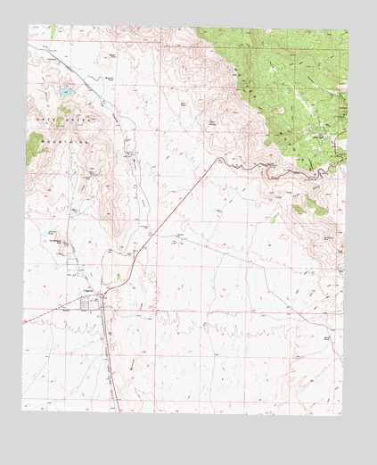
Congress, AZ USGS Topographic Map
Click on map above to begin viewing in our Map Viewer.

This topographic map contains these locations and features:
Feature Name Type Latitude Longitude GNIS ID View Map
Arrowhead WellWellN34.1853°W112.8274°811View Map
Billingsley Number Four DamDamN34.2300°W112.8441°21173View Map
Billingsley Number Three DamDamN34.2484°W112.8591°21174View Map
Billingsley Number Two DamDamN34.2284°W112.8574°21175View Map
Billingsley Reservoir Number FourReservoirN34.2303°W112.8443°21176View Map
Billingsley Reservoir Number ThreeReservoirN34.2484°W112.8591°21177View Map
Billingsley Reservoir Number TwoReservoirN34.2284°W112.8605°21178View Map
Blue Bucket MineMineN34.1820°W112.7596°1692View Map
CongressPopulated PlaceN34.1625°W112.8507°3172View Map
Congress CemeteryCemeteryN34.1900°W112.8549°3173View Map
Congress Census Designated PlaceCensusN34.1525°W112.8642°2407653View Map
Congress Elementary SchoolSchoolN34.1719°W112.8596°21231View Map
Congress Fire StationBuildingN34.1624°W112.8466°2672474View Map
Congress JunctionPopulated PlaceN34.1628°W112.8449°25257View Map
Congress MineMineN34.2009°W112.8507°3174View Map
Congress Post OfficePost OfficeN34.1614°W112.8565°44882View Map
Congress Public LibraryBuildingN34.1610°W112.8469°2669404View Map
Congress Railroad StationBuildingN34.1584°W112.8452°21230View Map
Cottonwood CanyonValleyN34.2009°W112.7599°3310View Map
Earis TankReservoirN34.1502°W112.7584°4258View Map
Elephant CurveBendN34.2056°W112.7810°4400View Map
First Baptist ChurchChurchN34.1596°W112.8418°2670933View Map
Fools GulchValleyN34.1934°W112.7771°4715View Map
Glen IlahPopulated PlaceN34.2150°W112.7591°5057View Map
KTIM-FM (Wickenburg)TowerN34.1922°W112.7543°45260View Map
Longort WellWellN34.2131°W112.8374°7357View Map
Lowman WellWellN34.2084°W112.8360°7524View Map
Mesquite TankReservoirN34.2328°W112.8420°7935View Map
PiedmontPopulated PlaceN34.2389°W112.8643°24560View Map
Piedmont Railroad StationBuildingN34.2389°W112.8638°21382View Map
Planet Saturn MineMineN34.1961°W112.7782°21391View Map
Rincon MineMineN34.1784°W112.7505°10295View Map
Sawyer TankReservoirN34.2399°W112.8408°10993View Map
Senate MineMineN34.2025°W112.8599°21430View Map
Sullivan TankReservoirN34.1823°W112.8676°11934View Map
Tenderfoot HillSummitN34.1797°W112.8610°12253View Map
Tenderfoot Hill ParkParkN34.1772°W112.8591°21465View Map
View PointsBendN34.2017°W112.7666°13225View Map
Weaver MountainsRangeN34.2159°W112.7785°35930View Map
Yarnell Census Designated PlaceCensusN34.2282°W112.7631°2409635View Map
Ziger SpringSpringN34.2193°W112.8048°14133View Map
Ziger TankReservoirN34.2251°W112.8137°14134View Map

Note: Coordinates in the location and feature list above are referenced to NAD83 datum.


Copyright (C) 2008-2025 Ryan Niemi / Sunset Dynamics ... All Rights Reserved