TopoQuest Logo
Do you find TopoQuest useful?
Help keep TopoQuest running and adding new maps/features by donating!
Bitcoin:  19c7KJd3qBynnjoSw5npx9KScwjBe4ifkT
Litecoin:  LXs6TkuXGGXo1vDsWCkWVdjQX94eUKd6ui
Home View Maps Find Maps Find Places Resources & Links


Continental Mountain, Idaho Topographic Map

USGS Map Title: Continental Mountain, ID
USGS Map MRC: 48116H8
DRG (GeoTIFF) Download: o48116h8.tif


Neighboring USGS Topographic Map Quads:


  Salmo Mountain, WA  
48117H1
 

  Continental Mountain, ID  
48116H8
 

  Grass Mountain, ID  
48116H7
 

  Helmer Mountain, WA  
48117G1
 

  Upper Priest Lake, ID  
48116G8
 

  Caribou Creek, ID  
48116G7


Map MRC Location:

N49°
W117°
N49°
W116°
H8 H7 H6 H5 H4 H3 H2 H1
G8 G7 G6 G5 G4 G3 G2 G1
F8 F7 F6 F5 F4 F3 F2 F1
E8 E7 E6 E5 E4 E3 E2 E1
D8 D7 D6 D5 D4 D3 D2 D1
C8 C7 C6 C5 C4 C3 C2 C1
B8 B7 B6 B5 B4 B3 B2 B1
A8 A7 A6 A5 A4 A3 A2 A1
N48°
W117°
N48°
W116°

Continental Mountain, ID USGS 1:24K Topographic Map Preview:
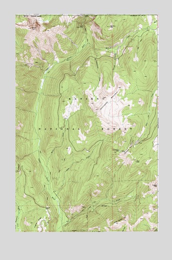
Continental Mountain, ID USGS Topographic Map
Click on map above to begin viewing in our Map Viewer.

This topographic map contains these locations and features:
Feature Name Type Latitude Longitude GNIS ID View Map
Cabinet PassGapN48.8888°W116.9738°378671View Map
Cedar CreekStreamN48.8797°W116.9600°397535View Map
Continental CreekStreamN48.9805°W116.9316°379632View Map
Continental LakeLakeN48.9216°W116.9090°379633View Map
Continental MineMineN48.9210°W116.9011°379634View Map
Continental MountainSummitN48.9455°W116.9277°379635View Map
Green Bonnet MountainSummitN48.8816°W116.9055°382622View Map
Kaniksu MountainSummitN48.9930°W116.9183°384098View Map
Lime CreekStreamN48.8938°W116.9655°397854View Map
Malcom CreekStreamN48.9816°W116.9408°386405View Map
McLean MineMineN48.8891°W116.9388°386648View Map
Rock CreekStreamN48.9066°W116.9713°389482View Map
Snowy TopSummitN48.9922°W116.9869°390789View Map
Spread CreekStreamN48.9802°W116.9205°398164View Map
Trap LakeLakeN48.9156°W116.8946°392337View Map
Trapper PeakSummitN48.9016°W116.8761°392363View Map
Upper Priest FallsFallsN48.9931°W116.9407°392646View Map

Note: Coordinates in the location and feature list above are referenced to NAD83 datum.


Copyright (C) 2008-2025 Ryan Niemi / Sunset Dynamics ... All Rights Reserved