TopoQuest Logo
Do you find TopoQuest useful?
Help keep TopoQuest running and adding new maps/features by donating!
Bitcoin:  19c7KJd3qBynnjoSw5npx9KScwjBe4ifkT
Litecoin:  LXs6TkuXGGXo1vDsWCkWVdjQX94eUKd6ui
Home View Maps Find Maps Find Places Resources & Links


Cooper, Iowa Topographic Map

USGS Map Title: Cooper, IA
USGS Map MRC: 41094H3
DRG (GeoTIFF) Download: o41094h3.tif


Neighboring USGS Topographic Map Quads:


  Jefferson West, IA  
42094A4
 

  Jefferson East, IA  
42094A3
 

  Grand Junction, IA  
42094A2
 

  Bagley NW, IA  
41094H4
 

  Cooper, IA  
41094H3
 

  Rippey, IA  
41094H2
 

  Bagley, IA  
41094G4
 

  Yale, IA  
41094G3
 

  Dawson, IA  
41094G2


Map MRC Location:

N42°
W95°
N42°
W94°
H8 H7 H6 H5 H4 H3 H2 H1
G8 G7 G6 G5 G4 G3 G2 G1
F8 F7 F6 F5 F4 F3 F2 F1
E8 E7 E6 E5 E4 E3 E2 E1
D8 D7 D6 D5 D4 D3 D2 D1
C8 C7 C6 C5 C4 C3 C2 C1
B8 B7 B6 B5 B4 B3 B2 B1
A8 A7 A6 A5 A4 A3 A2 A1
N41°
W95°
N41°
W94°

Cooper, IA USGS 1:24K Topographic Map Preview:
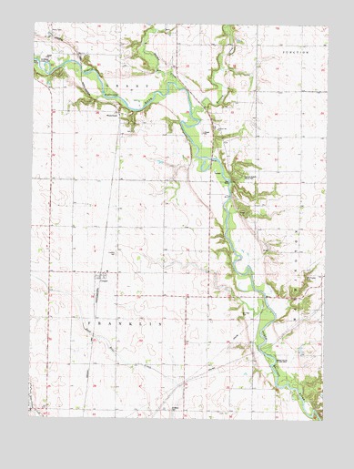
Cooper, IA USGS Topographic Map
Click on map above to begin viewing in our Map Viewer.

This topographic map contains these locations and features:
Feature Name Type Latitude Longitude GNIS ID View Map
Adkins Bridge AccessLocaleN41.9125°W94.2752°1995892View Map
Buttrick CreekStreamN41.9719°W94.3083°455026View Map
CooperPopulated PlaceN41.9203°W94.3447°455616View Map
Cooper (historical)LocaleN41.9205°W94.3452°1996005View Map
Cooper Post OfficePost OfficeN41.9208°W94.3447°1996004View Map
Franklin CemeteryCemeteryN41.9269°W94.3391°456727View Map
Gravel Dale Siding (historical)LocaleN41.9875°W94.3558°1995900View Map
Hardin CreekStreamN41.9808°W94.3147°457253View Map
Henderson County ParkParkN41.9875°W94.3725°1823143View Map
Old Rippey CemeteryCemeteryN41.9211°W94.2572°1823138View Map
Pleasant Hill CemeteryCemeteryN41.9675°W94.2977°1995997View Map
Pleasant Hill ChurchChurchN41.9667°W94.2969°460263View Map
Rippey State Access AreaParkN41.8942°W94.2769°463407View Map
Saint Marys CemeteryCemeteryN41.8780°W94.3155°1823137View Map
Saint Marys ChurchChurchN41.8780°W94.3155°461202View Map
Site of Stagecoach Trail Historical MarkerParkN41.9694°W94.2975°1995960View Map
Squirrel Hollow County ParkParkN41.9519°W94.2872°461943View Map
Squirrel Hollow Wildlife AreaParkN41.9472°W94.2836°1995893View Map
Township of FranklinCivilN41.9066°W94.3383°467855View Map
Township of GrantCivilN41.9884°W94.3320°467938View Map
Van Horn CemeteryCemeteryN41.9086°W94.2850°1823139View Map
WinkelmansPopulated PlaceN41.9711°W94.3386°464808View Map
Winkelmans (historical)LocaleN41.9711°W94.3386°1995907View Map

Note: Coordinates in the location and feature list above are referenced to NAD83 datum.


Copyright (C) 2008-2025 Ryan Niemi / Sunset Dynamics ... All Rights Reserved