TopoQuest Logo
Do you find TopoQuest useful?
Help keep TopoQuest running and adding new maps/features by donating!
Home View Maps Find Maps Find Places Resources & Links


Union Hill, Alabama Topographic Map

USGS Map Title: Union Hill, AL
USGS Map MRC: 34087H2
DRG (GeoTIFF) Download: o34087h2.tif


Neighboring USGS Topographic Map Quads:


  Bonnertown, TN  
35087A3
 

  Appleton, TN  
35087A2
 

  Aspen Hill, TN  
35087A1
 

  Lexington, AL  
34087H3
 

  Union Hill, AL  
34087H2
 

  Salem, AL  
34087H1
 

  Rogersville, AL  
34087G3
 

  Cairo, AL  
34087G2
 

  Ripley, AL  
34087G1


Map MRC Location:

N35°
W88°
N35°
W87°
H8 H7 H6 H5 H4 H3 H2 H1
G8 G7 G6 G5 G4 G3 G2 G1
F8 F7 F6 F5 F4 F3 F2 F1
E8 E7 E6 E5 E4 E3 E2 E1
D8 D7 D6 D5 D4 D3 D2 D1
C8 C7 C6 C5 C4 C3 C2 C1
B8 B7 B6 B5 B4 B3 B2 B1
A8 A7 A6 A5 A4 A3 A2 A1
N34°
W88°
N34°
W87°

Union Hill, AL USGS 1:24K Topographic Map Preview:
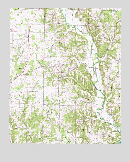
Union Hill, AL USGS Topographic Map
Click on map above to begin viewing in our Map Viewer.

This topographic map contains these locations and features:
Feature Name Type Latitude Longitude GNIS ID View Map
Band Mill SpringSpringN34.90115°W87.13596°113437View Map
Bassham Church (historical)ChurchN34.96675°W87.13668°137793View Map
Belue BranchStreamN34.87536°W87.24668°113901View Map
Bethel (historical)Populated PlaceN34.97731°W87.22779°145066View Map
Bethel Memorial Baptist ChurchChurchN34.97814°W87.22752°114086View Map
Beulah ChurchChurchN34.96786°W87.19168°114192View Map
Bridgeforth BranchStreamN34.94731°W87.15585°114903View Map
Cairo School (historical)SchoolN34.87759°W87.15057°138657View Map
Carrigar School (historical)SchoolN34.91397°W87.17390°138658View Map
Carriger Church of ChristChurchN34.90786°W87.17085°151719View Map
Cherry GrovePopulated PlaceN34.91397°W87.20279°156172View Map
Cherry Grove School (historical)SchoolN34.91342°W87.20307°138662View Map
Corder SpringSpringN34.94036°W87.12779°149154View Map
Craig ChapelChurchN34.95092°W87.12612°116806View Map
Daly BranchStreamN34.98536°W87.18668°117027View Map
Dee BranchStreamN34.87620°W87.22335°145139View Map
Deerlick BranchStreamN34.88731°W87.22891°117207View Map
Dobbins BranchStreamN34.91592°W87.14390°117323View Map
Doctor D E Jackson Memorial Hospital (historical)HospitalN34.99036°W87.15362°137825View Map
Dublin BranchStreamN34.87675°W87.12751°117605View Map
East Fork Scarce Grease BranchStreamN34.96897°W87.13529°117764View Map
Elledge CemeteryCemeteryN34.95674°W87.15862°163671View Map
Enon ChurchChurchN34.94370°W87.18446°118001View Map
Enon DamDamN34.95008°W87.17668°132067View Map
Evans CemeteryCemeteryN34.92758°W87.19112°118068View Map
Gin BranchStreamN34.90703°W87.14974°118978View Map
Good SpringsPopulated PlaceN34.94731°W87.19418°151794View Map
Good Springs School (historical)SchoolN34.94786°W87.19390°149141View Map
Good Springs Volunteer Fire DepartmentBuildingN34.94799°W87.19132°2683319View Map
Gray SpringSpringN34.94478°W87.17440°119299View Map
Hester Chapel CemeteryCemeteryN34.98258°W87.14917°163676View Map
Hesters Chapel Church of ChristChurchN34.98314°W87.14946°120008View Map
Hickory RidgeRidgeN34.93758°W87.16863°141184View Map
Hulsey BranchStreamN34.98231°W87.17724°120543View Map
LesterPopulated PlaceN34.99064°W87.15335°121506View Map
Lester Post OfficePost OfficeN34.99092°W87.15362°166631View Map
Maple SwampSwampN34.88184°W87.18762°122269View Map
McConnell BranchStreamN34.99508°W87.19140°122490View Map
McCravy CemeteryCemeteryN34.98508°W87.19751°152270View Map
McGowan BranchStreamN34.89786°W87.16557°122553View Map
Mechanic BranchStreamN34.90786°W87.14612°152295View Map
Mitchell CemeteryCemeteryN34.94480°W87.23335°142106View Map
Mitchell ChapelChurchN34.94425°W87.23363°152349View Map
Mount RozellPopulated PlaceN34.93508°W87.14029°123379View Map
New Georgia (historical)Populated PlaceN34.90120°W87.24752°142120View Map
New Georgia Church of ChristChurchN34.90092°W87.24835°152620View Map
New Georgia School (historical)SchoolN34.90092°W87.24891°159014View Map
Oak Grove CemeteryCemeteryN34.94647°W87.19112°137880View Map
Old Union ChurchChurchN34.93814°W87.23335°152803View Map
Powell SchoolSchoolN34.97842°W87.24696°125229View Map
Ridgway MillPopulated PlaceN34.93536°W87.19224°156968View Map
Rockford School (historical)SchoolN34.97647°W87.14668°154161View Map
Salem DivisionCivilN34.92435°W87.13517°165852View Map
Scarce GreasePopulated PlaceN34.97064°W87.13251°157021View Map
Scarce Grease BranchStreamN34.95139°W87.14944°126458View Map
Shack BranchStreamN34.96675°W87.15807°126572View Map
Smith HollowValleyN34.96897°W87.13529°127030View Map
Stinnet BranchStreamN34.89814°W87.14835°127412View Map
Stinnett HollowValleyN34.89870°W87.15279°141204View Map
Sugar (historical)Populated PlaceN34.99814°W87.21835°142214View Map
Todd CemeteryCemeteryN34.94341°W87.14279°127748View Map
Todd LakeReservoirN34.95008°W87.17668°132066View Map
Town of LesterCivilN34.98771°W87.15152°2406007View Map
Union HillPopulated PlaceN34.97731°W87.20057°157190View Map
Union Hill CemeteryCemeteryN34.98429°W87.21330°137913View Map
Union Hill ChurchChurchN34.97703°W87.20335°137914View Map
Union School (historical)SchoolN34.93758°W87.23335°142240View Map
Watkins Mill (historical)LocaleN34.89259°W87.24946°142249View Map
Webster HollowValleyN34.87675°W87.22335°128690View Map
Westmoreland (historical)Populated PlaceN34.94592°W87.21391°142257View Map

Note: Coordinates in the location and feature list above are referenced to NAD83 datum.


Copyright (C) 2008-2026 Ryan Niemi / Sunset Dynamics ... All Rights Reserved
