TopoQuest Logo
Do you find TopoQuest useful?
Help keep TopoQuest running and adding new maps/features by donating!
Home View Maps Find Maps Find Places Resources & Links


Blevins, Arkansas Topographic Map

USGS Map Title: Blevins, AR
USGS Map MRC: 33093G5
DRG (GeoTIFF) Download: o33093g5.tif


Neighboring USGS Topographic Map Quads:


  McCaskill, AR  
33093H6
 

  Pisgah, AR  
33093H5
 

  Piney Grove, AR  
33093H4
 

  Washington, AR  
33093G6
 

  Blevins, AR  
33093G5
 

  Prescott West, AR  
33093G4
 

  Sheppard, AR  
33093F6
 

  Hope, AR  
33093F5
 

  Emmet, AR  
33093F4


Map MRC Location:

N34°
W94°
N34°
W93°
H8 H7 H6 H5 H4 H3 H2 H1
G8 G7 G6 G5 G4 G3 G2 G1
F8 F7 F6 F5 F4 F3 F2 F1
E8 E7 E6 E5 E4 E3 E2 E1
D8 D7 D6 D5 D4 D3 D2 D1
C8 C7 C6 C5 C4 C3 C2 C1
B8 B7 B6 B5 B4 B3 B2 B1
A8 A7 A6 A5 A4 A3 A2 A1
N33°
W94°
N33°
W93°

Blevins, AR USGS 1:24K Topographic Map Preview:
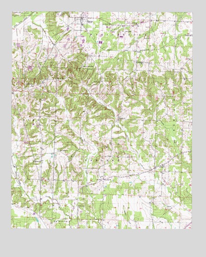
Blevins, AR USGS Topographic Map
Click on map above to begin viewing in our Map Viewer.

This topographic map contains these locations and features:
Feature Name Type Latitude Longitude GNIS ID View Map
Antioch SchoolSchoolN33.78650°W93.52184°45903View Map
Atkins Store (historical)LocaleN33.80400°W93.60434°61448View Map
Bells ChapelChurchN33.86344°W93.54712°76296View Map
BlevinsPopulated PlaceN33.87178°W93.57712°46718View Map
Blevins CemeteryCemeteryN33.85344°W93.58045°46719View Map
Blevins Elementary SchoolSchoolN33.87398°W93.57408°61452View Map
Blevins Post OfficePost OfficeN33.87214°W93.57643°2781836View Map
Blevins Training SchoolSchoolN33.84372°W93.57685°46720View Map
Blevins Volunteer Fire DepartmentBuildingN33.87221°W93.57505°2116160View Map
Chamblews Store (historical)LocaleN33.78900°W93.51601°61454View Map
City of BlevinsCivilN33.87171°W93.57768°2403878View Map
De AnnPopulated PlaceN33.77817°W93.56268°76754View Map
De Ann United Methodist ChurchChurchN33.78011°W93.56323°61450View Map
Deann Volunteer Fire DepartmentBuildingN33.78000°W93.56157°2116348View Map
Drab (historical)Populated PlaceN33.84428°W93.52157°61456View Map
DunlapPopulated PlaceN33.85261°W93.53907°56998View Map
H and P LakeReservoirN33.79951°W93.61483°80719View Map
H and P Lake DamDamN33.80011°W93.61685°80718View Map
Holly Grove United Methodist ChurchChurchN33.79511°W93.59240°77203View Map
Jakajones Church (historical)ChurchN33.82150°W93.60546°61449View Map
Marlbrook Baptist ChurchChurchN33.86761°W93.53907°77598View Map
Maxwell CemeteryCemeteryN33.87483°W93.59184°51747View Map
Minnes Store (historical)LocaleN33.82789°W93.54851°61451View Map
Mount Moriah ChurchChurchN33.78873°W93.60490°52320View Map
Mount Zion CemeteryCemeteryN33.76289°W93.57517°52450View Map
Oak Grove CemeteryCemeteryN33.83622°W93.59184°52883View Map
Oak Grove ChurchChurchN33.83261°W93.61129°52900View Map
Reeds Store (historical)LocaleN33.75734°W93.60573°61447View Map
Royston Lake OneReservoirN33.85556°W93.62063°80903View Map
Royston Lake One DamDamN33.85678°W93.62018°80902View Map
Royston Lake ThreeReservoirN33.83393°W93.62002°81016View Map
Royston Lake Three DamDamN33.83511°W93.62018°81015View Map
Royston Lake TwoReservoirN33.84249°W93.61258°80901View Map
Royston Lake Two DamDamN33.84345°W93.61185°80900View Map
Saint John ChurchChurchN33.81372°W93.55101°54351View Map
Shorter CemeteryCemeteryN33.84205°W93.56962°54830View Map
Shorter ChurchChurchN33.83483°W93.56434°54831View Map
Smith LakeReservoirN33.81998°W93.62298°81014View Map
South Fork Ozan CreekStreamN33.87428°W93.61129°55026View Map
T A Smith Lake DamDamN33.82011°W93.62185°81013View Map
Township of GarlandCivilN33.79009°W93.55744°66642View Map
Union Grove ChurchChurchN33.84622°W93.53462°55812View Map
White Oak ChurchChurchN33.77900°W93.56157°56264View Map
Yarburys Store (historical)LocaleN33.83845°W93.53962°61455View Map

Note: Coordinates in the location and feature list above are referenced to NAD83 datum.


Copyright (C) 2008-2026 Ryan Niemi / Sunset Dynamics ... All Rights Reserved
