TopoQuest Logo
Do you find TopoQuest useful?
Help keep TopoQuest running and adding new maps/features by donating!
Home View Maps Find Maps Find Places Resources & Links


McDougal, Arkansas Topographic Map

USGS Map Title: McDougal, AR
USGS Map MRC: 36090D4
DRG (GeoTIFF) Download: o36090d4.tif


Neighboring USGS Topographic Map Quads:


  Naylor, MO  
36090E5
 

  Vastus, MO  
36090E4
 

  Oglesville, MO  
36090E3
 

  Corning, AR  
36090D5
 

  McDougal, AR  
36090D4
 

  Pollard, AR  
36090D3
 

  Knobel, AR  
36090C5
 

  Boydsville, AR  
36090C4
 

  Rector, AR  
36090C3


Map MRC Location:

N37°
W91°
N37°
W90°
H8 H7 H6 H5 H4 H3 H2 H1
G8 G7 G6 G5 G4 G3 G2 G1
F8 F7 F6 F5 F4 F3 F2 F1
E8 E7 E6 E5 E4 E3 E2 E1
D8 D7 D6 D5 D4 D3 D2 D1
C8 C7 C6 C5 C4 C3 C2 C1
B8 B7 B6 B5 B4 B3 B2 B1
A8 A7 A6 A5 A4 A3 A2 A1
N36°
W91°
N36°
W90°

McDougal, AR USGS 1:24K Topographic Map Preview:
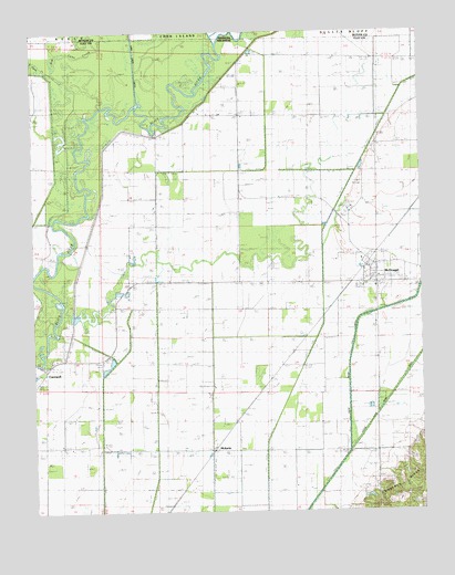
McDougal, AR USGS Topographic Map
Click on map above to begin viewing in our Map Viewer.

This topographic map contains these locations and features:
Feature Name Type Latitude Longitude GNIS ID View Map
Big Cane CreekStreamN36.48061°W90.47622°735510View Map
Burton CreekStreamN36.41339°W90.37760°47224View Map
Ditch Number 13CanalN36.40923°W90.41566°82074View Map
Ditch Number 16CanalN36.42034°W90.43066°82099View Map
Ditch Number 17CanalN36.40117°W90.44288°82111View Map
Ditch Number 18CanalN36.41756°W90.47955°82118View Map
Ditch Number 19CanalN36.40867°W90.46039°82129View Map
French Grove ChurchChurchN36.41284°W90.44344°49243View Map
Happy Home ChurchChurchN36.39201°W90.46955°49841View Map
HickoriaPopulated PlaceN36.39117°W90.44344°57912View Map
Hineman Ferry (historical)CrossingN36.44339°W90.48789°82636View Map
Independent ChurchChurchN36.39173°W90.49233°50488View Map
Little Cache River DitchCanalN36.42589°W90.39233°51212View Map
Little Cane CreekStreamN36.49034°W90.49623°51214View Map
Martin School (historical)SchoolN36.39089°W90.46150°82648View Map
McDougalPopulated PlaceN36.44006°W90.39149°58146View Map
McDougal Post OfficePost OfficeN36.43488°W90.39078°2781930View Map
McDougal Volunteer Fire StationBuildingN36.43419°W90.39312°2116781View Map
Moark LandingLocaleN36.47867°W90.46816°82650View Map
New Home ChurchChurchN36.39034°W90.42483°52651View Map
Post Oak ChurchChurchN36.45423°W90.39761°53718View Map
Post Oak School (historical)SchoolN36.47061°W90.38927°82658View Map
Town of McDougalCivilN36.43655°W90.39071°2406129View Map
Township of Bennett (historical)CivilN36.44728°W90.38761°63710View Map
Township of Bennett-LemmonsCivilN36.42778°W90.40356°2063355View Map
Township of Lemmons (historical)CivilN36.37923°W90.43344°63724View Map
Wildwood School (historical)SchoolN36.46756°W90.45039°82680View Map
Wood School (historical)SchoolN36.39062°W90.42372°82683View Map

Note: Coordinates in the location and feature list above are referenced to NAD83 datum.


Copyright (C) 2008-2026 Ryan Niemi / Sunset Dynamics ... All Rights Reserved
