TopoQuest Logo
Do you find TopoQuest useful?
Help keep TopoQuest running and adding new maps/features by donating!
Home View Maps Find Maps Find Places Resources & Links


Jacumba, California Topographic Map

USGS Map Title: Jacumba, CA
USGS Map MRC: 32116F2
DRG (GeoTIFF) Download: o32116f2.tif


Neighboring USGS Topographic Map Quads:


  Sombrero Peak, CA  
32116G3
 

  Sweeney Pass, CA  
32116G2
 

  Carrizo Mountain, CA  
32116G1
 

  Live Oak Springs, CA  
32116F3
 

  Jacumba, CA  
32116F2
 

  In-Ko-Pah Gorge, CA  
32116F1
 

  Tierra del Sol, CA  
32116E3


Map MRC Location:

N33°
W117°
N33°
W116°
H8 H7 H6 H5 H4 H3 H2 H1
G8 G7 G6 G5 G4 G3 G2 G1
F8 F7 F6 F5 F4 F3 F2 F1
E8 E7 E6 E5 E4 E3 E2 E1
D8 D7 D6 D5 D4 D3 D2 D1
C8 C7 C6 C5 C4 C3 C2 C1
B8 B7 B6 B5 B4 B3 B2 B1
A8 A7 A6 A5 A4 A3 A2 A1
N32°
W117°
N32°
W116°

Jacumba, CA USGS 1:24K Topographic Map Preview:
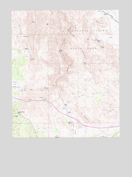
Jacumba, CA USGS Topographic Map
Click on map above to begin viewing in our Map Viewer.

This topographic map contains these locations and features:
Feature Name Type Latitude Longitude GNIS ID View Map
Arsenic SpringSpringN32.65023°W116.18590°238779View Map
Bankhead SpringSpringN32.64653°W116.24401°238957View Map
Bankhead SpringsPopulated PlaceN32.64978°W116.24391°238958View Map
Boundary CreekStreamN32.62506°W116.18029°1667297View Map
Camp Sizzle SpringSpringN32.66423°W116.18363°1682441View Map
Carrizo GorgeValleyN32.74450°W116.19724°255426View Map
Carrizo GorgeLocaleN32.71006°W116.19585°240275View Map
Carrizo Gorge SidingLocaleN32.70895°W116.19502°1682442View Map
Dos CabezasPopulated PlaceN32.74589°W116.14029°1660564View Map
Dos Cabezas SidingLocaleN32.74423°W116.13557°1682444View Map
Dos Cabezas SpringSpringN32.71412°W116.14368°241574View Map
Dubber SpurLocaleN32.65728°W116.19057°254051View Map
Goat CanyonValleyN32.73284°W116.19168°242757View Map
Gray MountainSummitN32.64590°W116.16696°242968View Map
Iron SpringSpringN32.66427°W116.21909°243894View Map
Jacumba Census Designated PlaceCensusN32.62774°W116.18270°2583040View Map
Jacumba MountainsRangeN32.71978°W116.17252°243982View Map
Jacumba ValleyValleyN32.65506°W116.19029°243984View Map
Lone Tiger SpringSpringN32.66089°W116.18196°1682448View Map
McCain ValleyValleyN32.67228°W116.23696°245638View Map
Mortero PalmsPopulated PlaceN32.71923°W116.15168°1661063View Map
Mount TuleSummitN32.70145°W116.22752°250685View Map
Palm GrovePopulated PlaceN32.73534°W116.20974°1661177View Map
Piedras GrandesSummitN32.73700°W116.15196°247452View Map
Piedras Grandes Cultural PreserveReserveN32.72915°W116.15229°2741294View Map
Redondo FlatFlatN32.72561°W116.24030°248092View Map
Redondo SpringSpringN32.72474°W116.23714°248093View Map
Round MountainSummitN32.63951°W116.18335°248417View Map
Sacotone SpringSpringN32.71219°W116.23223°248499View Map
Squaw TitSummitN32.65062°W116.13807°1661498View Map
Table MountainSummitN32.65589°W116.13557°250224View Map
TitusPopulated PlaceN32.63256°W116.17974°1661574View Map
Tule CanyonValleyN32.67534°W116.20057°250670View Map
Tule LakeReservoirN32.67550°W116.24461°250677View Map
Tunnel Fifteen SpurLocaleN32.72923°W116.18307°255803View Map
West 844 DamDamN32.67450°W116.24613°1664092View Map

Note: Coordinates in the location and feature list above are referenced to NAD83 datum.


Copyright (C) 2008-2026 Ryan Niemi / Sunset Dynamics ... All Rights Reserved
