TopoQuest Logo
Do you find TopoQuest useful?
Help keep TopoQuest running and adding new maps/features by donating!
Home View Maps Find Maps Find Places Resources & Links


Moodus, Connecticut Topographic Map

USGS Map Title: Moodus, CT
USGS Map MRC: 41072E4
DRG (GeoTIFF) Download: o41072e4.tif


Neighboring USGS Topographic Map Quads:


  Glastonbury, CT  
41072F5
 

  Marlborough, CT  
41072F4
 

  Columbia, CT  
41072F3
 

  Middle Haddam, CT  
41072E5
 

  Moodus, CT  
41072E4
 

  Colchester, CT  
41072E3
 

  Haddam, CT  
41072D5
 

  Deep River, CT  
41072D4
 

  Hamburg, CT  
41072D3


Map MRC Location:

N42°
W73°
N42°
W72°
H8 H7 H6 H5 H4 H3 H2 H1
G8 G7 G6 G5 G4 G3 G2 G1
F8 F7 F6 F5 F4 F3 F2 F1
E8 E7 E6 E5 E4 E3 E2 E1
D8 D7 D6 D5 D4 D3 D2 D1
C8 C7 C6 C5 C4 C3 C2 C1
B8 B7 B6 B5 B4 B3 B2 B1
A8 A7 A6 A5 A4 A3 A2 A1
N41°
W73°
N41°
W72°

Moodus, CT USGS 1:24K Topographic Map Preview:
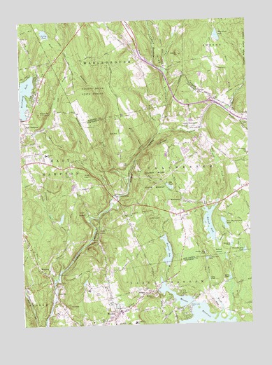
Moodus, CT USGS Topographic Map
Click on map above to begin viewing in our Map Viewer.

This topographic map contains these locations and features:
Feature Name Type Latitude Longitude GNIS ID View Map
Amasa Day HouseBuildingN41.50288°W72.44675°1923650View Map
Arrow PointCapeN41.60121°W72.49703°1923654View Map
Babcock PondLakeN41.54163°W72.39708°205185View Map
Babcock Pond DamDamN41.53954°W72.39647°1770865View Map
Babcock SwampSwampN41.53007°W72.39256°205186View Map
Baker HillSummitN41.58732°W72.48842°205206View Map
Banner Golf CourseLocaleN41.51260°W72.45925°1923657View Map
BashanPopulated PlaceN41.51315°W72.43342°212417View Map
Bashan Lake CemeteryCemeteryN41.50751°W72.40868°205293View Map
Basin Hill CemeteryCemeteryN41.51751°W72.48073°205296View Map
Bear SwampSwampN41.58383°W72.48493°1923662View Map
Bevins Pond DamDamN41.58010°W72.49953°1770889View Map
Blackledge RiverStreamN41.57927°W72.42175°205572View Map
Bull HillSummitN41.57899°W72.44536°205818View Map
Bull Hill CemeteryCemeteryN41.57083°W72.44435°205820View Map
Camp HalburnLocaleN41.52149°W72.48064°205951View Map
Cattle Lot BrookStreamN41.60621°W72.46814°206066View Map
Cave HillSummitN41.50871°W72.47425°206070View Map
Chalker HillSummitN41.61093°W72.41147°206165View Map
Colchester Hayward Volunteer Fire Department 2BuildingN41.55379°W72.41125°2420004View Map
Cone PondLakeN41.51826°W72.39809°206420View Map
Cranberry MeadowSwampN41.57954°W72.49120°1923746View Map
Day Meadow BrookStreamN41.58093°W72.40842°206623View Map
Day PondLakeN41.55687°W72.41908°206624View Map
Day Pond BrookStreamN41.56343°W72.43786°206625View Map
Day Pond State ParkParkN41.55343°W72.41842°1930801View Map
Dickinson CreekStreamN41.55704°W72.44064°206690View Map
East Haddam Fire Company 2 Moodus StationBuildingN41.50308°W72.44601°2420205View Map
East Haddam Free Public LibraryBuildingN41.50121°W72.44953°1923793View Map
East Haddam SchoolSchoolN41.50065°W72.43898°206817View Map
East Hampton Ambulance AssociationBuildingN41.56700°W72.49869°2660888View Map
East Hampton CemeteryCemeteryN41.57508°W72.49975°1923799View Map
East Hampton Census Designated PlaceCensusN41.57351°W72.49183°2377817View Map
Elbow BrookStreamN41.51954°W72.48231°206916View Map
Fawn BrookStreamN41.60399°W72.41786°207047View Map
Fawn Hill BrookStreamN41.60982°W72.47064°207048View Map
Flat BrookStreamN41.55177°W72.44981°207106View Map
Hartford County 4-H CampLocaleN41.59177°W72.42564°1950338View Map
Interchange 16CrossingN41.59121°W72.39481°1931023View Map
Jeremiahs BackSummitN41.59010°W72.37953°1931063View Map
Jeremy RiverStreamN41.57927°W72.42175°212869View Map
Jones Street CemeteryCemeteryN41.60461°W72.39048°208196View Map
Jones Street PondLakeN41.61865°W72.39135°208197View Map
Jones Street Pond DamDamN41.61927°W72.39119°1771247View Map
Lakeview CemeteryCemeteryN41.58368°W72.49883°208365View Map
LeesvillePopulated PlaceN41.51177°W72.48120°212495View Map
Leesville DamDamN41.51677°W72.48287°1771467View Map
Leesville PondReservoirN41.51677°W72.48287°1771468View Map
Lyman BrookStreamN41.60788°W72.42481°208642View Map
Markham BayBayN41.60177°W72.49342°1923964View Map
Markham PointCapeN41.59565°W72.49620°1923965View Map
Marlborough Congregational ChurchChurchN41.61788°W72.44564°1950474View Map
Meadow BrookStreamN41.58760°W72.38703°208807View Map
Memorial SchoolSchoolN41.57038°W72.48564°208826View Map
Molley BrookStreamN41.50565°W72.39120°208993View Map
MoodusPopulated PlaceN41.50288°W72.45009°209012View Map
Moodus CemeteryCemeteryN41.50703°W72.45175°209013View Map
Moodus Census Designated PlaceCensusN41.50436°W72.44903°2377832View Map
Moodus Post OfficePost OfficeN41.50528°W72.44611°1923994View Map
Moodus ReservoirReservoirN41.50508°W72.40472°209014View Map
Moodus Reservoir DamDamN41.51399°W72.42620°1770869View Map
Nathan Hale PlaceLocaleN41.50454°W72.44731°1923998View Map
Nathan Hale Plaza Shopping CenterLocaleN41.50510°W72.44648°1923999View Map
North CemeteryCemeteryN41.61841°W72.49844°209336View Map
North WestchesterPopulated PlaceN41.58093°W72.40120°209382View Map
North Westchester PondReservoirN41.58010°W72.40175°1931301View Map
Number One PondLakeN41.52678°W72.39915°209426View Map
Number Two PondLakeN41.52937°W72.40011°209427View Map
Old Comstock BridgeBridgeN41.55343°W72.44786°209470View Map
Pickerel LakeLakeN41.53021°W72.42076°209741View Map
Pickerel Lake BrookStreamN41.51732°W72.42203°209742View Map
Pickerel Lake DamDamN41.52982°W72.42120°1770879View Map
Pine BrookStreamN41.58038°W72.40008°209759View Map
Pine BrookStreamN41.50482°W72.38731°209763View Map
Pine Meadows Park PondReservoirN41.54138°W72.38915°209790View Map
Pine Meadows Park Pond DamDamN41.53899°W72.38786°1771194View Map
Ponemah CemeteryCemeteryN41.58092°W72.40722°209916View Map
Post PondReservoirN41.51885°W72.38675°209957View Map
Prospect HillSummitN41.57010°W72.37564°210001View Map
Rankl FieldAirportN41.59946°W72.43429°213069View Map
Safstrom BrookStreamN41.52315°W72.47898°210380View Map
Saint Bridget of Kildare ChurchChurchN41.50677°W72.45036°1924070View Map
Saint Bridgets CemeteryCemeteryN41.50741°W72.45049°210415View Map
Salmon River AirfieldAirportN41.58938°W72.44243°213070View Map
Senate BrookStreamN41.59177°W72.38286°210759View Map
Shady BrookStreamN41.50010°W72.44814°210770View Map
Somers Field (historical)AirportN41.58232°W72.46453°1950745View Map
Standish BrookStreamN41.53288°W72.39175°211131View Map
Standish PondLakeN41.53234°W72.38566°211133View Map
Strong PondLakeN41.62016°W72.48554°211259View Map
Tartia CemeteryCemeteryN41.56209°W72.47318°211361View Map
Thousand Acre PondLakeN41.52991°W72.37836°211458View Map
Tri-Town Shopping CenterLocaleN41.54649°W72.41147°1931620View Map
WestchesterPopulated PlaceN41.55065°W72.41203°212595View Map
Westchester CemeteryCemeteryN41.54933°W72.40032°212011View Map
Westchester Congregational ChurchChurchN41.55121°W72.41147°1931706View Map
Westchester GreenParkN41.55121°W72.41147°1931707View Map
Wolf BrookStreamN41.57204°W72.43203°212215View Map
WopowogPopulated PlaceN41.52315°W72.48509°212601View Map

Note: Coordinates in the location and feature list above are referenced to NAD83 datum.


Copyright (C) 2008-2026 Ryan Niemi / Sunset Dynamics ... All Rights Reserved
