TopoQuest Logo
Do you find TopoQuest useful?
Help keep TopoQuest running and adding new maps/features by donating!
Home View Maps Find Maps Find Places Resources & Links


Lean-to Point, Idaho Topographic Map

USGS Map Title: Lean-to Point, ID
USGS Map MRC: 46115E4
DRG (GeoTIFF) Download: o46115e4.tif


Neighboring USGS Topographic Map Quads:


  Clarke Mountain, ID  
46115F5
 

  Pot Mountain, ID  
46115F4
 

  Junction Mountain, ID  
46115F3
 

  Larch Butte, ID  
46115E5
 

  Lean-to Point, ID  
46115E4
 

  Cook Mountain, ID  
46115E3
 

  Snowy Summit, ID  
46115D5
 

  Weitas Butte, ID  
46115D4
 

  Liz Butte, ID  
46115D3


Map MRC Location:

N47°
W116°
N47°
W115°
H8 H7 H6 H5 H4 H3 H2 H1
G8 G7 G6 G5 G4 G3 G2 G1
F8 F7 F6 F5 F4 F3 F2 F1
E8 E7 E6 E5 E4 E3 E2 E1
D8 D7 D6 D5 D4 D3 D2 D1
C8 C7 C6 C5 C4 C3 C2 C1
B8 B7 B6 B5 B4 B3 B2 B1
A8 A7 A6 A5 A4 A3 A2 A1
N46°
W116°
N46°
W115°

Lean-to Point, ID USGS 1:24K Topographic Map Preview:
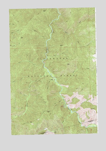
Lean-to Point, ID USGS Topographic Map
Click on map above to begin viewing in our Map Viewer.

This topographic map contains these locations and features:
Feature Name Type Latitude Longitude GNIS ID View Map
Bennett CreekStreamN46.52214°W115.40708°377364View Map
Bighorn CreekStreamN46.59408°W115.44430°377622View Map
Bighorn PointSummitN46.62269°W115.45180°377623View Map
Buck CreekStreamN46.59964°W115.40764°378370View Map
Burst CreekStreamN46.52658°W115.47680°378573View Map
Cabin CreekStreamN46.57158°W115.45319°378637View Map
Cabin PointSummitN46.59602°W115.48542°396205View Map
Doris ButteSummitN46.56908°W115.41791°380726View Map
Doris CreekStreamN46.54908°W115.42902°380727View Map
Hemlock CreekStreamN46.56269°W115.44569°383089View Map
Horse CampLocaleN46.57825°W115.37680°383359View Map
Horse Pack BridgeBridgeN46.52714°W115.42375°393975View Map
Johnagan MountainSummitN46.52436°W115.38486°383958View Map
Johnny ButteSummitN46.58769°W115.42819°383960View Map
Johnny CreekStreamN46.61297°W115.43541°383962View Map
Larch CreekStreamN46.55297°W115.46680°384436View Map
Lean CreekStreamN46.53519°W115.42402°384503View Map
Lean-to PointSummitN46.52241°W115.44847°384505View Map
Lean-To RidgeRidgeN46.51491°W115.46291°384504View Map
Little Weitas CreekStreamN46.50575°W115.39236°384989View Map
Middle CreekStreamN46.52075°W115.41263°386788View Map
Sand CreekStreamN46.52853°W115.41680°389889View Map
Slick CreekStreamN46.57630°W115.44653°390594View Map
Station CreekStreamN46.55297°W115.43597°391375View Map
Warm CreekStreamN46.53686°W115.47347°392844View Map
Wedge CampLocaleN46.51186°W115.47014°392978View Map
Weitas Work CenterLocaleN46.55408°W115.43819°398331View Map

Note: Coordinates in the location and feature list above are referenced to NAD83 datum.


Copyright (C) 2008-2026 Ryan Niemi / Sunset Dynamics ... All Rights Reserved
