TopoQuest Logo
Do you find TopoQuest useful?
Help keep TopoQuest running and adding new maps/features by donating!
Home View Maps Find Maps Find Places Resources & Links


Vergennes, Illinois Topographic Map

USGS Map Title: Vergennes, IL
USGS Map MRC: 37089H3
DRG (GeoTIFF) Download: o37089h3.tif


Neighboring USGS Topographic Map Quads:


  Pinckneyville, IL  
38089A4
 

  Pyatts, IL  
38089A3
 

  Du Quoin, IL  
38089A2
 

  Ava, IL  
37089H4
 

  Vergennes, IL  
37089H3
 

  Elkville, IL  
37089H2
 

  Oraville, IL  
37089G4
 

  Murphysboro, IL  
37089G3
 

  De Soto, IL  
37089G2


Map MRC Location:

N38°
W90°
N38°
W89°
H8 H7 H6 H5 H4 H3 H2 H1
G8 G7 G6 G5 G4 G3 G2 G1
F8 F7 F6 F5 F4 F3 F2 F1
E8 E7 E6 E5 E4 E3 E2 E1
D8 D7 D6 D5 D4 D3 D2 D1
C8 C7 C6 C5 C4 C3 C2 C1
B8 B7 B6 B5 B4 B3 B2 B1
A8 A7 A6 A5 A4 A3 A2 A1
N37°
W90°
N37°
W89°

Vergennes, IL USGS 1:24K Topographic Map Preview:
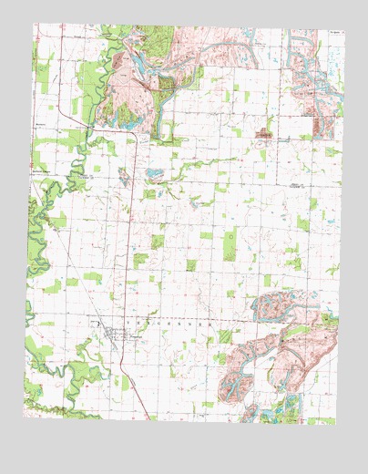
Vergennes, IL USGS Topographic Map
Click on map above to begin viewing in our Map Viewer.

This topographic map contains these locations and features:
Feature Name Type Latitude Longitude GNIS ID View Map
Bethel ChurchChurchN37.87755°W89.30231°404286View Map
Bottom School (historical)SchoolN37.90783°W89.35926°1772174View Map
Brooks School (historical)SchoolN37.93811°W89.34342°1772177View Map
Burroughs School (historical)SchoolN37.93644°W89.26258°1772181View Map
Cox Prairie School (historical)SchoolN37.90783°W89.32092°1772190View Map
Du Quoin Number 4 Election PrecinctCivilN37.97689°W89.29170°1928480View Map
Forest School (historical)SchoolN37.93700°W89.30120°1772196View Map
Galum CreekStreamN37.93700°W89.37203°408864View Map
GrubbsPopulated PlaceN37.93450°W89.36370°1772201View Map
MatthewsPopulated PlaceN37.96755°W89.37398°422949View Map
Matthews JunctionPopulated PlaceN37.95255°W89.37398°422950View Map
McElvain CemeteryCemeteryN37.99560°W89.28647°413255View Map
Oak Grove School (historical)SchoolN37.88922°W89.28314°1772225View Map
Panther CreekStreamN37.99533°W89.34120°415348View Map
Parrish CemeteryCemeteryN37.90727°W89.32397°415419View Map
Pinckneyville-Du Quoin AirportAirportN37.97731°W89.36308°427682View Map
Rattlesnake CreekStreamN37.87727°W89.35620°416404View Map
Ross CemeteryCemeteryN37.97254°W89.30341°416971View Map
Russian Orthodox CemeteryCemeteryN37.93532°W89.25758°1820797View Map
Sutter CemeteryCemeteryN37.96143°W89.30452°419437View Map
Sutter Church (historical)ChurchN37.96144°W89.30842°1725621View Map
Township of VergennesCivilN37.90706°W89.31948°429865View Map
Tuthill CemeteryCemeteryN37.92949°W89.34425°419966View Map
Vancil CemeteryCemeteryN37.97977°W89.26591°420225View Map
VergennesPopulated PlaceN37.90227°W89.33564°420254View Map
Vergennes Elementary SchoolSchoolN37.90505°W89.34592°1815638View Map
Vergennes Fire DepartmentBuildingN37.90063°W89.34089°2640925View Map
Vergennes Post OfficePost OfficeN37.90168°W89.34168°2788772View Map
Village of VergennesCivilN37.90149°W89.33988°2400057View Map
Walker School (historical)SchoolN37.97199°W89.28008°1725623View Map
Walkers CreekStreamN37.96283°W89.34370°420420View Map
Woodward School (historical)SchoolN37.97227°W89.32259°1725625View Map
Youngs CreekStreamN37.96227°W89.35259°421605View Map

Note: Coordinates in the location and feature list above are referenced to NAD83 datum.


Copyright (C) 2008-2026 Ryan Niemi / Sunset Dynamics ... All Rights Reserved
