TopoQuest Logo
Do you find TopoQuest useful?
Help keep TopoQuest running and adding new maps/features by donating!
Home View Maps Find Maps Find Places Resources & Links


Stanhope, Iowa Topographic Map

USGS Map Title: Stanhope, IA
USGS Map MRC: 42093C7
DRG (GeoTIFF) Download: o42093c7.tif


Neighboring USGS Topographic Map Quads:


  Duncombe, IA  
42093D8
 

  Webster City, IA  
42093D7
 

  Blairsburg, IA  
42093D6
 

  Stratford, IA  
42093C8
 

  Stanhope, IA  
42093C7
 

  Jewell, IA  
42093C6
 

  Fraser, IA  
42093B8
 

  Mackey, IA  
42093B7
 

  Ames NW, IA  
42093B6


Map MRC Location:

N43°
W94°
N43°
W93°
H8 H7 H6 H5 H4 H3 H2 H1
G8 G7 G6 G5 G4 G3 G2 G1
F8 F7 F6 F5 F4 F3 F2 F1
E8 E7 E6 E5 E4 E3 E2 E1
D8 D7 D6 D5 D4 D3 D2 D1
C8 C7 C6 C5 C4 C3 C2 C1
B8 B7 B6 B5 B4 B3 B2 B1
A8 A7 A6 A5 A4 A3 A2 A1
N42°
W94°
N42°
W93°

Stanhope, IA USGS 1:24K Topographic Map Preview:
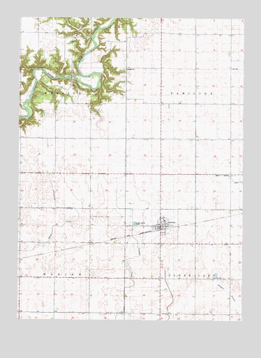
Stanhope, IA USGS Topographic Map
Click on map above to begin viewing in our Map Viewer.

This topographic map contains these locations and features:
Feature Name Type Latitude Longitude GNIS ID View Map
Central Iowa Cooperative ElevatorLocaleN42.28887°W93.79606°1996962View Map
City of StanhopeCivilN42.28893°W93.79600°2395950View Map
Country Relics VillageLocaleN42.28887°W93.79606°1996955View Map
Lake Center (historical)LocaleN42.29581°W93.75161°1996878View Map
Lake Center Post Office (historical)Post OfficeN42.29581°W93.75161°1996879View Map
Lawn Hill CemeteryCemeteryN42.26776°W93.76133°458249View Map
Our Saviour's Lutheran ChurchChurchN42.28887°W93.79606°1996961View Map
Saratoga CemeteryCemeteryN42.35387°W93.81689°461426View Map
StanhopePopulated PlaceN42.28887°W93.79606°461950View Map
Stanhope (historical)LocaleN42.28776°W93.79467°1996954View Map
Stanhope Fire and RescueBuildingN42.28955°W93.79699°2599742View Map
Stanhope Fire DepartmentBuildingN42.28955°W93.79699°1996960View Map
Stanhope LibraryBuildingN42.28887°W93.79606°1996959View Map
Stanhope Parish ChurchChurchN42.28887°W93.79606°1996958View Map
Stanhope Police DepartmentBuildingN42.28887°W93.79606°1996957View Map
Stanhope Post OfficePost OfficeN42.28982°W93.79629°1996956View Map
Township of Clear LakeCivilN42.25276°W93.75698°467620View Map
Township of HamiltonCivilN42.33982°W93.75731°467993View Map
Township of MarionCivilN42.25298°W93.87373°468352View Map
Township of WebsterCivilN42.33991°W93.87376°468961View Map
Tunnel (historical)LocaleN42.35359°W93.84745°466253View Map
Tunnel Mill AreaParkN42.34720°W93.86134°1996868View Map
Tunnel Post Office (historical)Post OfficeN42.34998°W93.84050°1996877View Map
Zion CemeteryCemeteryN42.35442°W93.75744°463261View Map

Note: Coordinates in the location and feature list above are referenced to NAD83 datum.


Copyright (C) 2008-2026 Ryan Niemi / Sunset Dynamics ... All Rights Reserved
