TopoQuest Logo
Do you find TopoQuest useful?
Help keep TopoQuest running and adding new maps/features by donating!
Home View Maps Find Maps Find Places Resources & Links


Tallega, Kentucky Topographic Map

USGS Map Title: Tallega, KY
USGS Map MRC: 37083E5
DRG (GeoTIFF) Download: o37083e5.tif


Neighboring USGS Topographic Map Quads:


  Zachariah, KY  
37083F6
 

  Campton, KY  
37083F5
 

  Landsaw, KY  
37083F4
 

  Beattyville, KY  
37083E6
 

  Tallega, KY  
37083E5
 

  Jackson, KY  
37083E4
 

  Booneville, KY  
37083D6
 

  Cowcreek, KY  
37083D5
 

  Canoe, KY  
37083D4


Map MRC Location:

N38°
W84°
N38°
W83°
H8 H7 H6 H5 H4 H3 H2 H1
G8 G7 G6 G5 G4 G3 G2 G1
F8 F7 F6 F5 F4 F3 F2 F1
E8 E7 E6 E5 E4 E3 E2 E1
D8 D7 D6 D5 D4 D3 D2 D1
C8 C7 C6 C5 C4 C3 C2 C1
B8 B7 B6 B5 B4 B3 B2 B1
A8 A7 A6 A5 A4 A3 A2 A1
N37°
W84°
N37°
W83°

Tallega, KY USGS 1:24K Topographic Map Preview:
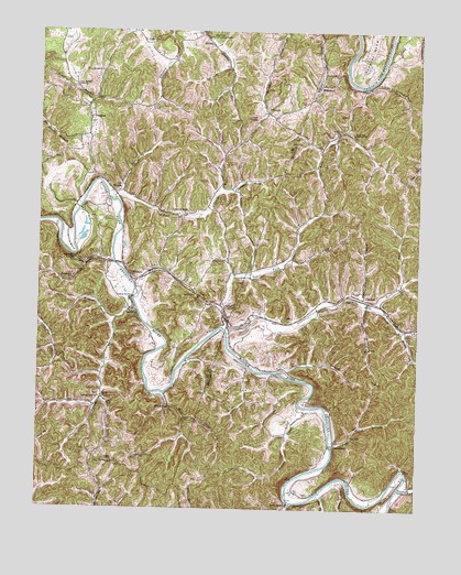
Tallega, KY USGS Topographic Map
Click on map above to begin viewing in our Map Viewer.

This topographic map contains these locations and features:
Feature Name Type Latitude Longitude GNIS ID View Map
Anvil KnobSummitN37.60231°W83.55519°486005View Map
AtholPopulated PlaceN37.55259°W83.56269°507424View Map
Bean ForkStreamN37.56481°W83.54102°486512View Map
Bear CreekStreamN37.58064°W83.59936°486550View Map
Beginning BranchStreamN37.53564°W83.54491°486771View Map
Bowman BranchStreamN37.55370°W83.51630°487749View Map
Brewer ForkStreamN37.54676°W83.50352°487864View Map
Bryant CreekStreamN37.52703°W83.53796°488168View Map
Canyon FallsPopulated PlaceN37.57648°W83.57741°488907View Map
Chapmans ForkStreamN37.58287°W83.56491°489358View Map
Clover BranchStreamN37.55564°W83.52046°489701View Map
Coal BranchStreamN37.56509°W83.59991°489723View Map
Coal Branch SchoolSchoolN37.55953°W83.61380°489728View Map
Cope BranchStreamN37.51648°W83.52713°490069View Map
CopebranchPopulated PlaceN37.51759°W83.52602°507754View Map
FillmorePopulated PlaceN37.60453°W83.54963°507998View Map
Glen Eden Community CenterBuildingN37.62398°W83.56797°492887View Map
Gum Springs Bible ChurchChurchN37.61064°W83.61324°493490View Map
Horseshoe BendBendN37.56925°W83.61574°494605View Map
Jetts CreekPopulated PlaceN37.50231°W83.54241°508343View Map
Jetts CreekStreamN37.50148°W83.54102°513004View Map
Keen ForkStreamN37.55287°W83.51268°495591View Map
Lick BranchStreamN37.50398°W83.53185°513394View Map
Lick CreekStreamN37.61064°W83.51741°496469View Map
Little Bear CreekStreamN37.58231°W83.59908°496609View Map
Little Rock Lick CreekStreamN37.60981°W83.51602°496845View Map
LonePopulated PlaceN37.53009°W83.60380°508495View Map
Lower Twin CreekStreamN37.54703°W83.56241°497309View Map
Lynam CreekStreamN37.54981°W83.59880°497361View Map
Lynam Creek SchoolSchoolN37.52898°W83.60436°497362View Map
Mill CreekStreamN37.53009°W83.58380°498254View Map
Mill Creek SchoolSchoolN37.52675°W83.58130°498277View Map
MonicaPopulated PlaceN37.58425°W83.60158°508624View Map
Mud TunnelTunnelN37.55648°W83.57269°499021View Map
New Springs ChurchChurchN37.61481°W83.60491°499402View Map
OakdalePopulated PlaceN37.55592°W83.51713°508731View Map
PrimrosePopulated PlaceN37.60231°W83.60852°508876View Map
Primrose Volunteer Fire DepartmentBuildingN37.60275°W83.60779°2637233View Map
Puncheon Camp CreekStreamN37.50592°W83.50518°501441View Map
Rock Lick Mission HallChurchN37.59814°W83.52157°502138View Map
Rock Lick SchoolSchoolN37.59870°W83.52685°502139View Map
Saint Helens DivisionCivilN37.57918°W83.61041°1937234View Map
Snake BranchStreamN37.50731°W83.52630°515521View Map
Spencer BendBendN37.62037°W83.51574°504052View Map
Spencer Bend ChurchChurchN37.61342°W83.52657°504053View Map
TallegaPopulated PlaceN37.56037°W83.59019°509181View Map
Tallega Mission SchoolSchoolN37.55203°W83.59324°504923View Map
Tyler TunnelTunnelN37.56564°W83.61380°505741View Map
Upper Twin CreekStreamN37.54564°W83.56185°505917View Map
VadaPopulated PlaceN37.62259°W83.59074°509268View Map
WidecreekPopulated PlaceN37.61120°W83.53130°509367View Map
Willba Post Office (historical)Post OfficeN37.62200°W83.56800°2377169View Map
WillibaPopulated PlaceN37.62314°W83.56908°509375View Map
Wolfpen BranchStreamN37.55564°W83.59380°507043View Map

Note: Coordinates in the location and feature list above are referenced to NAD83 datum.


Copyright (C) 2008-2026 Ryan Niemi / Sunset Dynamics ... All Rights Reserved
