TopoQuest Logo
Do you find TopoQuest useful?
Help keep TopoQuest running and adding new maps/features by donating!
Home View Maps Find Maps Find Places Resources & Links


Gilbert, Louisiana Topographic Map

USGS Map Title: Gilbert, LA
USGS Map MRC: 32091A6
DRG (GeoTIFF) Download: o32091a6.tif


Neighboring USGS Topographic Map Quads:


  Liddieville, LA  
32091B7
 

  Winnsboro, LA  
32091B6
 

  Crowville, LA  
32091B5
 

  Fort Necessity, LA  
32091A7
 

  Gilbert, LA  
32091A6
 

  Como, LA  
32091A5
 

  Extension, LA  
31091H7
 

  Wisner, LA  
31091H6
 

  Oakley, LA  
31091H5


Map MRC Location:

N33°
W92°
N33°
W91°
H8 H7 H6 H5 H4 H3 H2 H1
G8 G7 G6 G5 G4 G3 G2 G1
F8 F7 F6 F5 F4 F3 F2 F1
E8 E7 E6 E5 E4 E3 E2 E1
D8 D7 D6 D5 D4 D3 D2 D1
C8 C7 C6 C5 C4 C3 C2 C1
B8 B7 B6 B5 B4 B3 B2 B1
A8 A7 A6 A5 A4 A3 A2 A1
N32°
W92°
N32°
W91°

Gilbert, LA USGS 1:24K Topographic Map Preview:
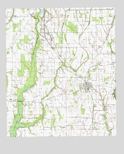
Gilbert, LA USGS Topographic Map
Click on map above to begin viewing in our Map Viewer.

This topographic map contains these locations and features:
Feature Name Type Latitude Longitude GNIS ID View Map
Ash SloughStreamN32.11543°W91.71374°541789View Map
Boggy BayouGutN32.11210°W91.68318°533290View Map
Boles ChapelChurchN32.03988°W91.74485°533307View Map
BrownellPopulated PlaceN32.11654°W91.74207°543031View Map
ChasePopulated PlaceN32.09710°W91.69901°543075View Map
Chase CemeteryCemeteryN32.10820°W91.71067°541676View Map
Chase ChurchChurchN32.08682°W91.69763°533885View Map
Chase ChurchChurchN32.08265°W91.68151°541677View Map
Chase Post OfficePost OfficeN32.09460°W91.69874°1630063View Map
GilbertPopulated PlaceN32.04932°W91.65818°543234View Map
Gilbert Junior High SchoolSchoolN32.04895°W91.66239°544091View Map
Holcombs Flying Service Incorporated Airport (historical)AirportN32.06821°W91.62623°1632716View Map
JiggerPopulated PlaceN32.03488°W91.74679°543343View Map
Jigger Apostolic ChurchChurchN32.03460°W91.74485°544582View Map
Jigger ChurchChurchN32.02516°W91.74957°541675View Map
Jigger Post OfficePost OfficeN32.03488°W91.74568°1630065View Map
Little Turkey CreekStreamN32.00932°W91.73985°536621View Map
Louisiana State University Research CenterLocaleN32.09988°W91.70151°556637View Map
Mount Olive ChurchChurchN32.08793°W91.64735°537362View Map
Oakley CemeteryCemeteryN32.02682°W91.63595°544096View Map
Oakley ChurchChurchN32.02738°W91.63679°537806View Map
Old Macedonia ChurchChurchN32.07015°W91.62818°537836View Map
Saint Mark ChurchChurchN32.01266°W91.64735°538964View Map
Stokes BayouGutN32.11710°W91.69735°539677View Map
Sweet Home ChurchChurchN32.11210°W91.65818°539756View Map
Turkey Creek Baptist ChurchChurchN32.03432°W91.72124°556281View Map
Union Grove ChurchChurchN32.09043°W91.72096°540105View Map
Village of GilbertCivilN32.05070°W91.65677°2407463View Map
Village of Gilbert Volunteer Fire DepartmentBuildingN32.05616°W91.66307°2673137View Map
Waller LandingPopulated PlaceN32.04154°W91.62707°543768View Map
Ward TwoCivilN32.03071°W91.63873°545027View Map
Wisner Junior High SchoolSchoolN32.00738°W91.65096°556463View Map
Wisner-Gilbert Airport (historical)AirportN32.01432°W91.66401°1633015View Map

Note: Coordinates in the location and feature list above are referenced to NAD83 datum.


Copyright (C) 2008-2026 Ryan Niemi / Sunset Dynamics ... All Rights Reserved
