TopoQuest Logo
Do you find TopoQuest useful?
Help keep TopoQuest running and adding new maps/features by donating!
Home View Maps Find Maps Find Places Resources & Links


Crump, Michigan Topographic Map

USGS Map Title: Crump, MI
USGS Map MRC: 43084G1
DRG (GeoTIFF) Download: o43084g1.tif


Neighboring USGS Topographic Map Quads:


  Bentley, MI  
43084H2
 

  Mount Forest, MI  
43084H1
 

  Standish, MI  
43083H8
 

  Estey, MI  
43084G2
 

  Crump, MI  
43084G1
 

  Pinconning, MI  
43083G8
 

  Midland North, MI  
43084F2
 

  Willard, MI  
43084F1
 

  Kawkawlin, MI  
43083F8


Map MRC Location:

N44°
W85°
N44°
W84°
H8 H7 H6 H5 H4 H3 H2 H1
G8 G7 G6 G5 G4 G3 G2 G1
F8 F7 F6 F5 F4 F3 F2 F1
E8 E7 E6 E5 E4 E3 E2 E1
D8 D7 D6 D5 D4 D3 D2 D1
C8 C7 C6 C5 C4 C3 C2 C1
B8 B7 B6 B5 B4 B3 B2 B1
A8 A7 A6 A5 A4 A3 A2 A1
N43°
W85°
N43°
W84°

Crump, MI USGS 1:24K Topographic Map Preview:
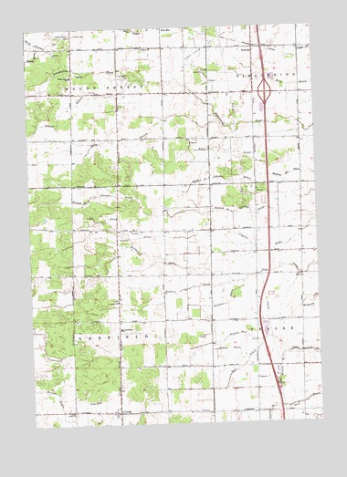
Crump, MI USGS Topographic Map
Click on map above to begin viewing in our Map Viewer.

This topographic map contains these locations and features:
Feature Name Type Latitude Longitude GNIS ID View Map
Bryce DrainStreamN43.84224°W84.00443°622161View Map
Coggins DrainCanalN43.80586°W84.02443°623542View Map
CrumpPopulated PlaceN43.75391°W84.08721°624155View Map
Crump ChurchChurchN43.75419°W84.10777°624156View Map
Crump Post Office (historical)Post OfficeN43.75389°W84.08722°2548184View Map
Erickson DrainCanalN43.79474°W84.03693°625626View Map
Forest Hill CemeteryCemeteryN43.85946°W84.07999°626263View Map
Fraser ChurchChurchN43.76447°W84.02721°626434View Map
Fraser Garfield Drain Branch Number OneStreamN43.77252°W84.01387°626436View Map
Fraser Garfield Drain Branch Number TwoStreamN43.77224°W84.01387°626437View Map
Garfield ChurchChurchN43.78863°W84.08693°626655View Map
Garfield Post Office (historical)Post OfficeN43.81111°W84.04583°2548181View Map
Garfield Township CemeteryCemeteryN43.78944°W84.08805°2548201View Map
Garfield Township Fire Department Station 21BuildingN43.79756°W84.09635°2626871View Map
Garfield-Fraser SchoolSchoolN43.78002°W84.08582°626666View Map
Gross AirportAirportN43.84621°W84.00929°1624107View Map
Hudson BranchStreamN43.85863°W84.07860°628762View Map
Interchange 181CrossingN43.85417°W84.02056°2548214View Map
Lee Davis DrainCanalN43.81058°W84.08332°630254View Map
Linwood Rest AreaLocaleN43.76194°W84.01806°2548222View Map
Mount Forest CemeteryCemeteryN43.87279°W84.10471°632790View Map
Mount Forest Oil FieldOilfieldN43.86947°W84.04555°1623521View Map
Mount Forest SchoolSchoolN43.85919°W84.10499°632791View Map
Mount Forest Township Fire Department Station 23BuildingN43.86860°W84.11047°2626965View Map
Ryan DrainStreamN43.77613°W84.02499°636434View Map
Saint Marys CemeteryCemeteryN43.87279°W84.10332°636892View Map
Saint Marys ChurchChurchN43.86836°W84.07388°636904View Map
Selman DrainStreamN43.77030°W84.03082°637572View Map
South Branch Pinconning RiverStreamN43.84530°W84.04054°638302View Map
Township of GarfieldCivilN43.78279°W84.10686°1626335View Map
Township of Mount ForestCivilN43.86856°W84.10598°1626772View Map
Uhlman DrainStreamN43.79474°W84.03249°1615317View Map
Willard DrainStreamN43.79474°W84.03693°1616491View Map
WKQZ-FM (Midland)TowerN43.84613°W84.09221°1625436View Map
WMJT-FM (Pinconning)TowerN43.84613°W84.09221°1625472View Map
WoodvillePopulated PlaceN43.86724°W84.02527°1617955View Map

Note: Coordinates in the location and feature list above are referenced to NAD83 datum.


Copyright (C) 2008-2026 Ryan Niemi / Sunset Dynamics ... All Rights Reserved
