TopoQuest Logo
Do you find TopoQuest useful?
Help keep TopoQuest running and adding new maps/features by donating!
Home View Maps Find Maps Find Places Resources & Links


Vassar, Michigan Topographic Map

USGS Map Title: Vassar, MI
USGS Map MRC: 43083C5
DRG (GeoTIFF) Download: o43083c5.tif


Neighboring USGS Topographic Map Quads:


  Reese, MI  
43083D6
 

  Gilford, MI  
43083D5
 

  Caro, MI  
43083D4
 

  Frankenmuth, MI  
43083C6
 

  Vassar, MI  
43083C5
 

  Juniata, MI  
43083C4
 

  Clio, MI  
43083B6
 

  Otisville, MI  
43083B5
 

  Columbiaville, MI  
43083B4


Map MRC Location:

N44°
W84°
N44°
W83°
H8 H7 H6 H5 H4 H3 H2 H1
G8 G7 G6 G5 G4 G3 G2 G1
F8 F7 F6 F5 F4 F3 F2 F1
E8 E7 E6 E5 E4 E3 E2 E1
D8 D7 D6 D5 D4 D3 D2 D1
C8 C7 C6 C5 C4 C3 C2 C1
B8 B7 B6 B5 B4 B3 B2 B1
A8 A7 A6 A5 A4 A3 A2 A1
N43°
W84°
N43°
W83°

Vassar, MI USGS 1:24K Topographic Map Preview:
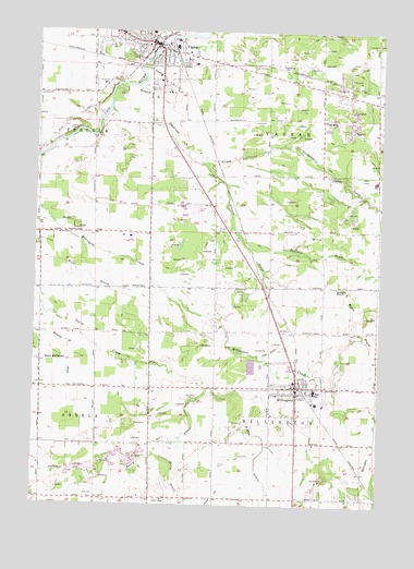
Vassar, MI USGS Topographic Map
Click on map above to begin viewing in our Map Viewer.

This topographic map contains these locations and features:
Feature Name Type Latitude Longitude GNIS ID View Map
Arthur Latham ParkParkN43.28333°W83.55139°2554334View Map
Brainard DrainCanalN43.35891°W83.58413°621869View Map
Case DrainCanalN43.29086°W83.53912°622831View Map
Chadwick SchoolSchoolN43.36613°W83.53607°623033View Map
Chapel Hill Assembly of God ChurchChurchN43.35500°W83.58056°2553937View Map
City of VassarCivilN43.37190°W83.57690°1627190View Map
Community Baptist ChurchChurchN43.25139°W83.62167°2554329View Map
Donigan DrainCanalN43.31697°W83.51884°624784View Map
Elkhorn SchoolSchoolN43.30780°W83.58524°625463View Map
First Baptist ChurchChurchN43.36111°W83.60139°2553947View Map
First Baptist ChurchChurchN43.28167°W83.50083°2554322View Map
First Presbyterian ChurchChurchN43.37222°W83.58500°2553943View Map
First United Methodist ChurchChurchN43.37306°W83.58306°2553941View Map
Fuller CemeteryCemeteryN43.36471°W83.51166°2554513View Map
Goodings CreekStreamN43.35975°W83.59746°626945View Map
Grace Lutheran ChurchChurchN43.37250°W83.59333°2553945View Map
Greater Ephesians Church of GodChurchN43.37250°W83.57444°2553936View Map
Holiness Missionary ChurchChurchN43.36000°W83.52167°2553949View Map
Jensen FieldAirportN43.26291°W83.56204°1624048View Map
Keinath DrainCanalN43.29336°W83.61385°629508View Map
Kilbourn CemeteryCemeteryN43.37221°W83.50194°2554514View Map
Kirk Later Elementary SchoolSchoolN43.27722°W83.52222°2554331View Map
Living Hope Christian ChurchChurchN43.32250°W83.55472°2554317View Map
Mapes DrainCanalN43.29919°W83.50912°631419View Map
Meachum Junior High SchoolSchoolN43.28056°W83.52333°2554333View Map
MillingtonPopulated PlaceN43.28141°W83.52968°632413View Map
Millington - Arbela Township Fire DepartmentBuildingN43.27951°W83.52949°2627019View Map
Millington Bank Historical MarkerParkN43.28028°W83.52972°2554522View Map
Millington Baptist ChurchChurchN43.27972°W83.52861°2554327View Map
Millington CemeteryCemeteryN43.28194°W83.53750°2554510View Map
Millington Church of GodChurchN43.26667°W83.53389°2554326View Map
Millington Church of the NazareneChurchN43.27583°W83.52944°2554324View Map
Millington High SchoolSchoolN43.27667°W83.52000°2554332View Map
Millington Police DepartmentBuildingN43.27927°W83.52925°2554320View Map
Millington Post OfficePost OfficeN43.28194°W83.52806°2554321View Map
Millington School District Number Two Historical MarkerParkN43.28111°W83.52333°2554527View Map
Millington StationLocaleN43.28083°W83.52722°2554318View Map
Millington Township LibraryBuildingN43.28056°W83.52778°2554319View Map
Moore DrainStreamN43.36863°W83.58357°632642View Map
Nazarene ChurchChurchN43.37306°W83.58417°2553940View Map
Partridge's RV and Mobile Home ParkPopulated PlaceN43.36167°W83.58056°2553953View Map
Pedlow DrainCanalN43.26447°W83.54162°634558View Map
Pineview Mennonite ChurchChurchN43.30778°W83.51583°2553948View Map
Pinkerton SchoolSchoolN43.32225°W83.60857°635017View Map
Riverside CemeteryCemeteryN43.36085°W83.59884°635988View Map
Saint Luke's Lutheran ChurchChurchN43.37389°W83.59306°2553944View Map
Saint Paul Lutheran ChurchChurchN43.27944°W83.53722°2554323View Map
Schurtz DrainCanalN43.32169°W83.55135°637444View Map
Seventh-Day Adventist ChurchChurchN43.35972°W83.60139°2553946View Map
Silas A Lane House Historical MarkerParkN43.36944°W83.58806°2554521View Map
Spears DrainCanalN43.36336°W83.57857°638482View Map
Stevens DrainCanalN43.32447°W83.61107°638809View Map
Township of MillingtonCivilN43.26550°W83.52158°1626744View Map
Township of VassarCivilN43.35049°W83.52163°1627191View Map
United Methodist ChurchChurchN43.26611°W83.52944°2554325View Map
VassarPopulated PlaceN43.37197°W83.58329°1615523View Map
Vassar City HallBuildingN43.37056°W83.58056°2553932View Map
Vassar City LibraryBuildingN43.37250°W83.58833°2553939View Map
Vassar FieldAirportN43.34342°W83.53959°1624188View Map
Vassar Fire DepartmentBuildingN43.36924°W83.57591°2626964View Map
Vassar Mobile Medical ResponseBuildingN43.36792°W83.56289°2661965View Map
Vassar Police DepartmentBuildingN43.37092°W83.57989°2626738View Map
Vassar Post OfficePost OfficeN43.37361°W83.58278°2553938View Map
Vassar StationLocaleN43.36917°W83.57500°2553930View Map
Vassar Township HallBuildingN43.36028°W83.52194°2553931View Map
Vassar's Logging Era Historical MarkerParkN43.37056°W83.58000°2554525View Map
Village of MillingtonCivilN43.27860°W83.52734°2399362View Map
WGMZ-FM (Tuscola)TowerN43.27002°W83.50384°1625519View Map
Wightman Building Historical MarkerParkN43.37111°W83.58389°2554520View Map
Woodvalley Mobile Home ParkPopulated PlaceN43.33028°W83.56667°2554335View Map
WOWE-FM (Vassar)TowerN43.29891°W83.50940°1625521View Map

Note: Coordinates in the location and feature list above are referenced to NAD83 datum.


Copyright (C) 2008-2026 Ryan Niemi / Sunset Dynamics ... All Rights Reserved
