TopoQuest Logo
Do you find TopoQuest useful?
Help keep TopoQuest running and adding new maps/features by donating!
Home View Maps Find Maps Find Places Resources & Links


Lambert, Mississippi Topographic Map

USGS Map Title: Lambert, MS
USGS Map MRC: 34090B3
DRG (GeoTIFF) Download: o34090b3.tif


Neighboring USGS Topographic Map Quads:


  Jonestown, MS  
34090C4
 

  Marks, MS  
34090C3
 

  Curtis Station, MS  
34090C2
 

  Sabino, MS  
34090B4
 

  Lambert, MS  
34090B3
 

  Crowder, MS  
34090B2
 

  Tutwiler, MS  
34090A4
 

  Vance, MS  
34090A3
 

  Fishhook Lake, MS  
34090A2


Map MRC Location:

N35°
W91°
N35°
W90°
H8 H7 H6 H5 H4 H3 H2 H1
G8 G7 G6 G5 G4 G3 G2 G1
F8 F7 F6 F5 F4 F3 F2 F1
E8 E7 E6 E5 E4 E3 E2 E1
D8 D7 D6 D5 D4 D3 D2 D1
C8 C7 C6 C5 C4 C3 C2 C1
B8 B7 B6 B5 B4 B3 B2 B1
A8 A7 A6 A5 A4 A3 A2 A1
N34°
W91°
N34°
W90°

Lambert, MS USGS 1:24K Topographic Map Preview:
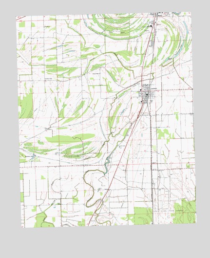
Lambert, MS USGS Topographic Map
Click on map above to begin viewing in our Map Viewer.

This topographic map contains these locations and features:
Feature Name Type Latitude Longitude GNIS ID View Map
Avant School (historical)SchoolN34.13345°W90.34870°683721View Map
Buck BayouGutN34.23956°W90.30509°667718View Map
Buckskin LakeLakeN34.16673°W90.36547°667752View Map
Buford LakeLakeN34.16228°W90.31226°667766View Map
DentonPopulated PlaceN34.14622°W90.31259°691811View Map
Denton CemeteryCemeteryN34.14649°W90.31981°669232View Map
Dorsey LakeLakeN34.22230°W90.26811°669336View Map
First Baptist Church of LambertChurchN34.20289°W90.28426°683733View Map
Fourmile BayouStreamN34.17928°W90.30898°670131View Map
Greenhill ChurchChurchN34.24372°W90.35482°670695View Map
Hazelwood (historical)LocaleN34.24733°W90.25704°683739View Map
Keefe (historical)LocaleN34.15706°W90.28065°683743View Map
LambertPopulated PlaceN34.20178°W90.28343°672279View Map
Lambert CemeteryCemeteryN34.19038°W90.28675°672281View Map
Lambert High SchoolSchoolN34.20733°W90.28426°706290View Map
Lambert Police DepartmentBuildingN34.20350°W90.28481°2754252View Map
Lambert Post OfficePost OfficeN34.20301°W90.28285°2768689View Map
Lambert Volunteer Fire Department Station 1 HeadquartersBuildingN34.20254°W90.28241°2665707View Map
Lambert Volunteer Fire Department Station 2BuildingN34.20303°W90.28022°2665908View Map
Mount Kingdom Church (historical)ChurchN34.23178°W90.32593°683750View Map
New Mount Carmel ChurchChurchN34.17067°W90.30370°674784View Map
OliverfriedPopulated PlaceN34.17372°W90.29787°683762View Map
Peterson LakeLakeN34.22761°W90.25787°675659View Map
Pleasant Ridge ChurchChurchN34.21511°W90.31537°676123View Map
Quitman County HospitalHospitalN34.24697°W90.27755°706293View Map
Quitman County Industrial High SchoolSchoolN34.24233°W90.27870°683767View Map
Selfs AirportAirportN34.23307°W90.28980°680423View Map
Southside SchoolSchoolN34.19761°W90.28704°706296View Map
Supervisor District 4CivilN34.15496°W90.36753°712049View Map
Sykes ChurchChurchN34.16122°W90.28065°678515View Map
Tony Sabravati Lake DamDamN34.15678°W90.35343°682488View Map
Town of LambertCivilN34.20060°W90.28453°2405982View Map
Visitor ChapelChurchN34.13844°W90.34676°679228View Map
Woodland ChapelChurchN34.21289°W90.35537°679843View Map
YarbroughPopulated PlaceN34.18761°W90.29037°683780View Map

Note: Coordinates in the location and feature list above are referenced to NAD83 datum.


Copyright (C) 2008-2026 Ryan Niemi / Sunset Dynamics ... All Rights Reserved
