TopoQuest Logo
Do you find TopoQuest useful?
Help keep TopoQuest running and adding new maps/features by donating!
Home View Maps Find Maps Find Places Resources & Links


Weir, Mississippi Topographic Map

USGS Map Title: Weir, MS
USGS Map MRC: 33089C3
DRG (GeoTIFF) Download: o33089c3.tif


Neighboring USGS Topographic Map Quads:


  Stewart, MS  
33089D4
 

  Tomnolen, MS  
33089D3
 

  Reform, MS  
33089D2
 

  French Camp, MS  
33089C4
 

  Weir, MS  
33089C3
 

  Ackerman, MS  
33089C2
 

  Ethel North, MS  
33089B4
 

  McCool, MS  
33089B3
 

  Highpoint, MS  
33089B2


Map MRC Location:

N34°
W90°
N34°
W89°
H8 H7 H6 H5 H4 H3 H2 H1
G8 G7 G6 G5 G4 G3 G2 G1
F8 F7 F6 F5 F4 F3 F2 F1
E8 E7 E6 E5 E4 E3 E2 E1
D8 D7 D6 D5 D4 D3 D2 D1
C8 C7 C6 C5 C4 C3 C2 C1
B8 B7 B6 B5 B4 B3 B2 B1
A8 A7 A6 A5 A4 A3 A2 A1
N33°
W90°
N33°
W89°

Weir, MS USGS 1:24K Topographic Map Preview:
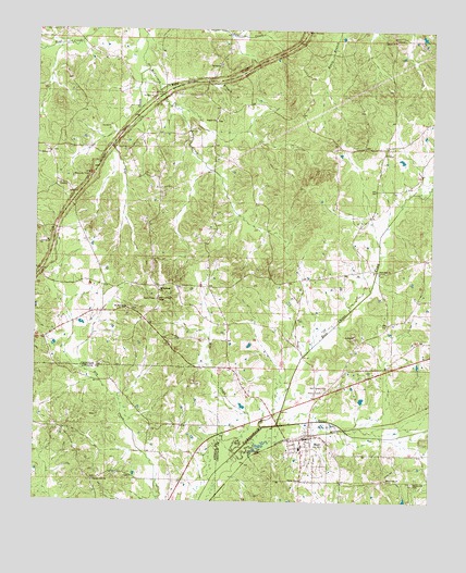
Weir, MS USGS Topographic Map
Click on map above to begin viewing in our Map Viewer.

This topographic map contains these locations and features:
Feature Name Type Latitude Longitude GNIS ID View Map
Besa Chitto CreekStreamN33.27040°W89.29840°692544View Map
Bethlehem CemeteryCemeteryN33.34290°W89.37034°707491View Map
Bethlehem ChurchChurchN33.34235°W89.37090°667007View Map
Bywy OverlookLocaleN33.37485°W89.28951°667898View Map
Centerville School (historical)SchoolN33.30068°W89.34868°685841View Map
Dry CreekStreamN33.36485°W89.34007°669421View Map
Dry Creek School (historical)SchoolN33.34318°W89.34563°685847View Map
Fairview School (historical)SchoolN33.29596°W89.26479°685851View Map
Fancher Hill Baptist ChurchChurchN33.25540°W89.35618°669907View Map
Fancher Hill School (historical)SchoolN33.25540°W89.35618°710880View Map
Grahamsville (historical)LocaleN33.30985°W89.30007°685852View Map
Grange Hall School (historical)SchoolN33.30874°W89.28618°685853View Map
Jenkinsville School (historical)SchoolN33.36957°W89.27562°685857View Map
Kenago (historical)LocaleN33.34790°W89.32313°685858View Map
Killough School (historical)SchoolN33.31540°W89.30007°685859View Map
King BranchStreamN33.36040°W89.33674°672143View Map
Malloxville School (historical)SchoolN33.33179°W89.26729°685892View Map
Mike CreekStreamN33.26290°W89.31118°673559View Map
Mill Springs CemeteryCemeteryN33.30651°W89.33618°707515View Map
Miller School (historical)SchoolN33.31874°W89.32174°685861View Map
Millsprings ChurchChurchN33.30596°W89.33563°673660View Map
Mount Moriah CemeteryCemeteryN33.30095°W89.34534°707517View Map
Mount Moriah ChurchChurchN33.30096°W89.34618°674071View Map
Myatt Creek School (historical)SchoolN33.29318°W89.32174°685862View Map
New Haven CemeteryCemeteryN33.37484°W89.36701°674640View Map
New Zion CemeteryCemeteryN33.34456°W89.28729°707521View Map
New Zion ChurchChurchN33.31096°W89.26590°674888View Map
New Zion Church (historical)ChurchN33.34401°W89.28812°685863View Map
Penderville CemeteryCemeteryN33.25540°W89.25506°675586View Map
Penderville ChurchChurchN33.25624°W89.26312°675587View Map
Pine Grove School (historical)SchoolN33.35596°W89.30285°685869View Map
Pisgah CemeteryCemeteryN33.35151°W89.31840°707523View Map
Pisgah ChurchChurchN33.35124°W89.31896°675940View Map
Pleasant Valley Church (historical)ChurchN33.36929°W89.32174°685871View Map
Salem CemeteryCemeteryN33.37151°W89.26145°707525View Map
Salem ChurchChurchN33.37235°W89.26201°677284View Map
Simpson School (historical)SchoolN33.36735°W89.35340°685880View Map
Simpson Volunteer Fire DepartmentBuildingN33.37077°W89.35924°2665872View Map
Supervisor District 1CivilN33.36417°W89.26599°711803View Map
Town of WeirCivilN33.26345°W89.29057°2406852View Map
WeirPopulated PlaceN33.26679°W89.29090°679425View Map
Weir Attendance CenterSchoolN33.26457°W89.29090°707530View Map
Weir CemeteryCemeteryN33.26345°W89.29479°707531View Map
Weir Chapel CemeteryCemeteryN33.28012°W89.28284°679426View Map
Weir Elementary SchoolSchoolN33.26401°W89.29090°707532View Map
Weir Lagoon DamDamN33.27013°W89.30007°681964View Map
Weir Lookout TowerTowerN33.30346°W89.33646°711332View Map
Weir Police DepartmentBuildingN33.26823°W89.28769°2754234View Map
Weir Post OfficePost OfficeN33.26628°W89.28882°2768772View Map
Weir Volunteer Fire DepartmentBuildingN33.26696°W89.28745°2665789View Map
Wilcox (historical)LocaleN33.30013°W89.35368°692356View Map
Winters BranchStreamN33.37096°W89.36785°685889View Map

Note: Coordinates in the location and feature list above are referenced to NAD83 datum.


Copyright (C) 2008-2026 Ryan Niemi / Sunset Dynamics ... All Rights Reserved
