TopoQuest Logo
Do you find TopoQuest useful?
Help keep TopoQuest running and adding new maps/features by donating!
Home View Maps Find Maps Find Places Resources & Links


Reeds, Missouri Topographic Map

USGS Map Title: Reeds, MO
USGS Map MRC: 37094A2
DRG (GeoTIFF) Download: o37094a2.tif


Neighboring USGS Topographic Map Quads:


  Carthage, MO  
37094B3
 

  Avilla, MO  
37094B2
 

  La Russell, MO  
37094B1
 

  Fidelity, MO  
37094A3
 

  Reeds, MO  
37094A2
 

  Sarcoxie, MO  
37094A1
 

  Granby, MO  
36094H3
 

  Newtonia, MO  
36094H2
 

  Pierce City, MO  
36094H1


Map MRC Location:

N38°
W95°
N38°
W94°
H8 H7 H6 H5 H4 H3 H2 H1
G8 G7 G6 G5 G4 G3 G2 G1
F8 F7 F6 F5 F4 F3 F2 F1
E8 E7 E6 E5 E4 E3 E2 E1
D8 D7 D6 D5 D4 D3 D2 D1
C8 C7 C6 C5 C4 C3 C2 C1
B8 B7 B6 B5 B4 B3 B2 B1
A8 A7 A6 A5 A4 A3 A2 A1
N37°
W95°
N37°
W94°

Reeds, MO USGS 1:24K Topographic Map Preview:
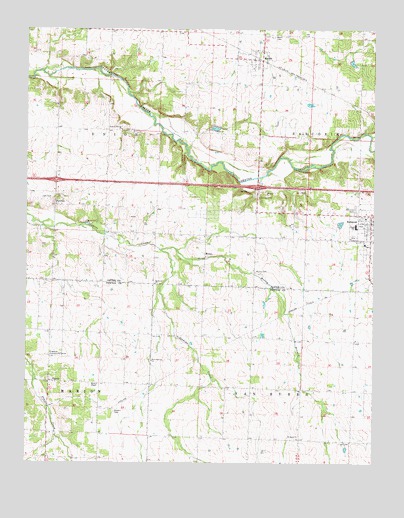
Reeds, MO USGS Topographic Map
Click on map above to begin viewing in our Map Viewer.

This topographic map contains these locations and features:
Feature Name Type Latitude Longitude GNIS ID View Map
Banner School (historical)SchoolN37.06867°W94.15355°746128View Map
Dudman Springs ChurchChurchN37.09617°W94.21633°717153View Map
Fair BanksLocaleN37.00340°W94.15105°740540View Map
Fairview School (historical)SchoolN37.02867°W94.20466°746320View Map
Freedom Community CenterLocaleN37.03090°W94.24133°729890View Map
Gem CemeteryCemeteryN37.07644°W94.24105°718378View Map
Gem School (historical)SchoolN37.09534°W94.23966°746125View Map
Jasper School (historical)SchoolN37.12469°W94.20225°746101View Map
MotleyPopulated PlaceN37.06034°W94.18605°741083View Map
Motley BranchStreamN37.06145°W94.20216°722683View Map
Motley CemeteryCemeteryN37.05561°W94.16798°722684View Map
New Fairview ChurchChurchN37.02951°W94.20522°723193View Map
ParshleyPopulated PlaceN37.07423°W94.23966°724054View Map
PepsinPopulated PlaceN37.02367°W94.24188°724223View Map
Powers CemeteryCemeteryN37.01478°W94.21854°724818View Map
Prairie View School (historical)SchoolN37.02923°W94.16855°746321View Map
Redwood ChurchChurchN37.05201°W94.20411°725179View Map
Redwood School (historical)SchoolN37.06589°W94.20383°746126View Map
ReedsPopulated PlaceN37.11617°W94.16577°725195View Map
Reeds CemeteryCemeteryN37.12311°W94.16160°725196View Map
Reeds Post OfficePost OfficeN37.11593°W94.16612°2782983View Map
Saint Agnes ChurchChurchN37.00728°W94.15244°725715View Map
Sarcoxie CemeteryCemeteryN37.07311°W94.13132°726062View Map
Sarcoxie High SchoolSchoolN37.06860°W94.13178°745711View Map
Town of ReedsCivilN37.11647°W94.16824°2396872View Map
Township of UnionCivilN37.10320°W94.23444°766821View Map
Union School (historical)SchoolN37.09478°W94.19050°746127View Map
Wesley ChapelChurchN37.02256°W94.22411°728514View Map

Note: Coordinates in the location and feature list above are referenced to NAD83 datum.


Copyright (C) 2008-2026 Ryan Niemi / Sunset Dynamics ... All Rights Reserved
