TopoQuest Logo
Do you find TopoQuest useful?
Help keep TopoQuest running and adding new maps/features by donating!
Home View Maps Find Maps Find Places Resources & Links


Nickerson NE, Nebraska Topographic Map

USGS Map Title: Nickerson NE, NE
USGS Map MRC: 41096F3
DRG (GeoTIFF) Download: o41096f3.tif


Neighboring USGS Topographic Map Quads:


  Oakland, NE  
41096G4
 

  Craig, NE  
41096G3
 

  Tekamah, NE  
41096G2
 

  Nickerson NW, NE  
41096F4
 

  Nickerson NE, NE  
41096F3
 

  Herman, NE  
41096F2
 

  Nickerson, NE  
41096E4
 

  Orum, NE  
41096E3
 

  Blair, NE  
41096E2


Map MRC Location:

N42°
W97°
N42°
W96°
H8 H7 H6 H5 H4 H3 H2 H1
G8 G7 G6 G5 G4 G3 G2 G1
F8 F7 F6 F5 F4 F3 F2 F1
E8 E7 E6 E5 E4 E3 E2 E1
D8 D7 D6 D5 D4 D3 D2 D1
C8 C7 C6 C5 C4 C3 C2 C1
B8 B7 B6 B5 B4 B3 B2 B1
A8 A7 A6 A5 A4 A3 A2 A1
N41°
W97°
N41°
W96°

Nickerson NE, NE USGS 1:24K Topographic Map Preview:
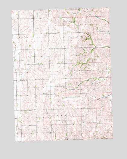
Nickerson NE, NE USGS Topographic Map
Click on map above to begin viewing in our Map Viewer.

This topographic map contains these locations and features:
Feature Name Type Latitude Longitude GNIS ID View Map
Alder Grove ChurchChurchN41.69388°W96.36669°826938View Map
Alder Grove Post Office (historical)Post OfficeN41.69444°W96.36697°1893050View Map
Behrendt DamDamN41.63979°W96.28767°1767069View Map
Behrendt ReservoirReservoirN41.63999°W96.28696°1767070View Map
Cameron DamDamN41.62546°W96.28910°1769866View Map
Cameron ReservoirLakeN41.62801°W96.28949°1769867View Map
New England CemeteryCemeteryN41.66915°W96.33307°831596View Map
Skinner DamDamN41.68490°W96.25252°1769786View Map
Skinner ReservoirReservoirN41.68425°W96.25226°1769787View Map
Township 5CivilN41.63240°W96.25740°838289View Map

Note: Coordinates in the location and feature list above are referenced to NAD83 datum.


Copyright (C) 2008-2026 Ryan Niemi / Sunset Dynamics ... All Rights Reserved
