TopoQuest Logo
Do you find TopoQuest useful?
Help keep TopoQuest running and adding new maps/features by donating!
Home View Maps Find Maps Find Places Resources & Links


State Line Peak, Nevada Topographic Map

USGS Map Title: State Line Peak, NV
USGS Map MRC: 40119A8
DRG (GeoTIFF) Download: o40119a8.tif


Neighboring USGS Topographic Map Quads:


  Calneva Lake, CA  
40120B1
 

  Flanigan, NV  
40119B8
 

  Astor Pass, NV  
40119B7
 

  Doyle, CA  
40120A1
 

  State Line Peak, NV  
40119A8
 

  Spanish Flat, NV  
40119A7
 

  Constantia, CA  
39120H1


Map MRC Location:

N41°
W120°
N41°
W119°
H8 H7 H6 H5 H4 H3 H2 H1
G8 G7 G6 G5 G4 G3 G2 G1
F8 F7 F6 F5 F4 F3 F2 F1
E8 E7 E6 E5 E4 E3 E2 E1
D8 D7 D6 D5 D4 D3 D2 D1
C8 C7 C6 C5 C4 C3 C2 C1
B8 B7 B6 B5 B4 B3 B2 B1
A8 A7 A6 A5 A4 A3 A2 A1
N40°
W120°
N40°
W119°

State Line Peak, NV USGS 1:24K Topographic Map Preview:
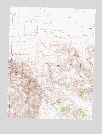
State Line Peak, NV USGS Topographic Map
Click on map above to begin viewing in our Map Viewer.

This topographic map contains these locations and features:
Feature Name Type Latitude Longitude GNIS ID View Map
Anderson CanyonValleyN40.09657°W119.90326°838448View Map
Antelope MineMineN40.04102°W119.96520°855558View Map
Bull SpringSpringN40.02491°W119.92603°855793View Map
Coyote SpringSpringN40.03741°W119.94826°855794View Map
Desert WellWellN40.09935°W119.92992°840016View Map
Fish SpringsSpringN40.10241°W119.88507°847171View Map
Fish Springs CreekStreamN40.10657°W119.94048°840482View Map
Fish Springs RanchLocaleN40.10268°W119.88464°840483View Map
Fort Sage MountainsSummitN40.02990°W119.98131°857992View Map
Gould SpringSpringN40.05762°W119.97173°846171View Map
Lime Rock WellWellN40.09463°W119.91270°841635View Map
Newcome LakeFlatN40.02074°W119.89687°855792View Map
Rock Springs CanyonValleyN40.09741°W119.89742°843310View Map
Sheep SpringsSpringN40.06078°W119.93013°847204View Map
State Line PeakSummitN40.02990°W119.97965°843983View Map
SugarloafSummitN40.03907°W119.89020°844062View Map
Two Mile SpringSpringN40.06935°W119.97826°846170View Map
Vinegar PeakSummitN40.03796°W119.87964°844590View Map
Vinegar SpringSpringN40.04997°W119.87814°856730View Map
Willow SpringsSpringN40.07276°W119.90681°844960View Map

Note: Coordinates in the location and feature list above are referenced to NAD83 datum.


Copyright (C) 2008-2026 Ryan Niemi / Sunset Dynamics ... All Rights Reserved
