TopoQuest Logo
Do you find TopoQuest useful?
Help keep TopoQuest running and adding new maps/features by donating!
Home View Maps Find Maps Find Places Resources & Links


Bronco NE, New Mexico Topographic Map

USGS Map Title: Bronco NE, NM
USGS Map MRC: 33103D1
DRG (GeoTIFF) Download: o33103d1.tif


Neighboring USGS Topographic Map Quads:


  Bledsoe SW, NM  
33103E2
 

  Bledsoe, TX  
33103E1
 

  Morton SW, TX  
33102E8
 

  Walking Cane Ranch, NM  
33103D2
 

  Bronco NE, NM  
33103D1
 

  Two B Ranch NW, TX  
33102D8
 

  Gladiola, NM  
33103C2
 

  Bronco, TX  
33103C1
 

  Two B Ranch SW, TX  
33102C8


Map MRC Location:

N34°
W104°
N34°
W103°
H8 H7 H6 H5 H4 H3 H2 H1
G8 G7 G6 G5 G4 G3 G2 G1
F8 F7 F6 F5 F4 F3 F2 F1
E8 E7 E6 E5 E4 E3 E2 E1
D8 D7 D6 D5 D4 D3 D2 D1
C8 C7 C6 C5 C4 C3 C2 C1
B8 B7 B6 B5 B4 B3 B2 B1
A8 A7 A6 A5 A4 A3 A2 A1
N33°
W104°
N33°
W103°

Bronco NE, NM USGS 1:24K Topographic Map Preview:
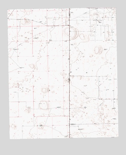
Bronco NE, NM USGS Topographic Map
Click on map above to begin viewing in our Map Viewer.

This topographic map contains these locations and features:
Feature Name Type Latitude Longitude GNIS ID View Map
05016 Water WellWellN33.38205°W103.09050°927737View Map
12562 Water WellWellN33.49232°W103.12383°927750View Map
12566 Water WellWellN33.48816°W103.05744°927749View Map
12617 Water WellWellN33.45788°W103.11745°927748View Map
12622 Water WellWellN33.46594°W103.05717°924377View Map
12623 Water WellWellN33.46621°W103.07717°924378View Map
12624 Water WellWellN33.43649°W103.08106°924387View Map
12625 Water WellWellN33.43538°W103.06550°924386View Map
12626 Water WellWellN33.42094°W103.06133°927742View Map
12627 Water WellWellN33.41427°W103.07939°927740View Map
12628 Water WellWellN33.41649°W103.06383°927741View Map
12629 Water WellWellN33.40066°W103.06911°927738View Map
12635 Water WellWellN33.48094°W103.11106°924381View Map
12875 Water WellWellN33.47871°W103.11078°924380View Map
12878 Water WellWellN33.46871°W103.09439°924379View Map
12879 Water WellWellN33.42149°W103.07939°924383View Map
13179 Water WellWellN33.44316°W103.11189°927743View Map
13180 Water WellWellN33.45705°W103.09300°927747View Map
13181 Water WellWellN33.45371°W103.07522°927746View Map
13182 Water WellWellN33.44427°W103.06605°927744View Map
13183 Water WellWellN33.44983°W103.08828°927745View Map
13184 Water WellWellN33.43844°W103.06550°924388View Map
13185 Water WellWellN33.43427°W103.06050°924385View Map
13186 Water WellWellN33.43177°W103.05578°924384View Map
13187 Water WellWellN33.41010°W103.07967°927739View Map
13378 Water WellWellN33.48788°W103.08828°924382View Map
Davis WindmillLocaleN33.41871°W103.07939°888225View Map
East WindmillLocaleN33.48649°W103.02050°1356762View Map
Electric WindmillLocaleN33.42066°W103.06383°888835View Map
Gilliam RanchLocaleN33.43844°W103.05467°1358027View Map
Goat WindmillLocaleN33.37705°W103.05911°889461View Map
Grice WindmillLocaleN33.46955°W103.05717°889627View Map
Hoffmann Helicopters HeliportAirportN33.40399°W103.08800°937032View Map
Middle WindmillLocaleN33.46982°W103.07744°892016View Map
North Beall WindmillLocaleN33.38344°W103.04522°1363991View Map
North Goat WindmillLocaleN33.40483°W103.06939°892603View Map
North WindmillLocaleN33.49538°W103.05244°1364197View Map
North WindmillLocaleN33.40316°W103.00466°1364195View Map
Pardnership WindmillLocaleN33.45955°W103.01550°1364808View Map
Prairie Chicken WindmillLocaleN33.46149°W103.11800°893454View Map
Sand WindmillLocaleN33.44371°W103.11189°894540View Map
South House WindmillLocaleN33.47205°W103.09439°895071View Map
South Lease WindmillLocaleN33.44316°W103.03744°1368711View Map
South Pasture WindmillLocaleN33.44066°W103.08106°895099View Map
South WindmillLocaleN33.39288°W103.00577°1368823View Map
South WindmillLocaleN33.46538°W103.05328°1368824View Map
Standefer RanchLocaleN33.48788°W103.08856°895296View Map
Walker Oil FieldOilfieldN33.43010°W103.01605°1370760View Map
Walker WindmillLocaleN33.40427°W103.03911°1370770View Map
West Goat WindmillLocaleN33.38705°W103.09050°896373View Map
West WindmillLocaleN33.43955°W103.06578°896454View Map

Note: Coordinates in the location and feature list above are referenced to NAD83 datum.


Copyright (C) 2008-2026 Ryan Niemi / Sunset Dynamics ... All Rights Reserved
