TopoQuest Logo
Do you find TopoQuest useful?
Help keep TopoQuest running and adding new maps/features by donating!
Home View Maps Find Maps Find Places Resources & Links


Nassau, New York Topographic Map

USGS Map Title: Nassau, NY
USGS Map MRC: 42073E5
DRG (GeoTIFF) Download: o42073e5.tif


Neighboring USGS Topographic Map Quads:


  Troy South, NY  
42073F6
 

  Averill Park, NY  
42073F5


  East Greenbush, NY  
42073E6
 

  Nassau, NY  
42073E5


  Kinderhook, NY  
42073D6
 

  East Chatham, NY  
42073D5


Map MRC Location:

N43°
W74°
N43°
W73°
H8 H7 H6 H5 H4 H3 H2 H1
G8 G7 G6 G5 G4 G3 G2 G1
F8 F7 F6 F5 F4 F3 F2 F1
E8 E7 E6 E5 E4 E3 E2 E1
D8 D7 D6 D5 D4 D3 D2 D1
C8 C7 C6 C5 C4 C3 C2 C1
B8 B7 B6 B5 B4 B3 B2 B1
A8 A7 A6 A5 A4 A3 A2 A1
N42°
W74°
N42°
W73°

Nassau, NY USGS 1:24K Topographic Map Preview:
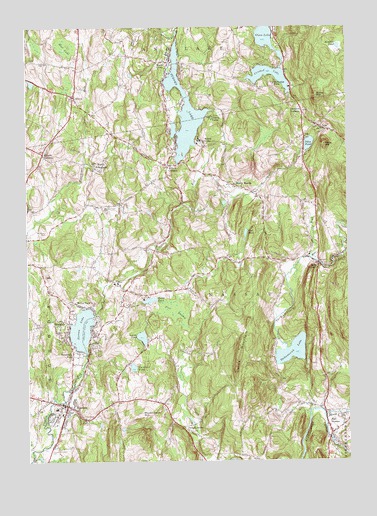
Nassau, NY USGS Topographic Map
Click on map above to begin viewing in our Map Viewer.

This topographic map contains these locations and features:
Feature Name Type Latitude Longitude GNIS ID View Map
Alder BrookStreamN42.55897°W73.51456°942265View Map
Alexander Farm AirportAirportN42.57993°W73.61612°977999View Map
Bailey MountainSummitN42.60508°W73.51150°942792View Map
Black BrookStreamN42.51286°W73.50928°944084View Map
BraesidePopulated PlaceN42.53703°W73.60873°944598View Map
Burden LakeLakeN42.60048°W73.56310°945198View Map
Cedar Acres Mobile Home ParkPopulated PlaceN42.55583°W73.59417°2513209View Map
Clarks Chapel CemeteryCemeteryN42.57324°W73.59523°946782View Map
Cleveland PondLakeN42.52696°W73.58384°946858View Map
Crooked LakeLakeN42.61250°W73.53051°947781View Map
Curtis MountainSummitN42.52925°W73.54400°947957View Map
Denault CornersPopulated PlaceN42.60064°W73.51706°948296View Map
Donald P Sutherland SchoolSchoolN42.51527°W73.61408°2669010View Map
East NassauPopulated PlaceN42.50786°W73.50650°949185View Map
East Nassau Baptist ChurchChurchN42.51146°W73.50816°2615858View Map
Glass LakeLakeN42.62313°W73.53100°951159View Map
Grace United Methodist ChurchChurchN42.51417°W73.60639°2513536View Map
Hoag CornersPopulated PlaceN42.55647°W73.51122°952906View Map
Hoags Corner Volunteer AmbulanceBuildingN42.55970°W73.51511°2720226View Map
Hoags Corners Volunteer Fire Company Station 1BuildingN42.56265°W73.51189°2735183View Map
Hoags Corners Volunteer Fire Company Station 2BuildingN42.55608°W73.51026°2735184View Map
Jacks CornersLocaleN42.50953°W73.56428°953873View Map
Larkin CemeteryCemeteryN42.56126°W73.50228°955059View Map
Lyons PondLakeN42.53567°W73.58014°956205View Map
Maple GrovePopulated PlaceN42.61480°W73.56900°956393View Map
Mashodack HillSummitN42.51341°W73.58123°956635View Map
Methodist FarmLocaleN42.60925°W73.52789°957037View Map
Millers CornersPopulated PlaceN42.58536°W73.56956°957330View Map
Morey ParkPopulated PlaceN42.54425°W73.59984°957657View Map
Mud LakeLakeN42.61952°W73.60928°958025View Map
Mud PondLakeN42.56568°W73.53956°958061View Map
NassauPopulated PlaceN42.51591°W73.61012°958278View Map
Nassau AmbulanceBuildingN42.51445°W73.61960°2720175View Map
Nassau and Schodack CemeteryCemeteryN42.50304°W73.61803°958287View Map
Nassau Free LibraryBuildingN42.51526°W73.60811°2617356View Map
Nassau Hose Company 1BuildingN42.51406°W73.61098°2735185View Map
Nassau LakeLakeN42.53802°W73.60387°958283View Map
Nassau Post OfficePost OfficeN42.51378°W73.61239°2618031View Map
Nassau Reformed ChurchChurchN42.51472°W73.60583°2513537View Map
Nassau Town HallBuildingN42.51558°W73.60775°2617649View Map
New Hope for Life MinistriesChurchN42.51402°W73.61166°2616783View Map
North NassauPopulated PlaceN42.57925°W73.54317°972870View Map
North SchodackPopulated PlaceN42.58452°W73.59817°958907View Map
Pikes HillSummitN42.59119°W73.50872°960391View Map
Pikes PondLakeN42.59132°W73.51469°960393View Map
Pine SwampSwampN42.54369°W73.56761°960556View Map
Rainbow Mobile Home ParkPopulated PlaceN42.53333°W73.60750°2513221View Map
Rendert PondLakeN42.61945°W73.50320°962381View Map
Rosecrans ParkPopulated PlaceN42.53036°W73.60706°962916View Map
Saint Mary's ChurchChurchN42.51528°W73.60694°2513538View Map
Saint Stephen's Lutheran ChurchChurchN42.55667°W73.61972°2513598View Map
Shivers CornersLocaleN42.58814°W73.61845°965139View Map
SlitersPopulated PlaceN42.60480°W73.60623°965428View Map
Smith PondLakeN42.54634°W73.57703°965507View Map
Tackawasick CreekStreamN42.51425°W73.51539°966986View Map
Tackawasick LakeLakeN42.53140°W73.52194°979679View Map
Totem LodgeLocaleN42.59202°W73.55511°967683View Map
Town of NassauCivilN42.54323°W73.54673°979250View Map
Village of East NassauCivilN42.53312°W73.50853°2391652View Map
Village of NassauCivilN42.51396°W73.61075°2391005View Map
Woodlawn CemeteryCemeteryN42.56510°W73.61984°971670View Map

Note: Coordinates in the location and feature list above are referenced to NAD83 datum.


Copyright (C) 2008-2026 Ryan Niemi / Sunset Dynamics ... All Rights Reserved
