TopoQuest Logo
Do you find TopoQuest useful?
Help keep TopoQuest running and adding new maps/features by donating!
Home View Maps Find Maps Find Places Resources & Links


Gardar, North Dakota Topographic Map

USGS Map Title: Gardar, ND
USGS Map MRC: 48097E7
DRG (GeoTIFF) Download: o48097e7.tif


Neighboring USGS Topographic Map Quads:


  Concrete, ND  
48097F8
 

  Mountain, ND  
48097F7
 

  Hensel, ND  
48097F6
 

  Union, ND  
48097E8
 

  Gardar, ND  
48097E7
 

  Crystal, ND  
48097E6
 

  Edinburg NW, ND  
48097D8
 

  Edinburg, ND  
48097D7
 

  Park River, ND  
48097D6


Map MRC Location:

N49°
W98°
N49°
W97°
H8 H7 H6 H5 H4 H3 H2 H1
G8 G7 G6 G5 G4 G3 G2 G1
F8 F7 F6 F5 F4 F3 F2 F1
E8 E7 E6 E5 E4 E3 E2 E1
D8 D7 D6 D5 D4 D3 D2 D1
C8 C7 C6 C5 C4 C3 C2 C1
B8 B7 B6 B5 B4 B3 B2 B1
A8 A7 A6 A5 A4 A3 A2 A1
N48°
W98°
N48°
W97°

Gardar, ND USGS 1:24K Topographic Map Preview:
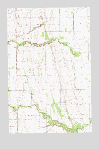
Gardar, ND USGS Topographic Map
Click on map above to begin viewing in our Map Viewer.

This topographic map contains these locations and features:
Feature Name Type Latitude Longitude GNIS ID View Map
Dundee (historical)LocaleN48.50583°W97.76704°1034381View Map
GardarPopulated PlaceN48.58916°W97.87398°1029078View Map
Hvideso ChurchChurchN48.52833°W97.76870°1029584View Map
Lampton (historical)LocaleN48.52749°W97.80454°1034382View Map
Lampton CemeteryCemeteryN48.50754°W97.81805°1029822View Map
Pleasant Grove FarmLocaleN48.54360°W97.82398°1034522View Map
Stokesville CemeteryCemeteryN48.60162°W97.79595°1032328View Map
Township of GardarCivilN48.58657°W97.86186°1036721View Map
Township of Thingvalla (historical)CivilN48.62305°W97.85121°1036720View Map

Note: Coordinates in the location and feature list above are referenced to NAD83 datum.


Copyright (C) 2008-2026 Ryan Niemi / Sunset Dynamics ... All Rights Reserved
