TopoQuest Logo
Do you find TopoQuest useful?
Help keep TopoQuest running and adding new maps/features by donating!
Home View Maps Find Maps Find Places Resources & Links


Deersville, Ohio Topographic Map

USGS Map Title: Deersville, OH
USGS Map MRC: 40081C2
DRG (GeoTIFF) Download: o40081c2.tif


Neighboring USGS Topographic Map Quads:


  Uhrichsville, OH  
40081D3
 

  Bowerston, OH  
40081D2
 

  Scio, OH  
40081D1
 

  Tippecanoe, OH  
40081C3
 

  Deersville, OH  
40081C2
 

  Jewett, OH  
40081C1
 

  Freeport, OH  
40081B3
 

  Piedmont, OH  
40081B2
 

  Flushing, OH  
40081B1


Map MRC Location:

N41°
W82°
N41°
W81°
H8 H7 H6 H5 H4 H3 H2 H1
G8 G7 G6 G5 G4 G3 G2 G1
F8 F7 F6 F5 F4 F3 F2 F1
E8 E7 E6 E5 E4 E3 E2 E1
D8 D7 D6 D5 D4 D3 D2 D1
C8 C7 C6 C5 C4 C3 C2 C1
B8 B7 B6 B5 B4 B3 B2 B1
A8 A7 A6 A5 A4 A3 A2 A1
N40°
W82°
N40°
W81°

Deersville, OH USGS 1:24K Topographic Map Preview:
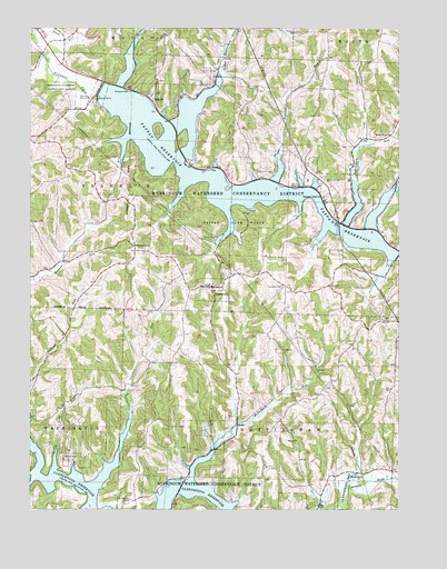
Deersville, OH USGS Topographic Map
Click on map above to begin viewing in our Map Viewer.

This topographic map contains these locations and features:
Feature Name Type Latitude Longitude GNIS ID View Map
Beall BayBayN40.32896°W81.15844°1960605View Map
Beaverdam RunStreamN40.33451°W81.13788°1037773View Map
Beaverdam Run BayBayN40.32979°W81.13871°1960606View Map
Bontrager BayBayN40.33312°W81.19844°1960607View Map
Brownsville ChurchChurchN40.31868°W81.21288°1038393View Map
Brushy Fork BayBayN40.25062°W81.18316°1960608View Map
Clear ForkStreamN40.33340°W81.12593°1039159View Map
Clear Fork BayBayN40.32868°W81.13121°1960609View Map
Clendening (historical)Populated PlaceN40.25257°W81.21399°1062448View Map
Clendening Post Office (historical)Post OfficeN40.25285°W81.21372°1993508View Map
Colman RunStreamN40.27534°W81.21511°1039267View Map
Colman Run BayBayN40.26534°W81.21955°1960610View Map
DeersvillePopulated PlaceN40.30757°W81.18649°1039654View Map
Deersville BayBayN40.26257°W81.19288°1960611View Map
Deersville CemeteryCemeteryN40.30839°W81.16288°1039655View Map
Deersville Community Volunteer Fire Department and Emergency Medical ServicesBuildingN40.30797°W81.18741°2550569View Map
Deersville Methodist Episcopal CemeteryCemeteryN40.30867°W81.19177°1699590View Map
Deersville Post OfficePost OfficeN40.30701°W81.18594°1994139View Map
East Shore Cottage AreaPopulated PlaceN40.34729°W81.19316°1960612View Map
Eddington RunStreamN40.34118°W81.16399°1061047View Map
Edgington Run BayBayN40.33840°W81.16510°1960613View Map
Forty Steuben CampLocaleN40.25257°W81.21511°1048327View Map
Hattonia (historical)Populated PlaceN40.28618°W81.12621°1052093View Map
Hattonia Post OfficePost OfficeN40.28618°W81.12621°1994147View Map
Laceyville (historical)Populated PlaceN40.32229°W81.13177°1061329View Map
Laceyville Post Office (historical)Post OfficeN40.32229°W81.13177°1993540View Map
Leiper RunStreamN40.34479°W81.13705°1065798View Map
Little Colman BayBayN40.26257°W81.24150°1960616View Map
Long PointCapeN40.25923°W81.24483°1960618View Map
Long RunStreamN40.26590°W81.24122°1042755View Map
Lower Beaverdam BayBayN40.35423°W81.19510°1960619View Map
Lower Beaverdam RunStreamN40.36312°W81.18399°1042804View Map
Mathews BayBayN40.32173°W81.15066°1960620View Map
McFadden RunStreamN40.26534°W81.18649°1043102View Map
Minksville CemeteryCemeteryN40.26034°W81.13704°1699599View Map
Minksville ChurchChurchN40.25840°W81.13649°1043403View Map
Mount Hope ChurchChurchN40.34757°W81.12649°1043573View Map
Pleasant Valley (historical)Populated PlaceN40.33062°W81.15066°1080517View Map
Pleasant Valley CemeteryCemeteryN40.33089°W81.14982°1699604View Map
Pleasant Valley ChurchChurchN40.33118°W81.14899°1044602View Map
Plum RunStreamN40.37257°W81.24927°1066902View Map
Smithdale (historical)Populated PlaceN40.33396°W81.15705°1068270View Map
Smithdale Post Office (historical)Post OfficeN40.34868°W81.15677°1993566View Map
TappanPopulated PlaceN40.35729°W81.20761°1063051View Map
Tappan CemeteryCemeteryN40.35811°W81.20760°1699610View Map
Tappan DamDamN40.35840°W81.22622°1077634View Map
Tappan LakeReservoirN40.33242°W81.17052°1046947View Map
Tappan Lake MarinaLocaleN40.33951°W81.19705°1960624View Map
Tappan Lake ParkParkN40.32368°W81.17844°1046946View Map
Tappan Lake Volunteer Fire DepartmentBuildingN40.34048°W81.19648°2550273View Map
Tappan Post Office (historical)Post OfficeN40.35701°W81.20816°1994131View Map
Township of FranklinCivilN40.33516°W81.22757°1086274View Map
Township of NottinghamCivilN40.26459°W81.16373°1086281View Map
Township of StockCivilN40.33258°W81.12781°1086284View Map
Van Horn PondReservoirN40.28507°W81.22150°1079446View Map
Van Horn Pond DamDamN40.28507°W81.22150°1079445View Map
Village of DeersvilleCivilN40.30826°W81.18802°2398708View Map
West Shore Cottage AreaPopulated PlaceN40.35562°W81.20066°1960625View Map
Willis RunStreamN40.37257°W81.21233°1047945View Map
Willis Run BayBayN40.36562°W81.21622°1960626View Map
Wye BayBayN40.34590°W81.21872°1960627View Map
YMCA CampLocaleN40.26284°W81.23705°1048170View Map

Note: Coordinates in the location and feature list above are referenced to NAD83 datum.


Copyright (C) 2008-2026 Ryan Niemi / Sunset Dynamics ... All Rights Reserved
