TopoQuest Logo
Do you find TopoQuest useful?
Help keep TopoQuest running and adding new maps/features by donating!
Home View Maps Find Maps Find Places Resources & Links


Litchfield, Pennsylvania Topographic Map

USGS Map Title: Litchfield, PA
USGS Map MRC: 41076H4
DRG (GeoTIFF) Download: o41076h4.tif


Neighboring USGS Topographic Map Quads:


  Waverly, NY  
42076A5
 

  Barton, NY  
42076A4
 

  Owego, NY  
42076A3
 

  Sayre, PA  
41076H5
 

  Litchfield, PA  
41076H4
 

  Windham, PA  
41076H3
 

  Ulster, PA  
41076G5
 

  Towanda, PA  
41076G4
 

  Rome, PA  
41076G3


Map MRC Location:

N42°
W77°
N42°
W76°
H8 H7 H6 H5 H4 H3 H2 H1
G8 G7 G6 G5 G4 G3 G2 G1
F8 F7 F6 F5 F4 F3 F2 F1
E8 E7 E6 E5 E4 E3 E2 E1
D8 D7 D6 D5 D4 D3 D2 D1
C8 C7 C6 C5 C4 C3 C2 C1
B8 B7 B6 B5 B4 B3 B2 B1
A8 A7 A6 A5 A4 A3 A2 A1
N41°
W77°
N41°
W76°

Litchfield, PA USGS 1:24K Topographic Map Preview:
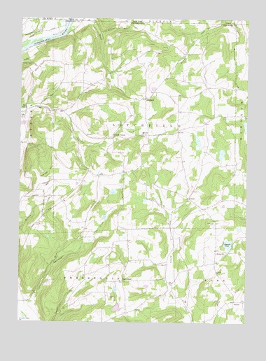
Litchfield, PA USGS Topographic Map
Click on map above to begin viewing in our Map Viewer.

This topographic map contains these locations and features:
Feature Name Type Latitude Longitude GNIS ID View Map
Bayards PondReservoirN41.90729°W76.38451°1168826View Map
Browns RunStreamN41.99369°W76.45550°1170400View Map
BumpvillePopulated PlaceN41.90424°W76.38577°1203186View Map
Bumpville CemeteryCemeteryN41.91578°W76.39198°1170666View Map
Campbell School (historical)SchoolN41.93674°W76.46300°1197334View Map
Chapman School (historical)SchoolN41.92730°W76.48550°1197335View Map
Cottonhollow School (historical)SchoolN41.95257°W76.44883°1197331View Map
Cottons CornersLocaleN41.95119°W76.44772°1172492View Map
Lars/Private AirportAirportN41.94940°W76.48071°1194315View Map
LitchfieldPopulated PlaceN41.96757°W76.43022°1204032View Map
Litchfield Township Volunteer Fire Company Station 26BuildingN41.98335°W76.43656°2653193View Map
Merrill Family CemeteryCemeteryN41.96976°W76.46497°2776461View Map
Merrill School (historical)SchoolN41.97369°W76.46550°1197333View Map
North GhentPopulated PlaceN41.89202°W76.44188°1204300View Map
Orange HillSummitN41.93924°W76.47994°1198294View Map
Orange Hill CemeteryCemeteryN41.91544°W76.49072°1183015View Map
Perry SchoolSchoolN41.93563°W76.44272°1197332View Map
Randolph School (historical)SchoolN41.91035°W76.41466°1197330View Map
Rossi Family CemeteryCemeteryN41.99836°W76.42543°2776486View Map
Sayre ReservoirReservoirN41.98213°W76.49591°1187053View Map
State Line CemeteryCemeteryN41.99890°W76.46702°2776502View Map
Tioga ValleyPopulated PlaceN41.96174°W76.47800°1202034View Map
TownerPopulated PlaceN41.88396°W76.38049°1204823View Map
Towner Hill CemeteryCemeteryN41.88417°W76.37564°2776507View Map
Township of LitchfieldCivilN41.95585°W76.43064°1215983View Map
Trinket CemeteryCemeteryN41.89218°W76.44365°2776508View Map
Trinket Old CemeteryCemeteryN41.89211°W76.44217°2776509View Map
VawterPopulated PlaceN41.92619°W76.40633°1204868View Map
White School (historical)SchoolN41.95730°W76.39883°1197329View Map

Note: Coordinates in the location and feature list above are referenced to NAD83 datum.


Copyright (C) 2008-2026 Ryan Niemi / Sunset Dynamics ... All Rights Reserved
