TopoQuest Logo
Do you find TopoQuest useful?
Help keep TopoQuest running and adding new maps/features by donating!
Home View Maps Find Maps Find Places Resources & Links


Martha, Tennessee Topographic Map

USGS Map Title: Martha, TN
USGS Map MRC: 36086B4
DRG (GeoTIFF) Download: o36086b4.tif


Neighboring USGS Topographic Map Quads:


  Hendersonville, TN  
36086C5
 

  Laguardo, TN  
36086C4
 

  Hunters Point, TN  
36086C3
 

  Hermitage, TN  
36086B5
 

  Martha, TN  
36086B4
 

  Lebanon, TN  
36086B3
 

  La Vergne, TN  
36086A5
 

  Gladeville, TN  
36086A4
 

  Vine, TN  
36086A3


Map MRC Location:

N37°
W87°
N37°
W86°
H8 H7 H6 H5 H4 H3 H2 H1
G8 G7 G6 G5 G4 G3 G2 G1
F8 F7 F6 F5 F4 F3 F2 F1
E8 E7 E6 E5 E4 E3 E2 E1
D8 D7 D6 D5 D4 D3 D2 D1
C8 C7 C6 C5 C4 C3 C2 C1
B8 B7 B6 B5 B4 B3 B2 B1
A8 A7 A6 A5 A4 A3 A2 A1
N36°
W87°
N36°
W86°

Martha, TN USGS 1:24K Topographic Map Preview:
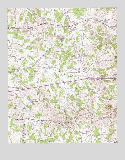
Martha, TN USGS Topographic Map
Click on map above to begin viewing in our Map Viewer.

This topographic map contains these locations and features:
Feature Name Type Latitude Longitude GNIS ID View Map
BeckwithPopulated PlaceN36.20672°W86.45888°1314644View Map
Beckwith SchoolSchoolN36.19755°W86.45249°1276747View Map
Belinda CityPopulated PlaceN36.16756°W86.48583°1647665View Map
Benjamin Franklin LakeReservoirN36.16517°W86.47471°1277005View Map
Big HillSummitN36.15867°W86.38388°1277307View Map
Breeden's OrchardLocaleN36.22528°W86.47028°2678186View Map
Cairo BendPopulated PlaceN36.23894°W86.40027°1305591View Map
Center ChapelChurchN36.14728°W86.49416°1305799View Map
Commissioner District 11CivilN36.16532°W86.48117°2464351View Map
Commissioner District 14CivilN36.14375°W86.40581°2464384View Map
Commissioner District 23CivilN36.21157°W86.37927°2464109View Map
Commissioner District 25CivilN36.20337°W86.45503°2464113View Map
Cooks ChurchChurchN36.23783°W86.45499°1306082View Map
Cooks SchoolSchoolN36.23866°W86.45805°1281137View Map
Coronia SchoolSchoolN36.14395°W86.46222°1281327View Map
Daniels Lake DamDamN36.12506°W86.37999°1302378View Map
Gaines CemeteryCemeteryN36.19116°W86.46721°1285068View Map
Gravel Hill Church (historical)ChurchN36.16617°W86.37999°1323178View Map
Horn Spring Number TwoSpringN36.23700°W86.37721°1652023View Map
Interchange 232CrossingN36.18506°W86.40694°1312852View Map
Lebanon Fire Department Station 3BuildingN36.23704°W86.39372°2654069View Map
LeevillePopulated PlaceN36.19089°W86.41749°1290986View Map
Leeville High School (historical)SchoolN36.18978°W86.42110°1323203View Map
Life ChurchChurchN36.23533°W86.42922°2611331View Map
Lindsayville (historical)Populated PlaceN36.13422°W86.41527°1312861View Map
Lohmans Store (historical)Populated PlaceN36.14450°W86.46749°1312864View Map
MarthaPopulated PlaceN36.22978°W86.42694°1292781View Map
Martha Baptist ChurchChurchN36.23450°W86.44249°1323215View Map
Martha BranchStreamN36.23644°W86.42277°1292782View Map
Martha-Laguardo Division (historical)CensusN36.24200°W86.42638°1649029View Map
Mays SchoolSchoolN36.24366°W86.46722°1293038View Map
Middle Fork Cedar CreekStreamN36.18672°W86.41222°1293667View Map
Mount Olivet ChurchChurchN36.19422°W86.42527°1294728View Map
Mount View School (historical)SchoolN36.15561°W86.37833°1323225View Map
Muncie (historical)Populated PlaceN36.23116°W86.38166°1312873View Map
Munsey-Maple Hill SchoolSchoolN36.23200°W86.38110°1295099View Map
North Fork Cedar CreekStreamN36.18894°W86.41416°1295868View Map
Old Union ChurchChurchN36.14617°W86.46110°1296388View Map
Posey HillSummitN36.14478°W86.43194°1298286View Map
Powell Church (historical)ChurchN36.23255°W86.40888°1323234View Map
Powell Grove CemeteryCemeteryN36.23338°W86.40832°1298414View Map
Prowell LakeReservoirN36.23742°W86.38827°1298616View Map
Rutland BranchStreamN36.19422°W86.45888°1300360View Map
Rutland CemeteryCemeteryN36.19144°W86.46860°1300361View Map
Rutland ChurchChurchN36.18589°W86.47110°1323242View Map
Rutland ChurchChurchN36.17589°W86.48749°1300363View Map
Rutland SchoolSchoolN36.18672°W86.47055°1300364View Map
Silver SpringsPopulated PlaceN36.19478°W86.45333°1303624View Map
Silver Springs Baptist ChurchChurchN36.19700°W86.45305°1323254View Map
South Fork Cedar CreekStreamN36.18922°W86.41416°1270853View Map
Stoner Creek Elementary SchoolSchoolN36.17228°W86.49416°1323260View Map
Sullivan BranchStreamN36.19367°W86.45555°1271747View Map
Tucker GapGapN36.18478°W86.37860°1304183View Map
Tuckers Gap (historical)Populated PlaceN36.18533°W86.37916°1312889View Map
Viverett CemeteryCemeteryN36.22532°W86.46971°1273488View Map
West End Elementary SchoolSchoolN36.23172°W86.47999°1323277View Map
Wilson CreekStreamN36.18867°W86.44444°1274827View Map

Note: Coordinates in the location and feature list above are referenced to NAD83 datum.


Copyright (C) 2008-2026 Ryan Niemi / Sunset Dynamics ... All Rights Reserved
