TopoQuest Logo
Do you find TopoQuest useful?
Help keep TopoQuest running and adding new maps/features by donating!
Home View Maps Find Maps Find Places Resources & Links


Bob Creek, Texas Topographic Map

USGS Map Title: Bob Creek, TX
USGS Map MRC: 33100D3
DRG (GeoTIFF) Download: o33100d3.tif


Neighboring USGS Topographic Map Quads:


  Pitchfork Flats, TX  
33100E4
 

  Guthrie, TX  
33100E3
 

  Dark Canyon, TX  
33100E2
 

  Southerland Canyon, TX  
33100D4
 

  Bob Creek, TX  
33100D3
 

  Kiowa Peak NW, TX  
33100D2
 

  Seven Diamond L Canyon, TX  
33100C4
 

  Lovers Resort, TX  
33100C3
 

  Kiowa Peak SW, TX  
33100C2


Map MRC Location:

N34°
W101°
N34°
W100°
H8 H7 H6 H5 H4 H3 H2 H1
G8 G7 G6 G5 G4 G3 G2 G1
F8 F7 F6 F5 F4 F3 F2 F1
E8 E7 E6 E5 E4 E3 E2 E1
D8 D7 D6 D5 D4 D3 D2 D1
C8 C7 C6 C5 C4 C3 C2 C1
B8 B7 B6 B5 B4 B3 B2 B1
A8 A7 A6 A5 A4 A3 A2 A1
N33°
W101°
N33°
W100°

Bob Creek, TX USGS 1:24K Topographic Map Preview:
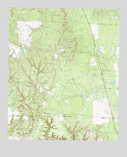
Bob Creek, TX USGS Topographic Map
Click on map above to begin viewing in our Map Viewer.

This topographic map contains these locations and features:
Feature Name Type Latitude Longitude GNIS ID View Map
Bob CreekStreamN33.37537°W100.33039°1352541View Map
Brushy TankReservoirN33.46187°W100.35785°1353094View Map
Brushy Tank DamDamN33.46175°W100.35706°1864466View Map
Deadmans HoleLakeN33.37509°W100.32955°1355779View Map
Gilkerson CemeteryCemeteryN33.41438°W100.36883°1358017View Map
Martin RanchLocaleN33.39842°W100.31066°1362226View Map
Negro TankReservoirN33.45515°W100.37322°1363660View Map
Salt Croton CreekStreamN33.37537°W100.32900°1367419View Map
Springer LakeReservoirN33.44056°W100.37343°1864465View Map
Springer Lake DamDamN33.44009°W100.37206°1864464View Map

Note: Coordinates in the location and feature list above are referenced to NAD83 datum.


Copyright (C) 2008-2026 Ryan Niemi / Sunset Dynamics ... All Rights Reserved
