TopoQuest Logo
Do you find TopoQuest useful?
Help keep TopoQuest running and adding new maps/features by donating!
Home View Maps Find Maps Find Places Resources & Links


Chesaw, Washington Topographic Map

USGS Map Title: Chesaw, WA
USGS Map MRC: 48119H1
DRG (GeoTIFF) Download: o48119h1.tif


Neighboring USGS Topographic Map Quads:


  Molson, WA  
48119H2
 

  Chesaw, WA  
48119H1
 

  Buckhorn Mountain, WA  
48118H8
 

  Havillah, WA  
48119G2
 

  Mount Bonaparte, WA  
48119G1
 

  Bodie, WA  
48118G8


Map MRC Location:

N49°
W120°
N49°
W119°
H8 H7 H6 H5 H4 H3 H2 H1
G8 G7 G6 G5 G4 G3 G2 G1
F8 F7 F6 F5 F4 F3 F2 F1
E8 E7 E6 E5 E4 E3 E2 E1
D8 D7 D6 D5 D4 D3 D2 D1
C8 C7 C6 C5 C4 C3 C2 C1
B8 B7 B6 B5 B4 B3 B2 B1
A8 A7 A6 A5 A4 A3 A2 A1
N48°
W120°
N48°
W119°

Chesaw, WA USGS 1:24K Topographic Map Preview:
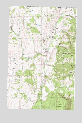
Chesaw, WA USGS Topographic Map
Click on map above to begin viewing in our Map Viewer.

This topographic map contains these locations and features:
Feature Name Type Latitude Longitude GNIS ID View Map
Ads LakeLakeN48.93487°W119.11414°1515734View Map
BolsterLocaleN48.97240°W119.03893°1516767View Map
Bolster CreekStreamN48.96879°W119.03782°1516768View Map
ChesawPopulated PlaceN48.94601°W119.05143°1517666View Map
Ethel CreekStreamN48.93018°W119.05226°1519386View Map
Gafvery CreekStreamN48.99018°W119.02976°1519864View Map
Gold CreekStreamN48.98935°W119.02588°1520088View Map
Hungry HollowValleyN48.92601°W119.11449°1521070View Map
Lime CreekStreamN48.92879°W119.04088°1522104View Map
Mary Ann CreekStreamN48.94073°W119.04671°1522779View Map
Mary Ann LakeLakeN48.93629°W119.08810°1522780View Map
North Fork Gold CreekStreamN48.98462°W119.00087°1523780View Map
North Fork Mary Ann CreekStreamN48.96824°W119.11532°1523803View Map
Okanogan County Fire District 11 ChesawBuildingN48.94517°W119.05105°2643867View Map
Poland China MineMineN48.97379°W119.12338°1524548View Map
Pontiac RidgeRidgeN48.89267°W119.00699°1524567View Map
Porphyry PeakSummitN48.95851°W119.06004°1524580View Map
Strawberry LakeLakeN48.97630°W119.07230°1526625View Map
Strawberry MountainSummitN48.97129°W119.08615°1526631View Map
Thorp CreekStreamN48.96129°W119.03560°1527127View Map
Walker LakeLakeN48.99344°W119.08366°1527768View Map

Note: Coordinates in the location and feature list above are referenced to NAD83 datum.


Copyright (C) 2008-2026 Ryan Niemi / Sunset Dynamics ... All Rights Reserved
