TopoQuest Logo
Do you find TopoQuest useful?
Help keep TopoQuest running and adding new maps/features by donating!
Home View Maps Find Maps Find Places Resources & Links


Elberton, Washington Topographic Map

USGS Map Title: Elberton, WA
USGS Map MRC: 46117H2
DRG (GeoTIFF) Download: o46117h2.tif


Neighboring USGS Topographic Map Quads:


  Steptoe, WA  
47117A3
 

  Garfield, WA  
47117A2
 

  Farmington, WA  
47117A1
 

  Colfax North, WA  
46117H3
 

  Elberton, WA  
46117H2
 

  Palouse, WA  
46117H1
 

  Colfax South, WA  
46117G3
 

  Albion, WA  
46117G2
 

  Viola, ID  
46117G1


Map MRC Location:

N47°
W118°
N47°
W117°
H8 H7 H6 H5 H4 H3 H2 H1
G8 G7 G6 G5 G4 G3 G2 G1
F8 F7 F6 F5 F4 F3 F2 F1
E8 E7 E6 E5 E4 E3 E2 E1
D8 D7 D6 D5 D4 D3 D2 D1
C8 C7 C6 C5 C4 C3 C2 C1
B8 B7 B6 B5 B4 B3 B2 B1
A8 A7 A6 A5 A4 A3 A2 A1
N46°
W118°
N46°
W117°

Elberton, WA USGS 1:24K Topographic Map Preview:
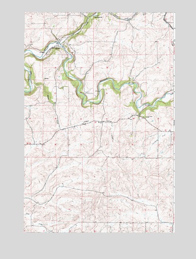
Elberton, WA USGS Topographic Map
Click on map above to begin viewing in our Map Viewer.

This topographic map contains these locations and features:
Feature Name Type Latitude Longitude GNIS ID View Map
Brush CreekStreamN46.95795°W117.24462°1503587View Map
Chases Mill (historical)LocaleN46.95517°W117.18768°1512924View Map
Eden ValleyValleyN46.93461°W117.21934°1504676View Map
Eden Valley CemeteryCemeteryN46.94057°W117.14899°1504678View Map
ElbertonPopulated PlaceN46.98128°W117.22129°1512183View Map
Silver CreekStreamN46.98222°W117.22083°1508339View Map
Silver SpringsSpringN46.96236°W117.23314°1508352View Map
Turnbow FlatFlatN46.93239°W117.12795°1509125View Map
Walker AirportAirportN46.91129°W117.21713°2443421View Map

Note: Coordinates in the location and feature list above are referenced to NAD83 datum.


Copyright (C) 2008-2026 Ryan Niemi / Sunset Dynamics ... All Rights Reserved
